Noble View Trails
Location: Russell, MA
Activity: hiking
Type: self-guided
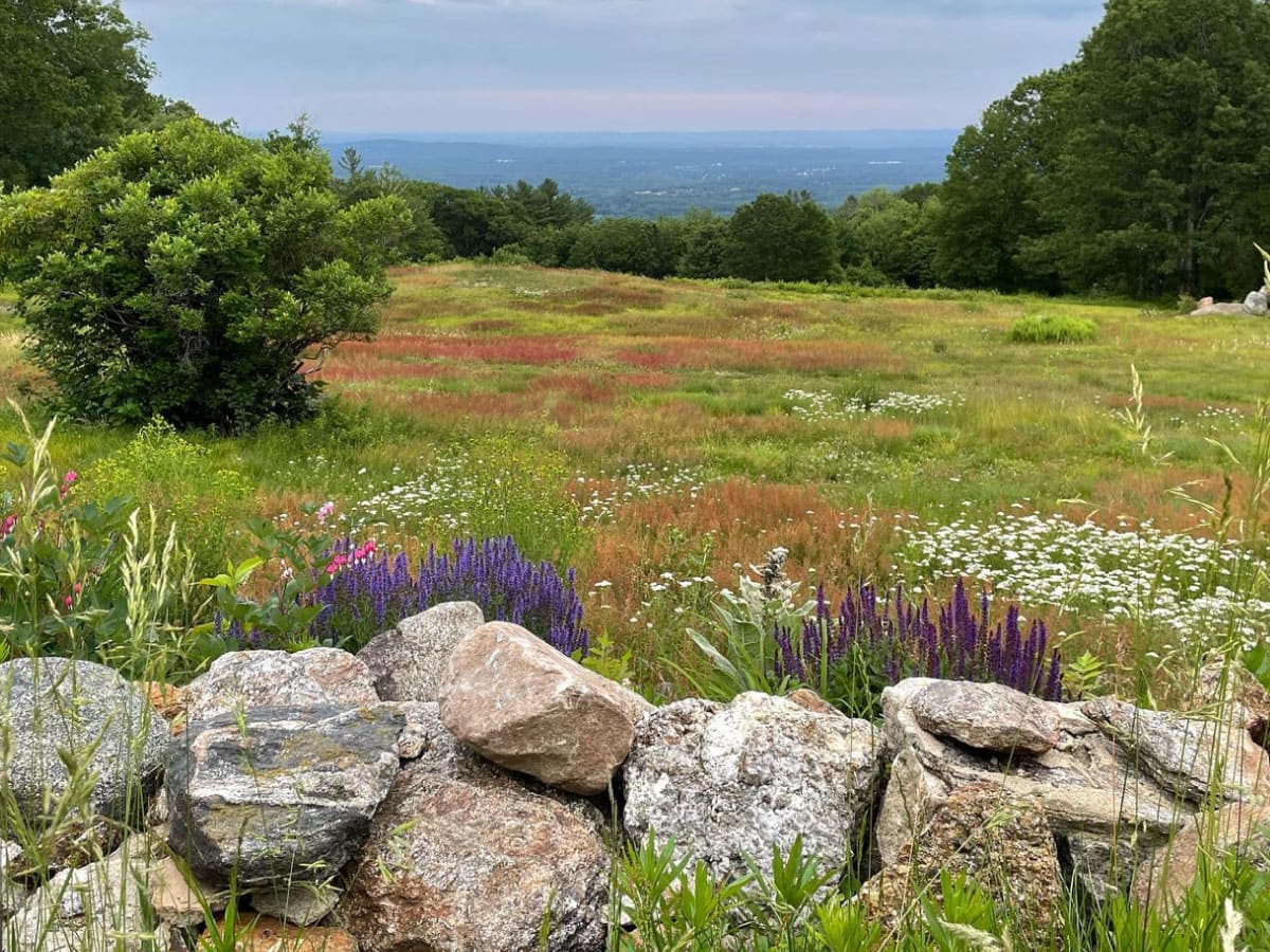
Elevated at nearly 1,100 feet above the Connecticut River Valley, AMC's Noble View Outdoor Center provides spectacular views of cities, towns, and countryside. Spend the night in an updated cottage or at a campsite and take in the incredible sunrise from the open hilltop just outside the cottages.
Noble View's 12 miles of well-marked trails wind through woodlands and abandoned farm fields, past brooks, waterfalls, stone walls, and cellar holes, and across a variety of habitats including a rare, old growth hemlock stand.
Here we list our favorite relaxed, easy, and moderate trails to explore.
This hike includes spur trails that bring you to some of the most popular views in the area.
From the farmhouse, go down (south) on Laurel Lane Trail, passing Ann's Trail on the right (W) and Dam Brook Trail on the left (east). Cross the Border Trail, and pass County Road Trail on left (east), then turn left (east) on Charcoal Kiln Trail.
Some distance along the Charcoal Kiln Trail there is a sign on the right marking a side trail to the Lookout. This is a rocky outcropping with a view high above Little River Gorge. The large standpipe in the western view is the surge tank for the hydro-electric plant operated by water released from Cobble Mountain Reservoir.
After admiring the view, retrace your steps to Charcoal Kiln Trail and turn right (east) and then continue to the junction with Dry Ridge Trail on the right (south). The Ledges are another rocky outcropping above Little River Gorge, with good views including a view of "980", the steep hill on the other side of the river. Your walk to this point probably took about 40 minutes, and it will take about the same time to return to Noble View by the same route.
From the Ledges you may continue downhill on Charcoal Kiln Trail to the old brick kiln used to make charcoal many years ago and return to Noble View by the steep Dam Brook Trail; or you may stay on Charcoal Kiln Trail until it reaches County Road Trail and then return to Noble View by the River Trail. Any of these alternate routes will, of course, require additional time.
Trip rating: moderate
Estimated time: 2.5-4 hours
Estimated time: 2.5-4 hours
This mostly flat trail brings you on a tour of the Malcolm B. Ross Memorial Forest.
From the Gantt Memorial Fireplace (note the engraved inscription on the granite block) north of the double cottage, follow the white-blazed trail along the left (west) edge of the cleared area north down the hill a short distance to the Border Trail. Turn left (west) here and stay on the Border Trail until it reaches the entrance road near South Quarter Road.
Walk up the Noble View entrance road to the gate, pass through and turn left on the Mac Ross Trail (sign). Stay on the Mac Ross Trail until you return to the cottages. You will pass on the right (south) the Outpost Campground, developed primarily for youngsters by a devoted Chapter member, Frank A. Mann, now deceased. Just beyond the campground on the left (north) of the Mac Ross Trail a spring will be seen, and shortly before reaching the cottages you will pass on the left (north) the Malcolm B. Ross Memorial with bronze plaque.
Malcolm B. Ross was an active member of Berkshire (now Western MA) Chapter for nearly 25 years. He served as Chapter Chairman, twice as Noble View Chairman, and as Chairman of the AMC Chapters Committee. The land that constitutes the Malcolm B. Ross Memorial Forest was purchased and added to Noble View in 1958. It measures roughly 600 ft. by 2700 ft. and contains over 30 acres.
Trip rating: easy
Estimated time: 50 minutes
Estimated time: 50 minutes
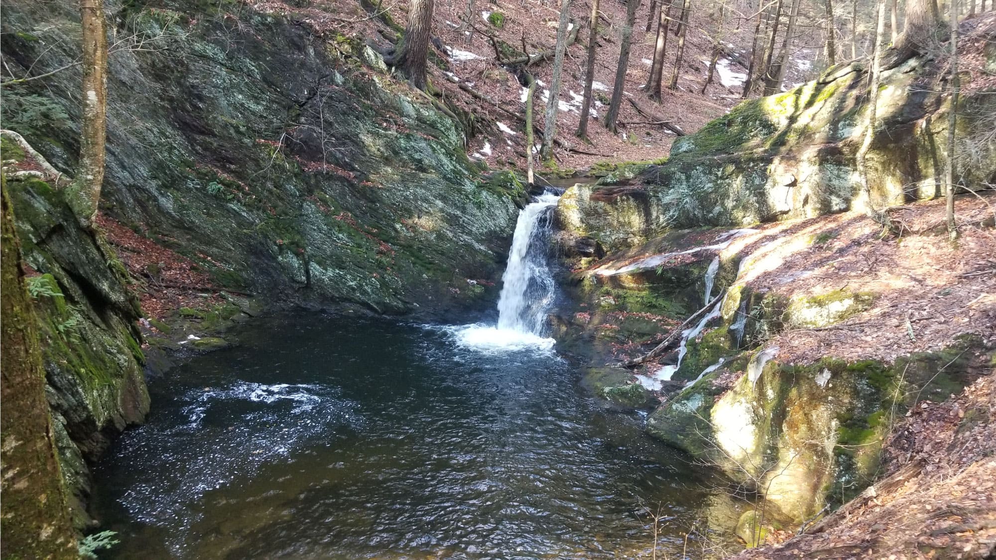
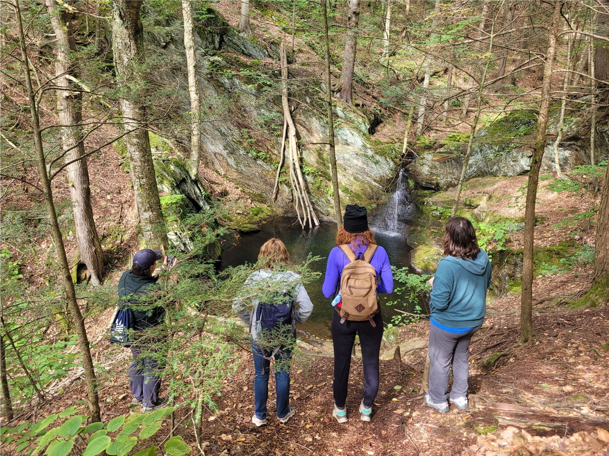
This 3.5-mile loop introduces you to a few of Noble View's well-loved trails, two cellar holes, and two waterfalls.
On the Noble View entrance road a short distance from the farmhouse, at the west end of the large gravel parking lot, is a sign indicating the beginning of the Pitcher Brook Trail. Pitcher Brook Trail passes through pleasant woods with laurel and blueberries in season, crosses Ann's Trail, then the Border Trail and then descends to the gorge of Pitcher Brook with its swift water, deep pools and two waterfalls called Big Pitcher and Little Pitcher. In spots the going is a little rough, but not difficult except when icy in winter.
Leaving the brook, the trail climbs mildly to the junction with Laurel Lane Trail, which can be followed back to the farmhouse, passing on the right Charcoal Kiln Trail, County Road Trail, Border Trail and Dam Brook Trail, in that order. Laurel Lane is wide and runs through mature forest. The footing in places is sometimes muddy, be alert for the "Dry Trail", which is west of and parallel to Laurel Lane between the Loop Trail and the entry road.
For those who are interested in the history of days long gone, this hike offers an opportunity to view two old cellar holes. On the left (northwest) of Laurel Lane, before reaching Charcoal Kiln Trail, you will pass a site known as the Pendleton-Snow Place. An atlas of Hampden County shows buildings standing at this site in 1912. There are two wells to search for, one near the house site and one on the opposite side of Laurel Lane where presumably the old barn stood.
Continuing north on Laurel Lane back toward the farmhouse, shortly after passing County Road Trail on the right and before reaching the Border Trail, there is a large and very old foundation and well on the left (west) of Laurel Lane. The names of the occupants of the house which stood here have not been definitely determined, but the place is supposed to have been the homestead of a family named Ashley.
Trip rating: relaxed, with some short ups and downs and stream crossings.
Estimated time: 1.5 hours
Estimated time: 1.5 hours
The Spring Trail begins at a sign at the southeast corner of the field in front (east) of Double Cottage. As you walk downhill on the south edge of the field to reach the Spring Trail, youâll see trees growing around and in an old cellar hole known as the Gowdy Place, which was purchased by Albert Noble (for whom Noble View is named) in 1835.
From the southeast corner of the field, at a junction with the Circuit Loop, the Spring Trail goes downhill to end at the Border Trail, passing on the way a huge birch tree about six feet in circumference. To the left (east), near the start of the trail, you can visit the covered spring that used to supply water, using a pump, to the sinks at the cottages.
Turn right (south) on the Border Trail and follow its ups and downs along the side of the hill to the junction with the Woodland Trail. Turn right (west) on the Woodland Trail and climb moderately through interesting forest. You will eventually come out on the Link Trail. Turn right (north) on the Link Trail and pass the Ski Trail on your way back to the buildings at Noble View
Trip rating: moderate
Estimated time: 1 hour
Estimated time: 1 hour

JEANNETTE PIERCE