Media Gallery List
Media: 123 |
Gallery View » Click or tap on the links for enlarged views, to stream videos, or to access committee albums.
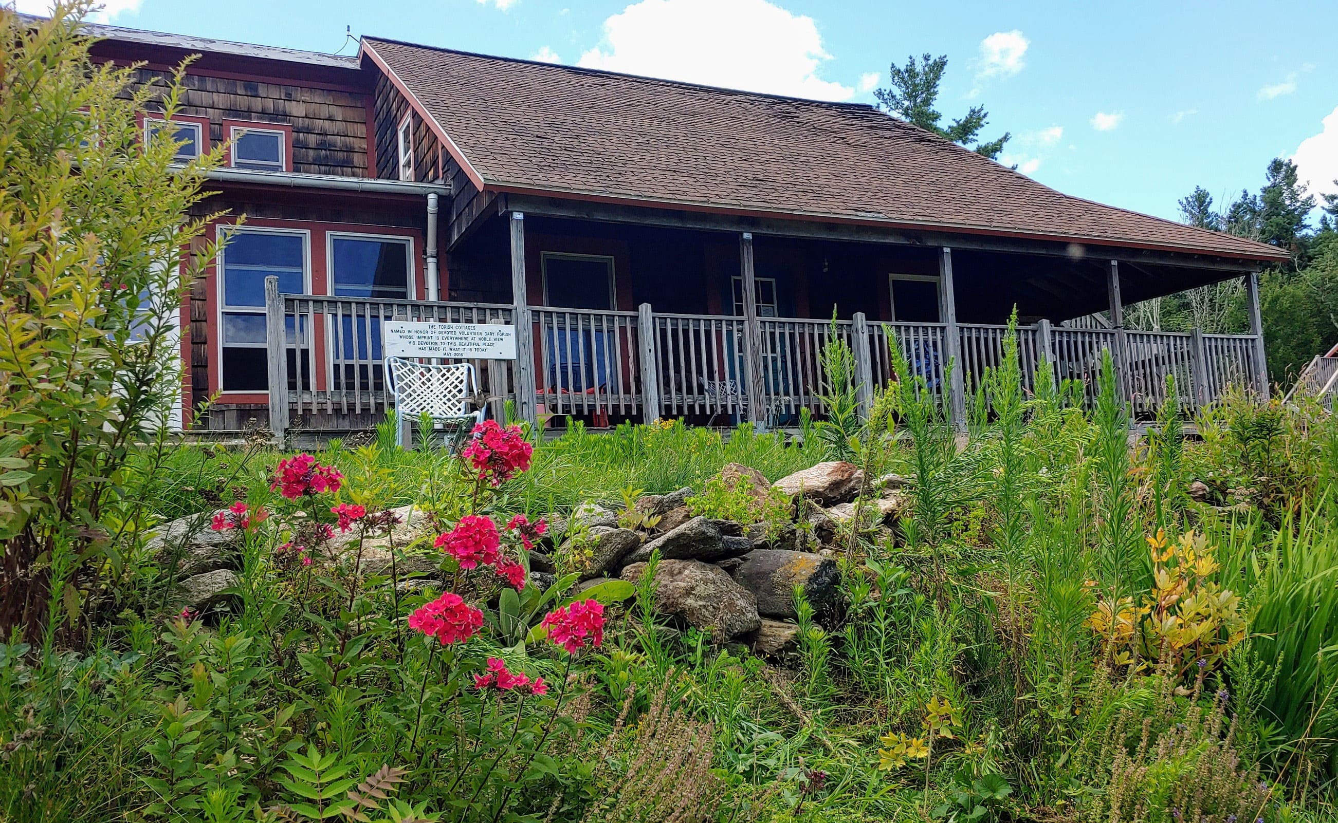
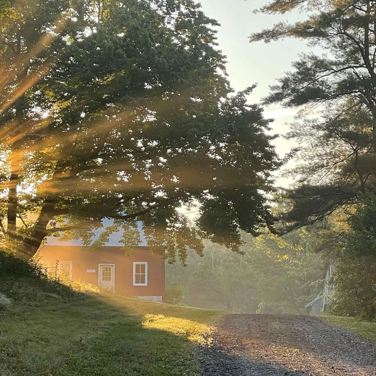
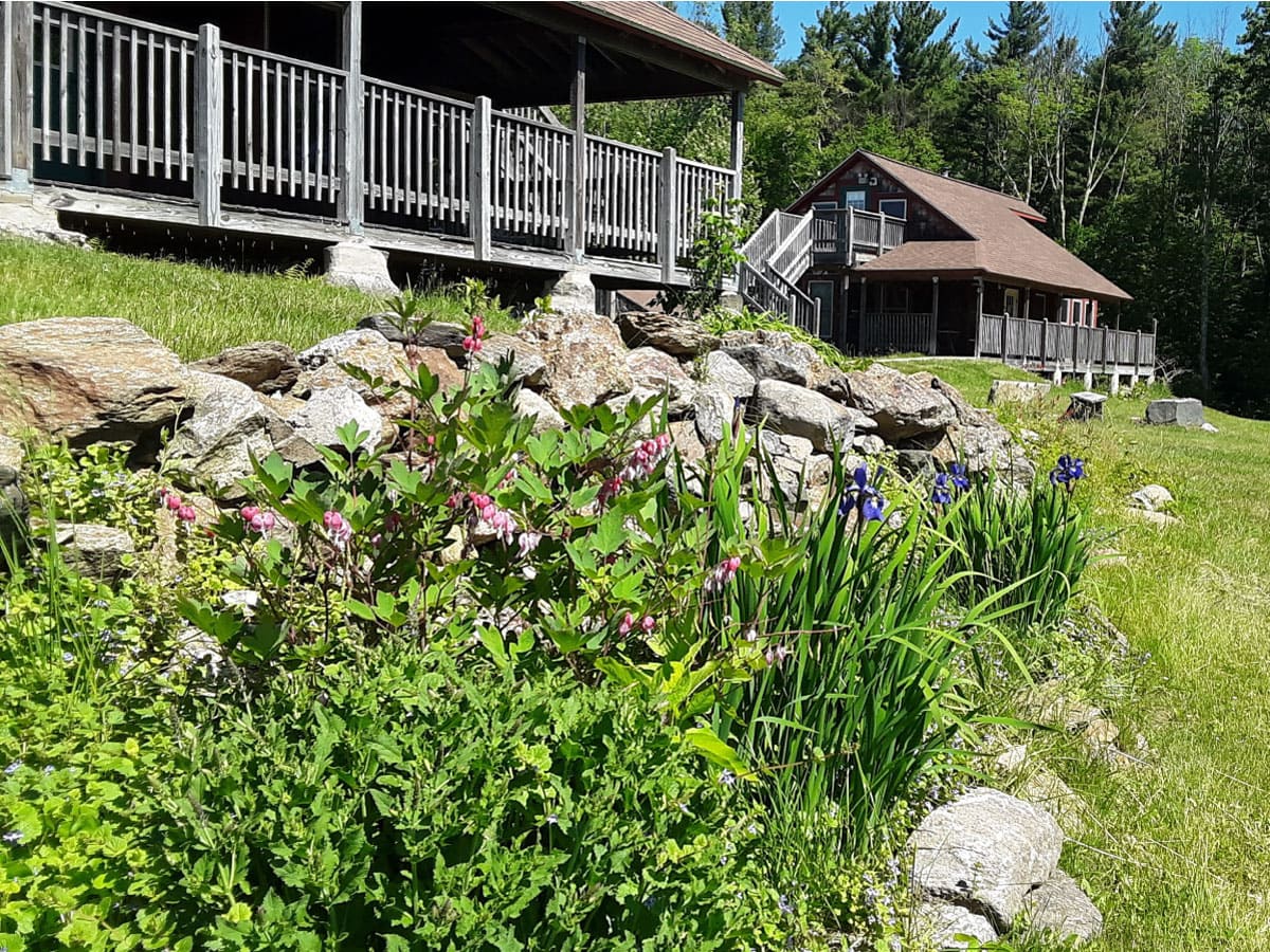
Noble View Farmhouse
[13‑Sep‑2025] Noble View farmhouse in September.
VIEW IMAGE » Western MA Bicylists
[30‑Aug‑2025] VIEW IMAGE » Western MA Bicylists
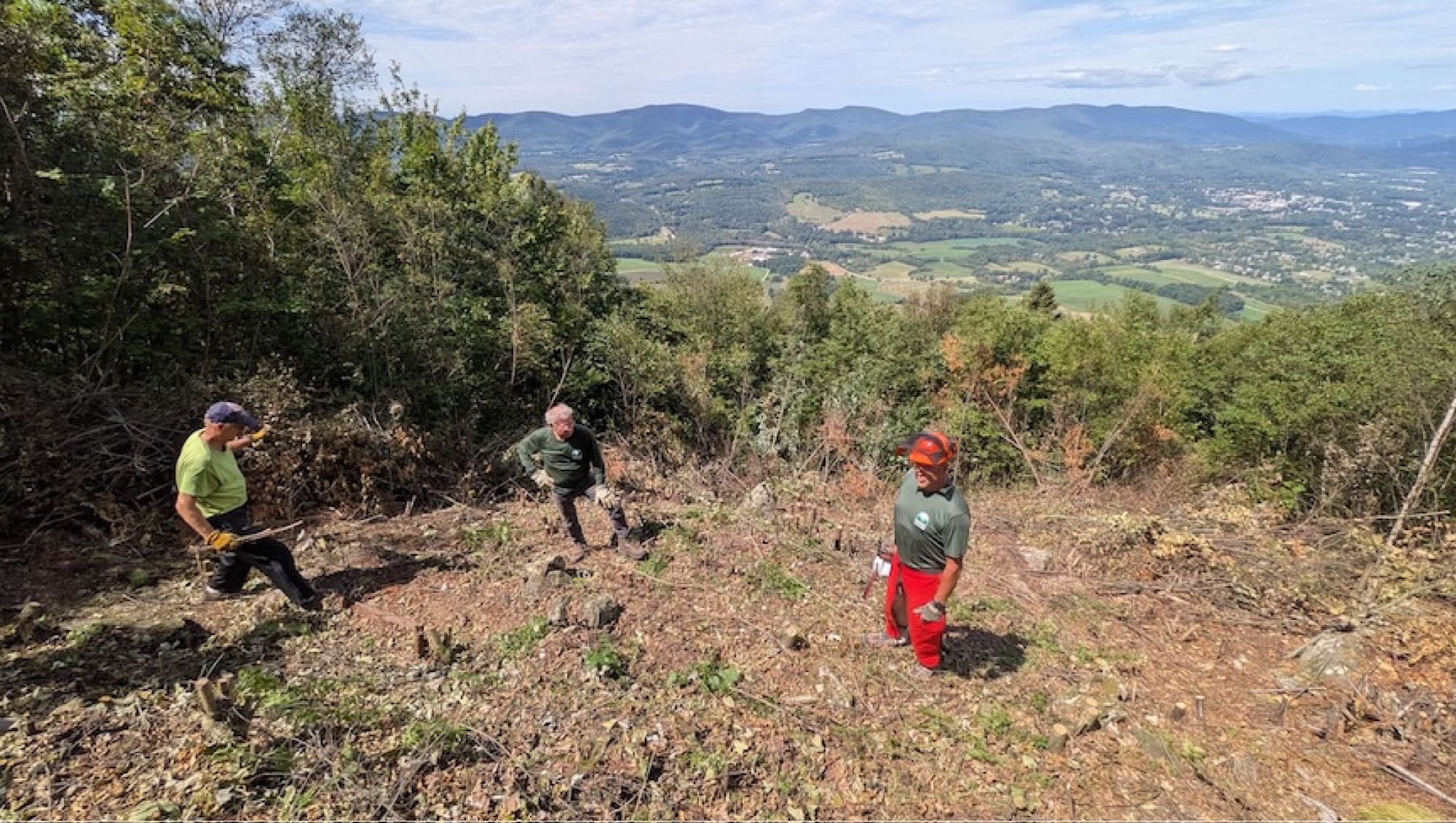
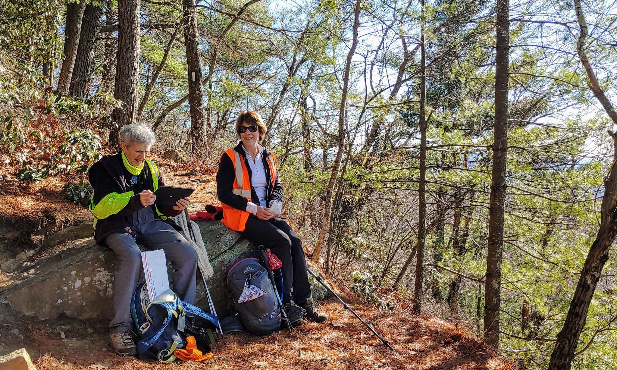
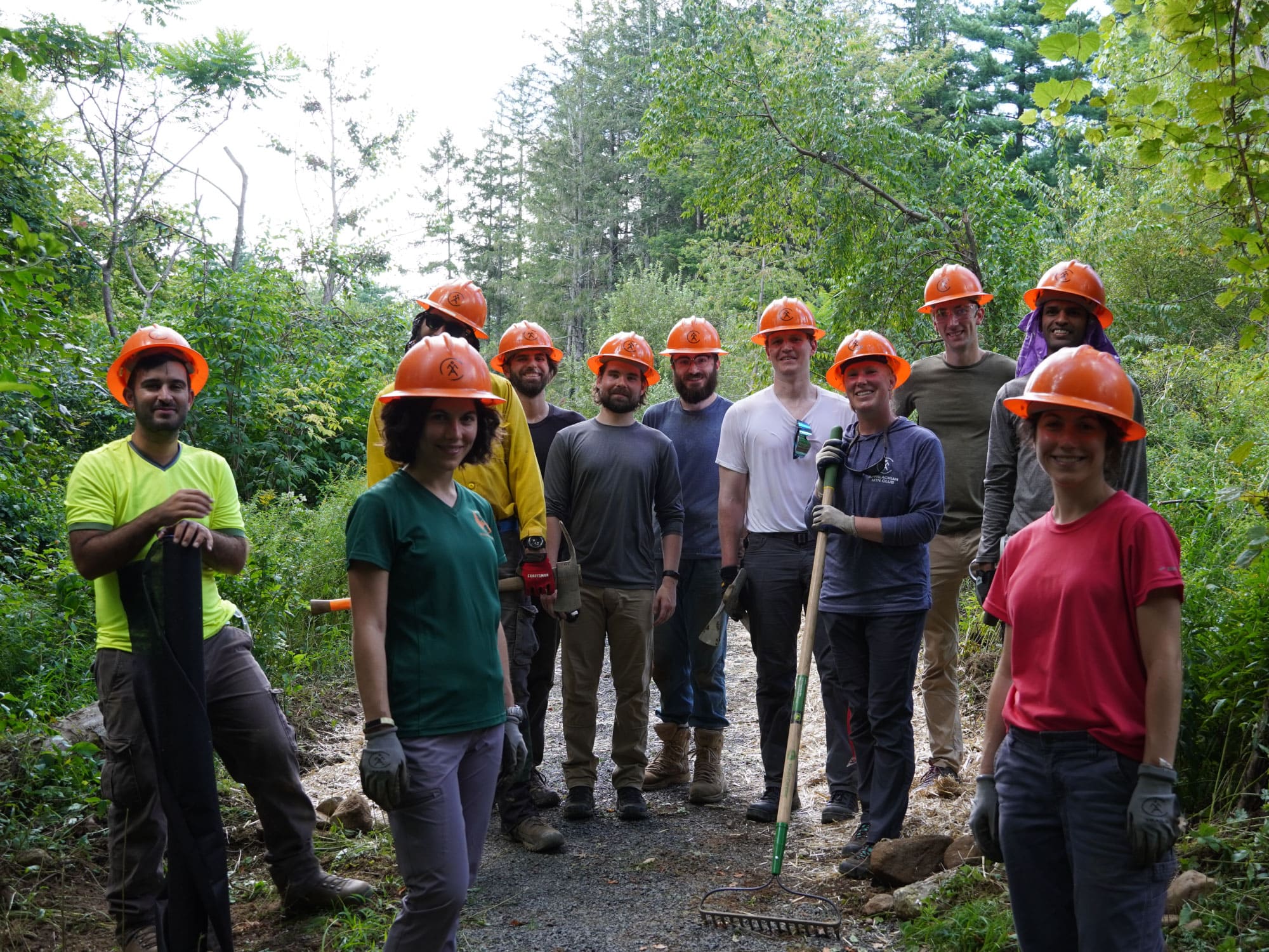
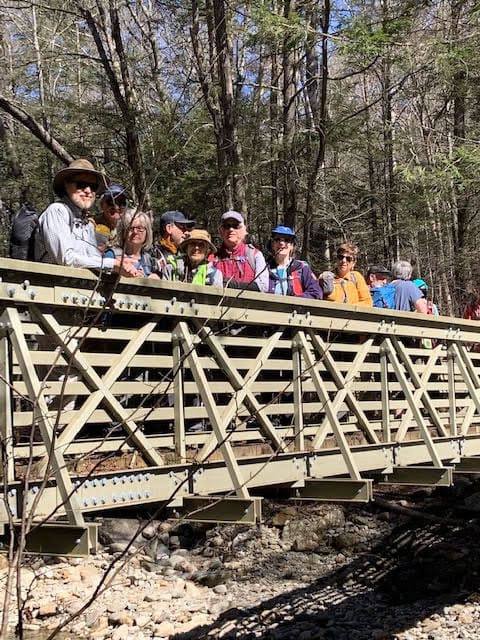
[30‑Aug‑2025] VIEW IMAGE » Trail Work at Wilbur Clearing Shelter
[16‑Aug‑2025] Moving cut saplings at Wilbur Clearing Shelter to the sides of the clearing.
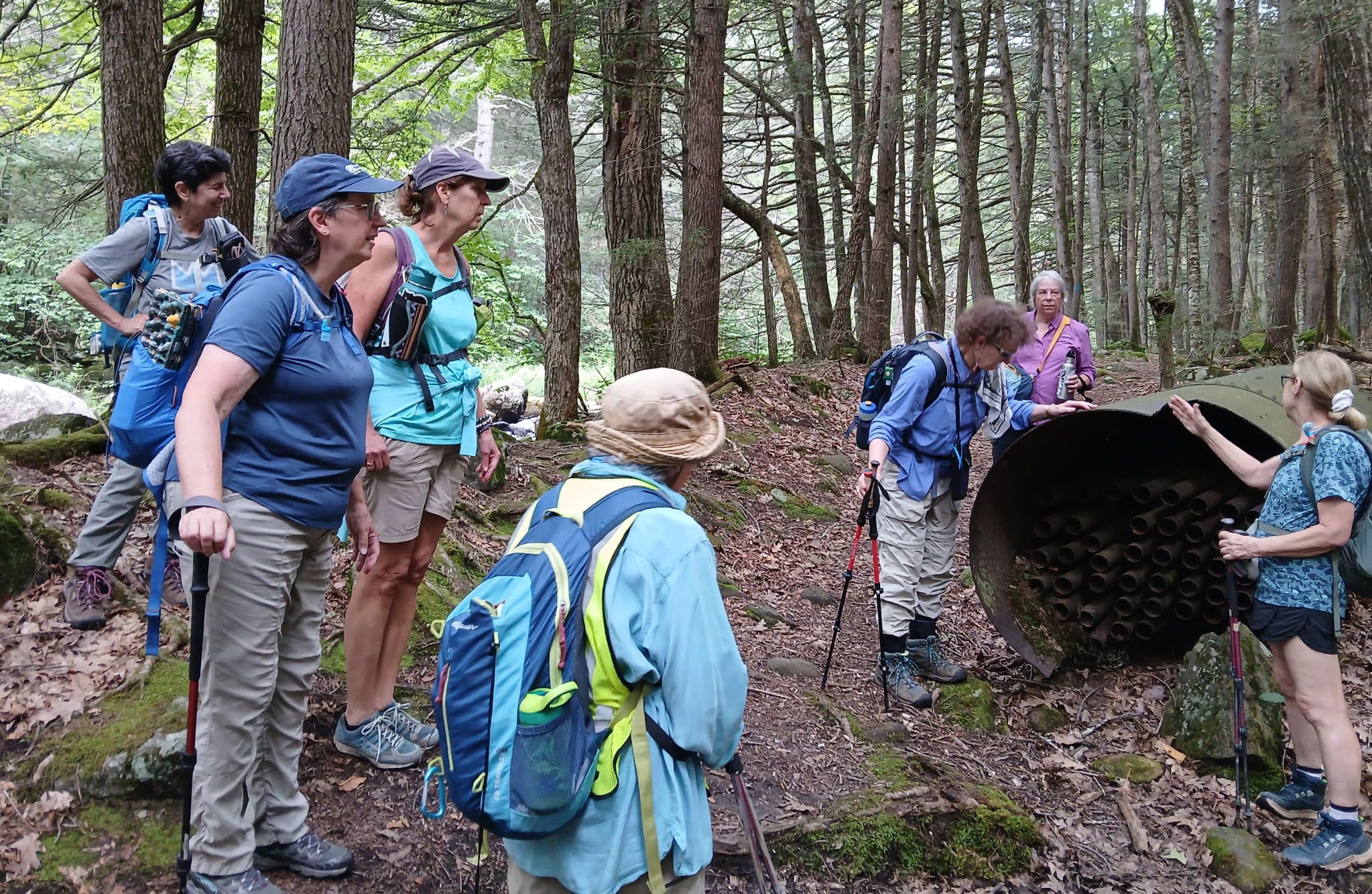
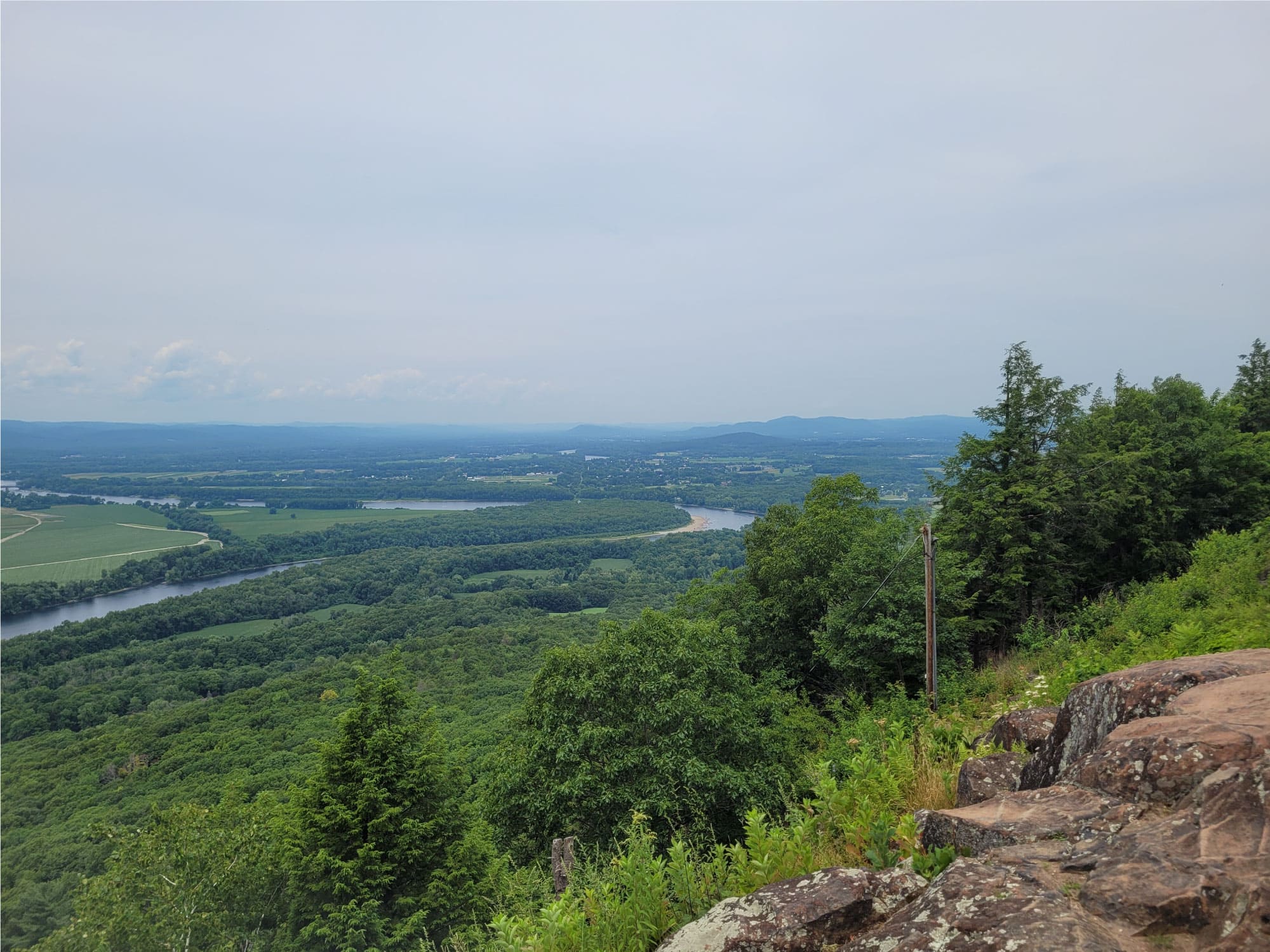
VIEW IMAGE » Granville State Forest
[12‑Aug‑2025] Tuesday's hike to Granville State Forest along the Hubbard River contained plenty of waterfalls and some unique objects to puzzle out.
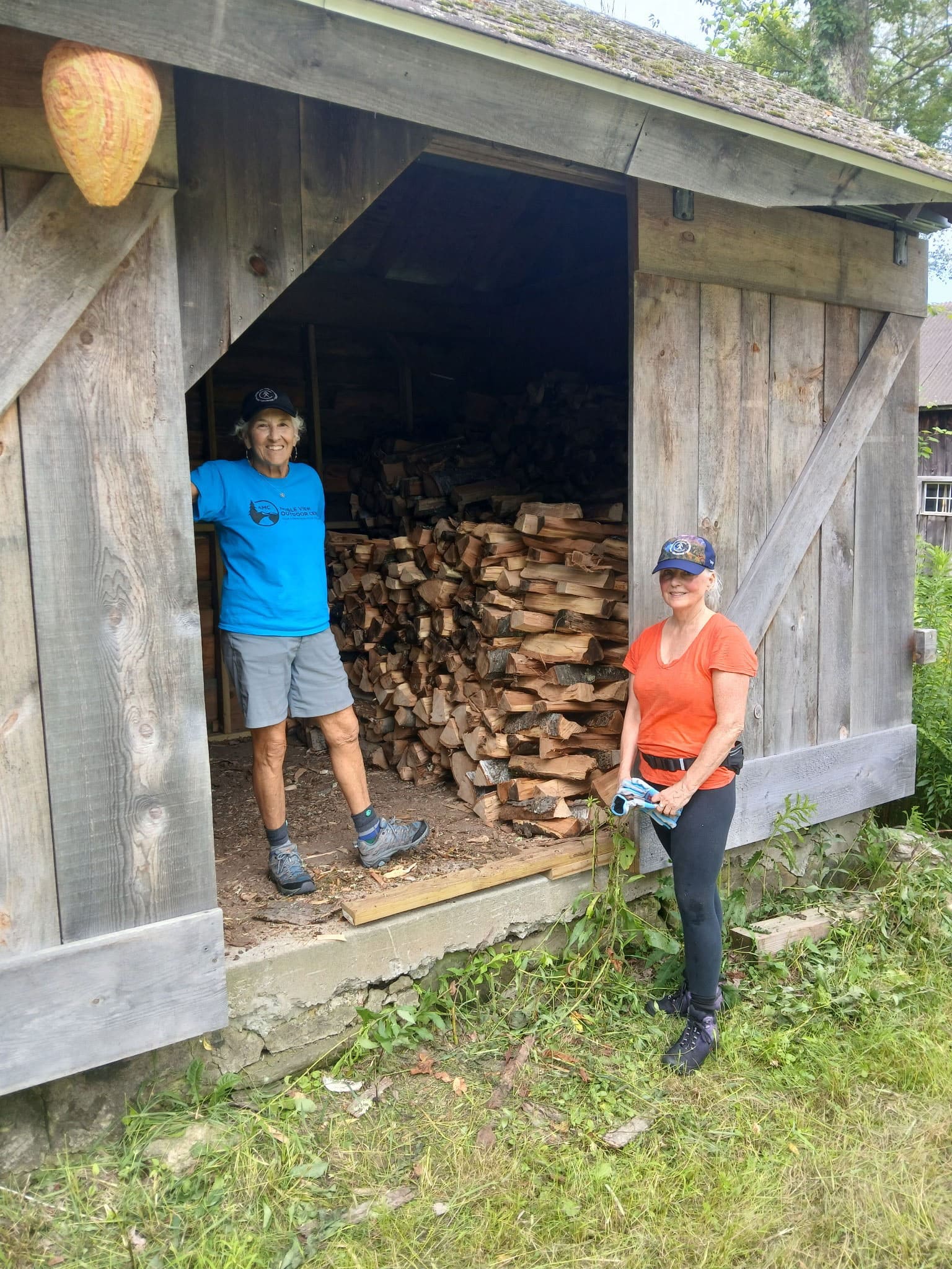
VIEW IMAGE » Wood Day at Noble View
[02‑Aug‑2025] Volunteers hauling, splitting, and stacking wood for use at the Noble View cottages.
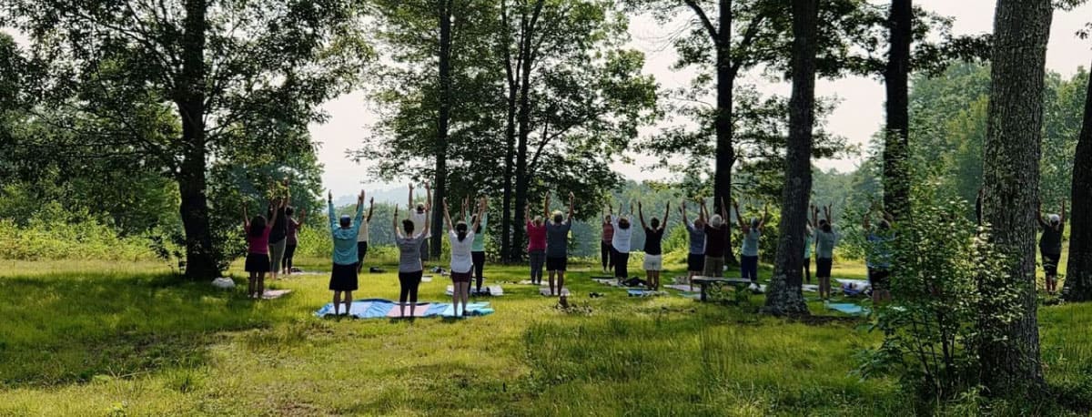
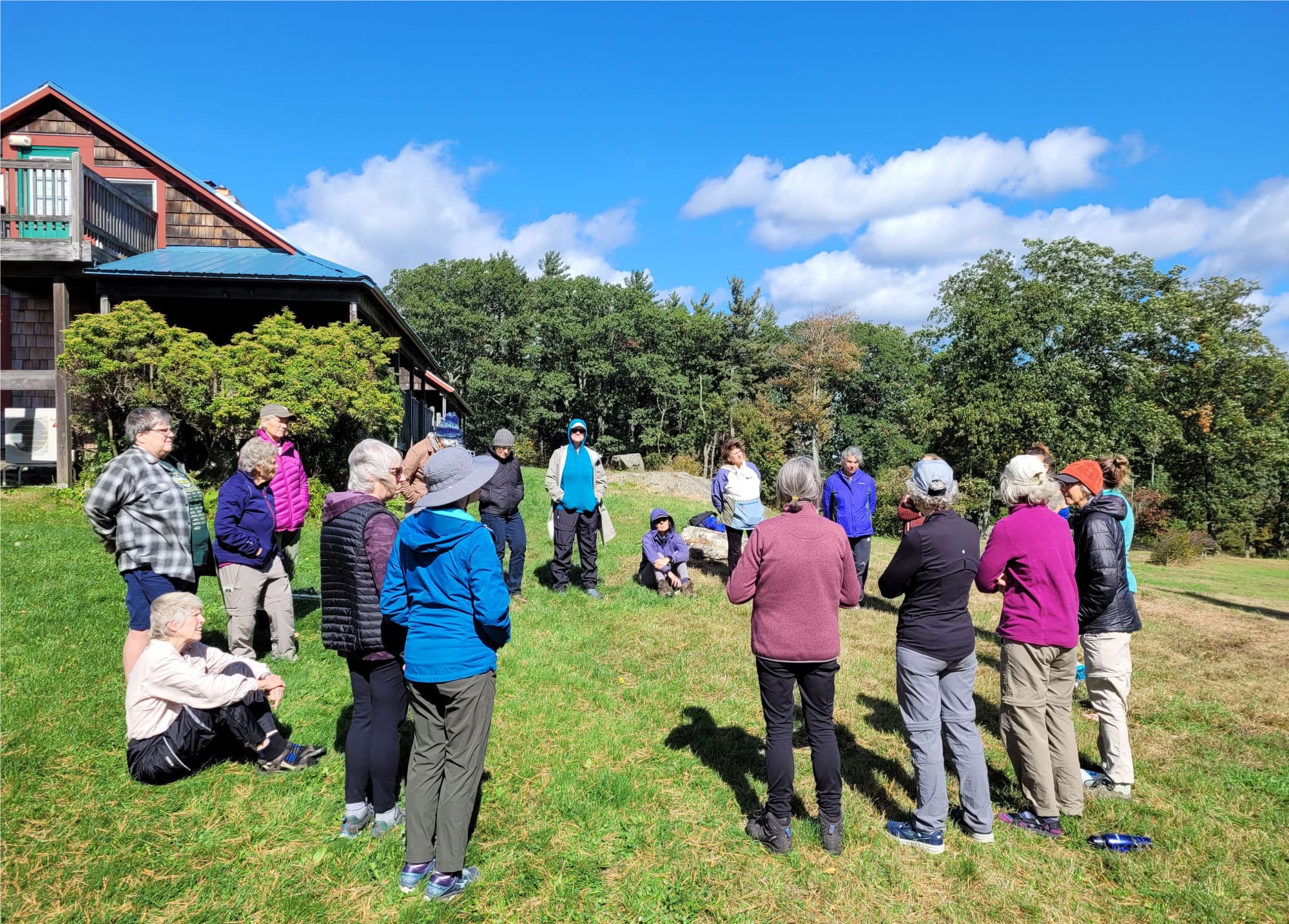
VIEW IMAGE » Yoga on the Mountain
[26‑Jul‑2025] Twenty-eight yogis joined yoga instructor, Sally Barber of the Westfield Yoga Center, for a relaxing yoga class in the meadow at Noble View.
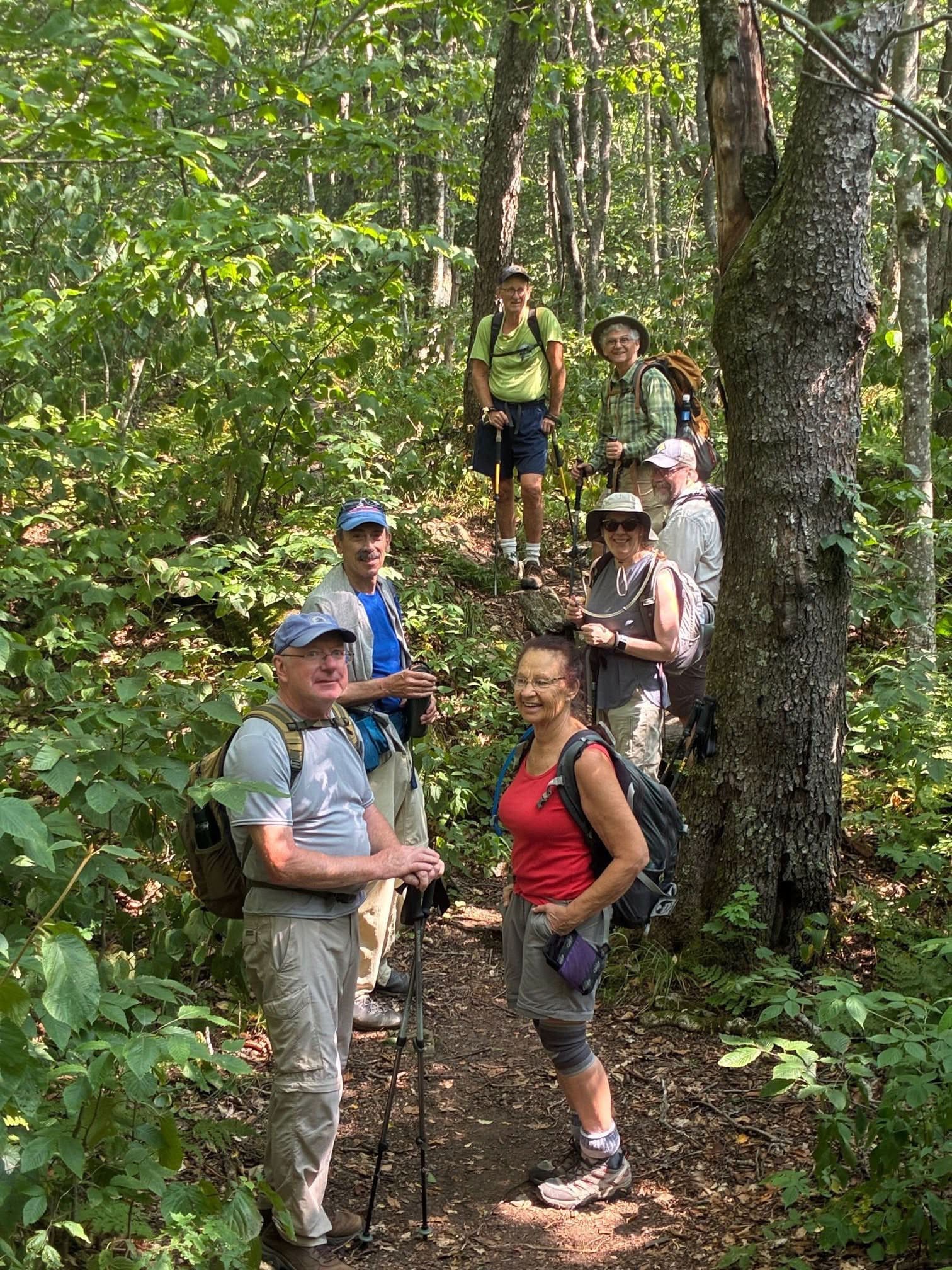
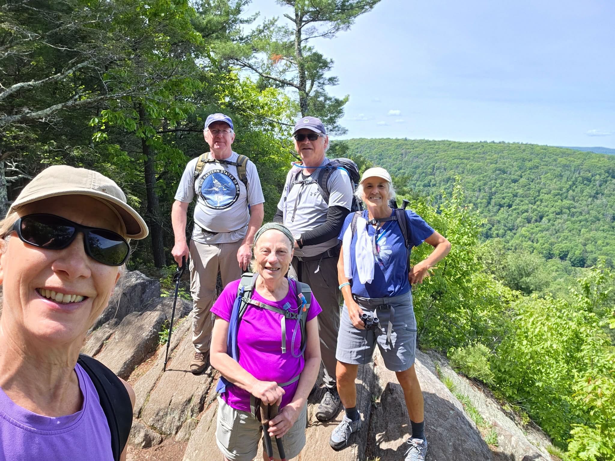
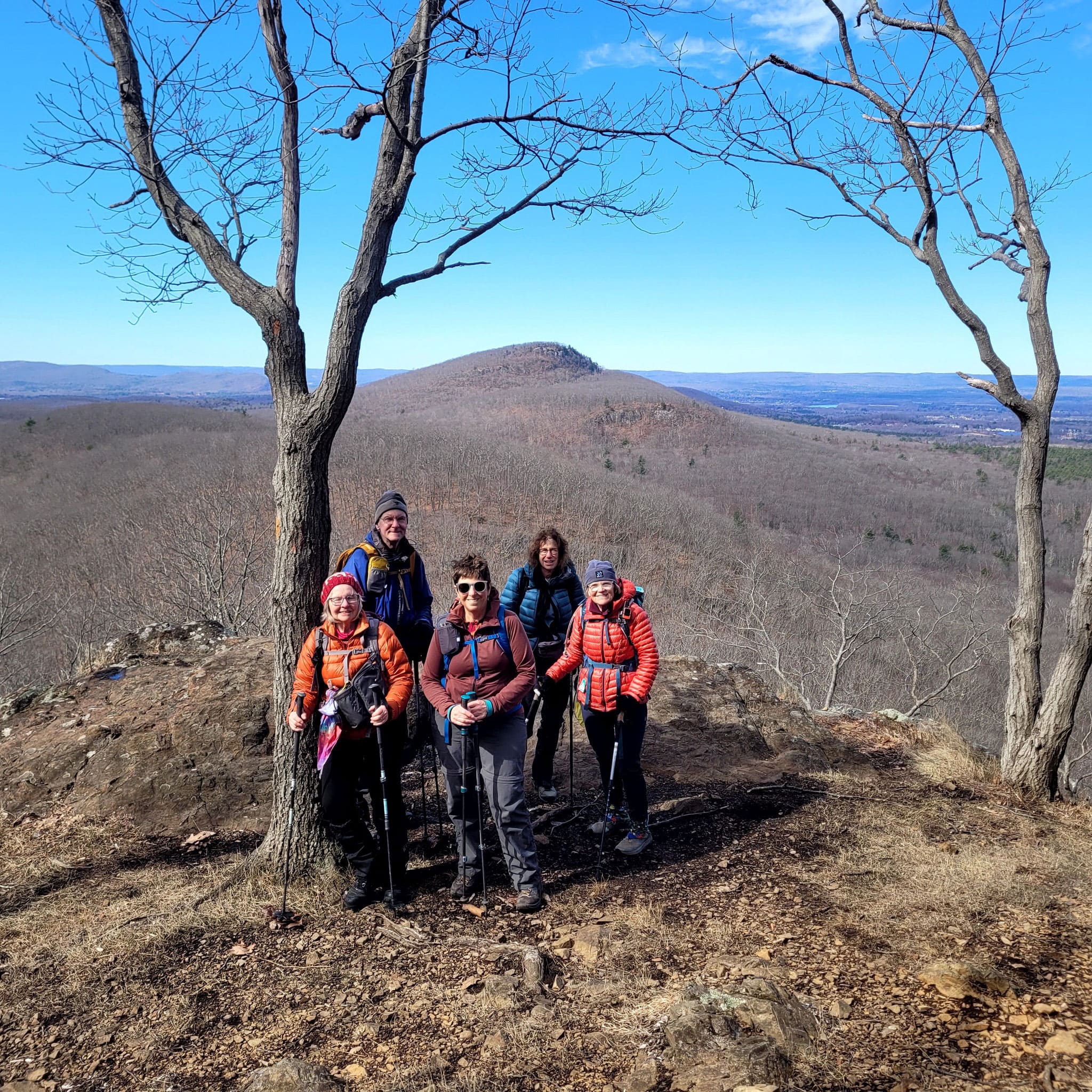
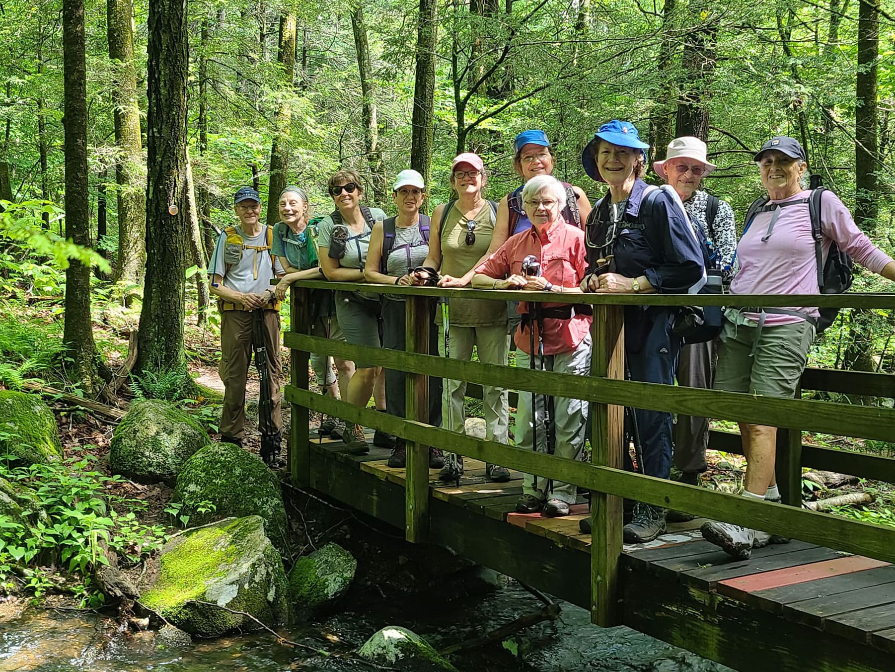
VIEW IMAGE » Mt Greylock to North Adams
[26‑Jul‑2025] Kathy Martin, Chair of the Western MA Chapter, led this group of hikers from the summit of Mt Greylock to North Adams on the 13
th section of the Chapter's Appalachian Trail Series.
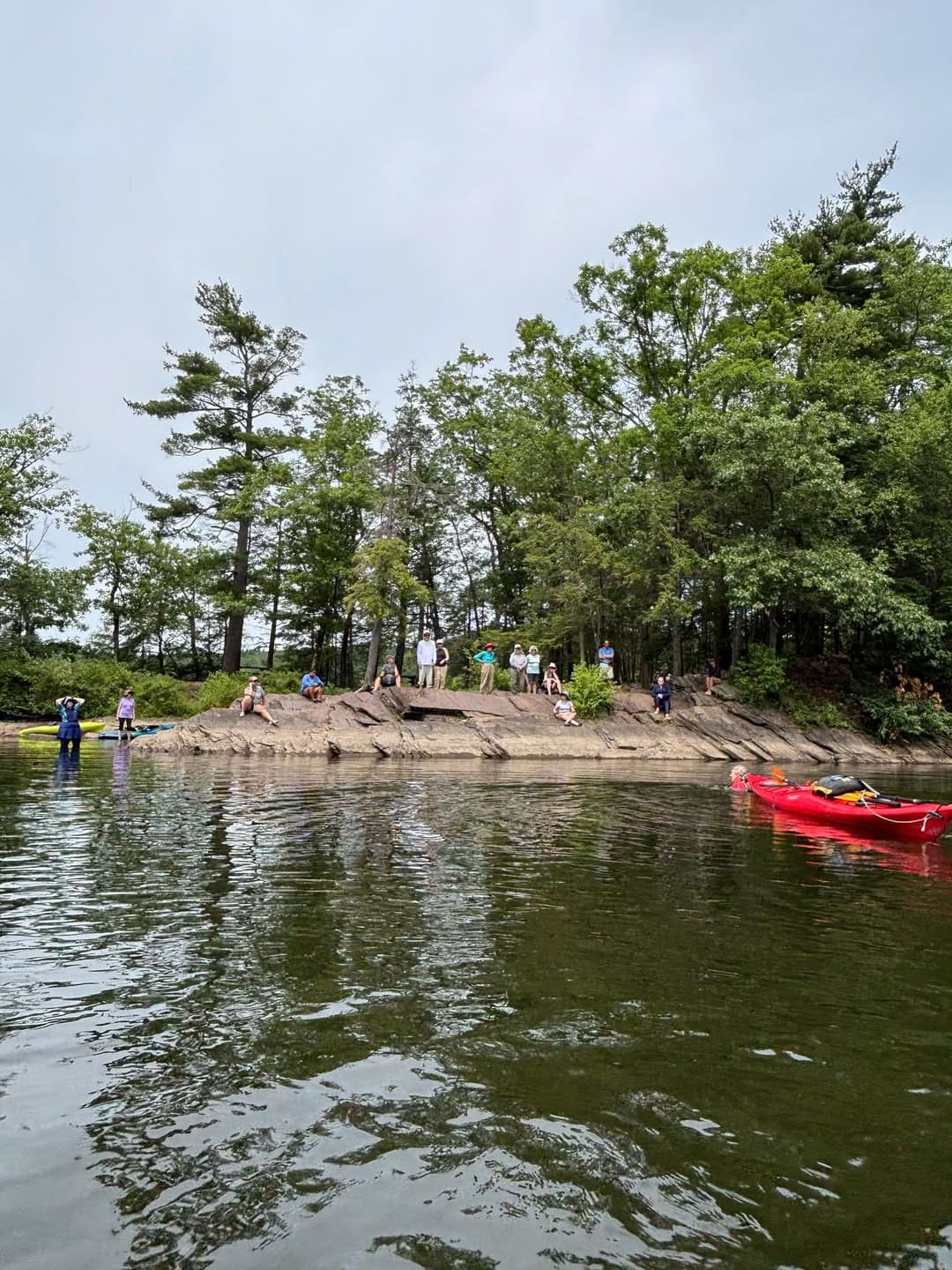
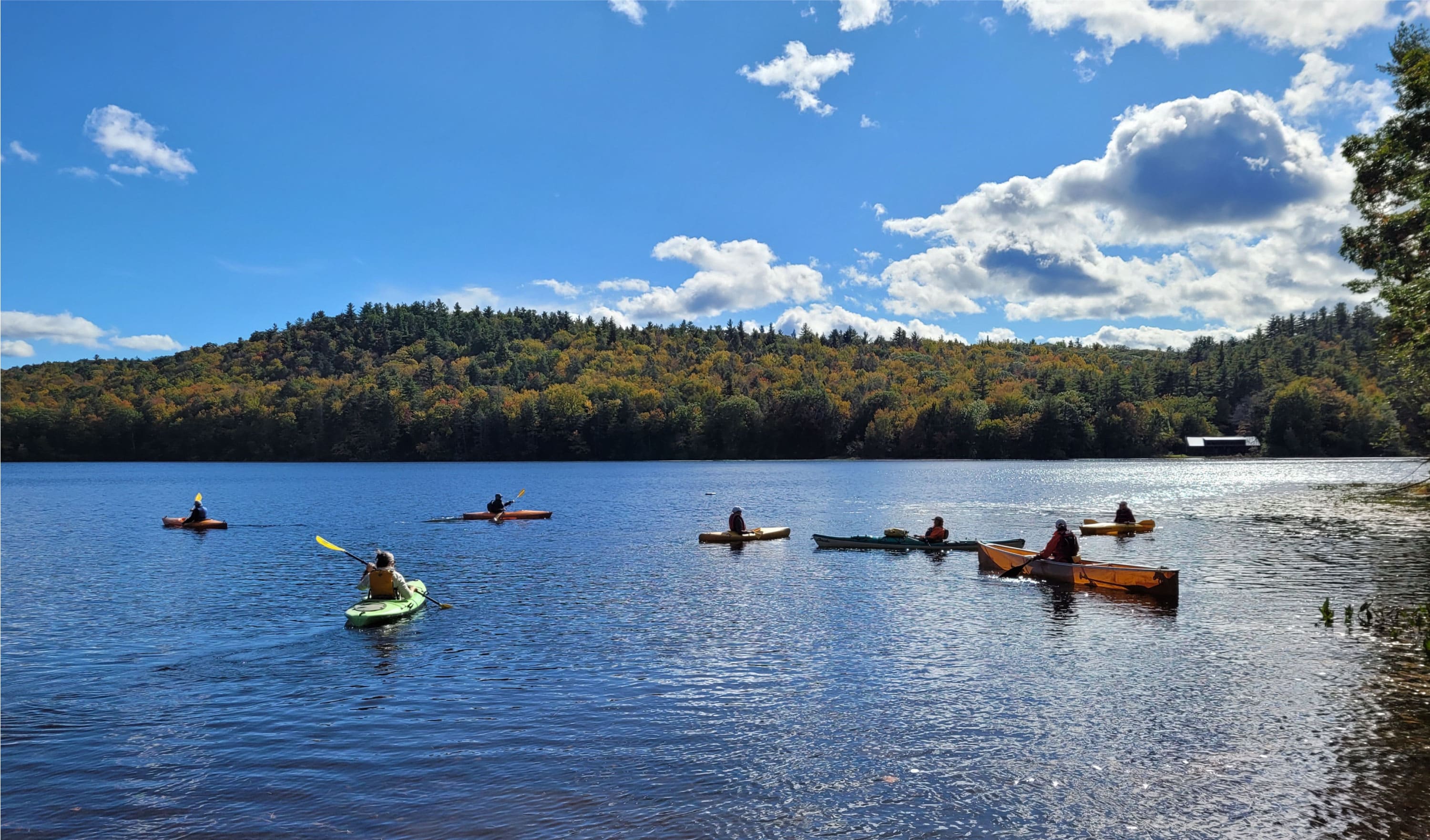
VIEW IMAGE » Barton Cove Paddling Class
[25‑Jul‑2025] Participants watch rescue demos before practicing this skill in deep water.
VIEW IMAGE » Pleasant Valley Wildlife Sanctuary
[15‑Jul‑2025] The chapter's Tuesday hikers relax at the top of Lenox Mountain during a hike in Pleasant Valley Wildlife Sanctuary.
VIEW IMAGE » Chesterfield Gorge
[15‑Jul‑2025] The 20s/30s crew had a fabulous day exploring Chesterfield Gorge. The views were epic, the company even better, and we capped it all off with food and brews at Northampton Brewery.
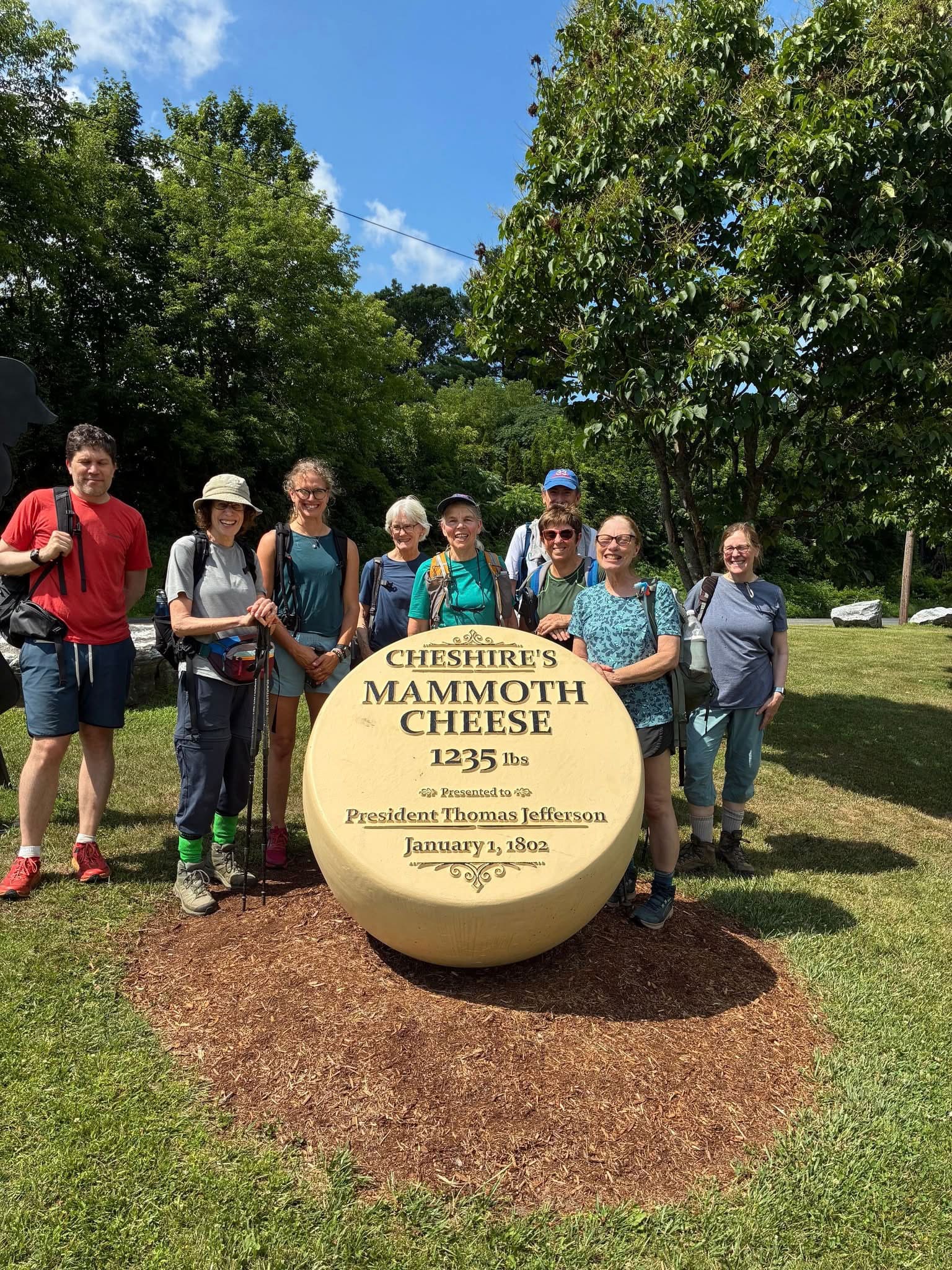
VIEW IMAGE » A.T. Hike Series Section 11
[13‑Jul‑2025] Hikers at Cheshire's Mammoth Cheese Monument.
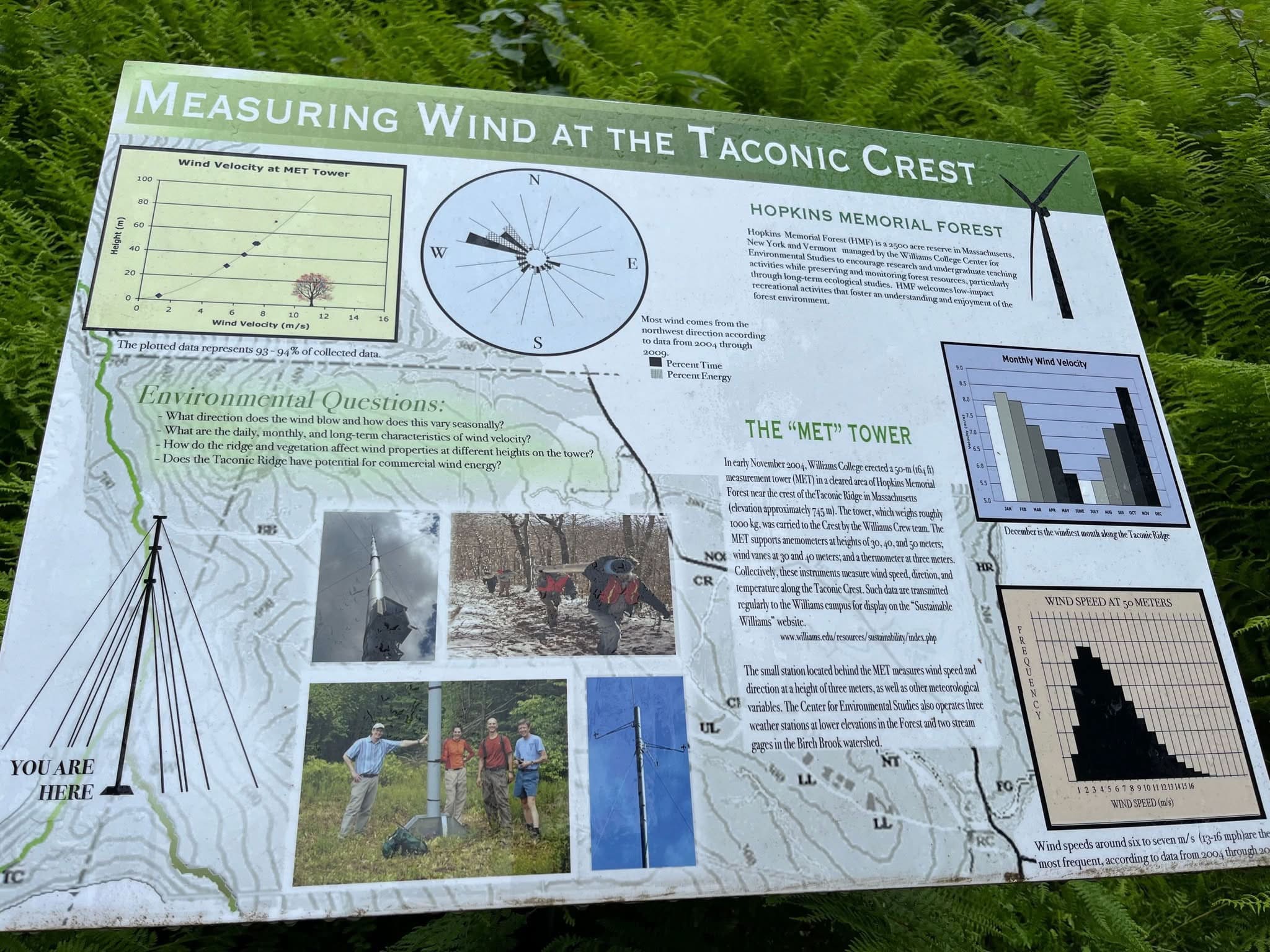
VIEW IMAGE » Taconic Weather Patterns
[12‑Jul‑2025] Placard describing how wind is measured at the Taconic Crest.
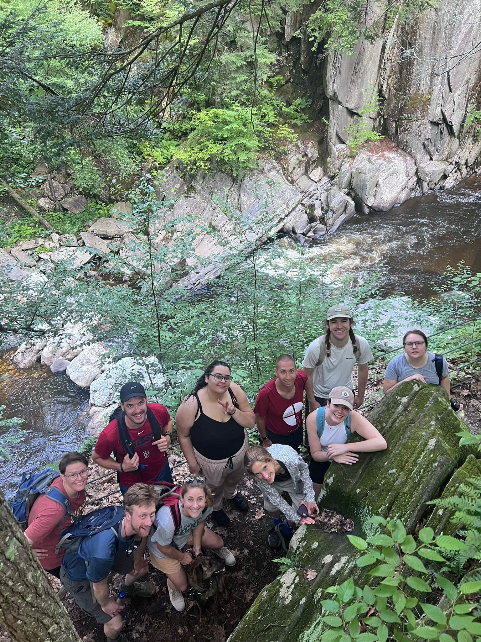
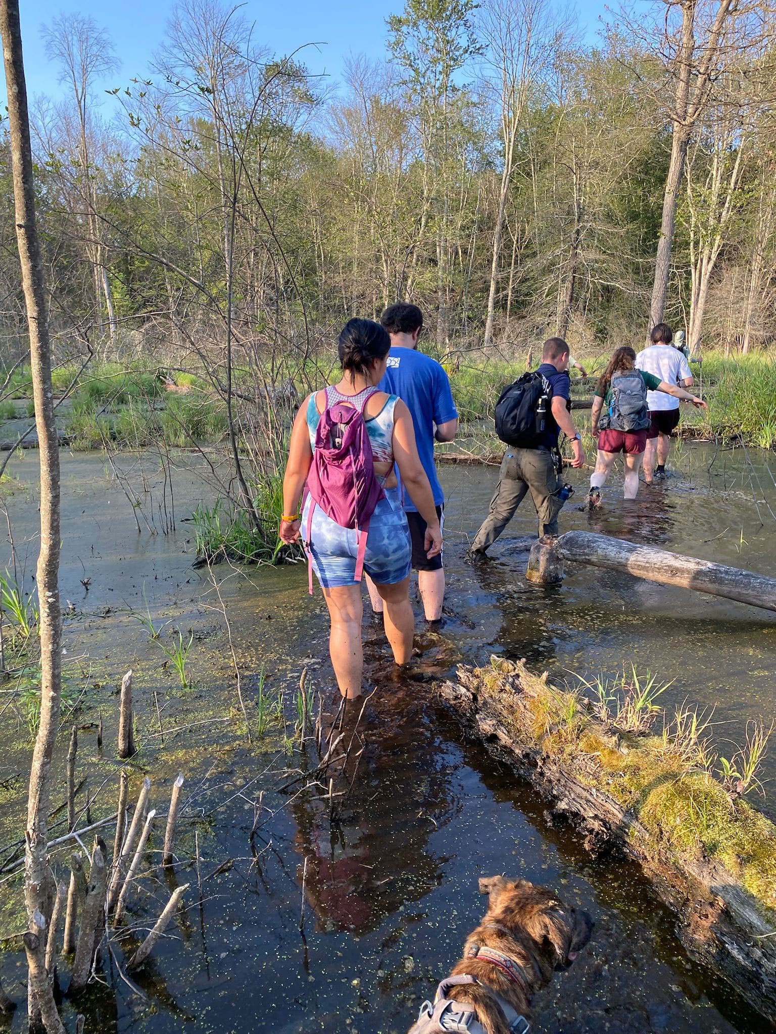
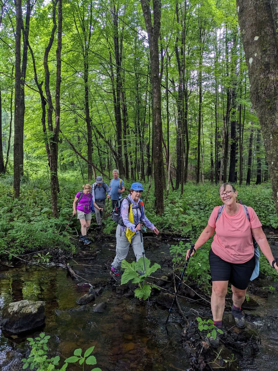
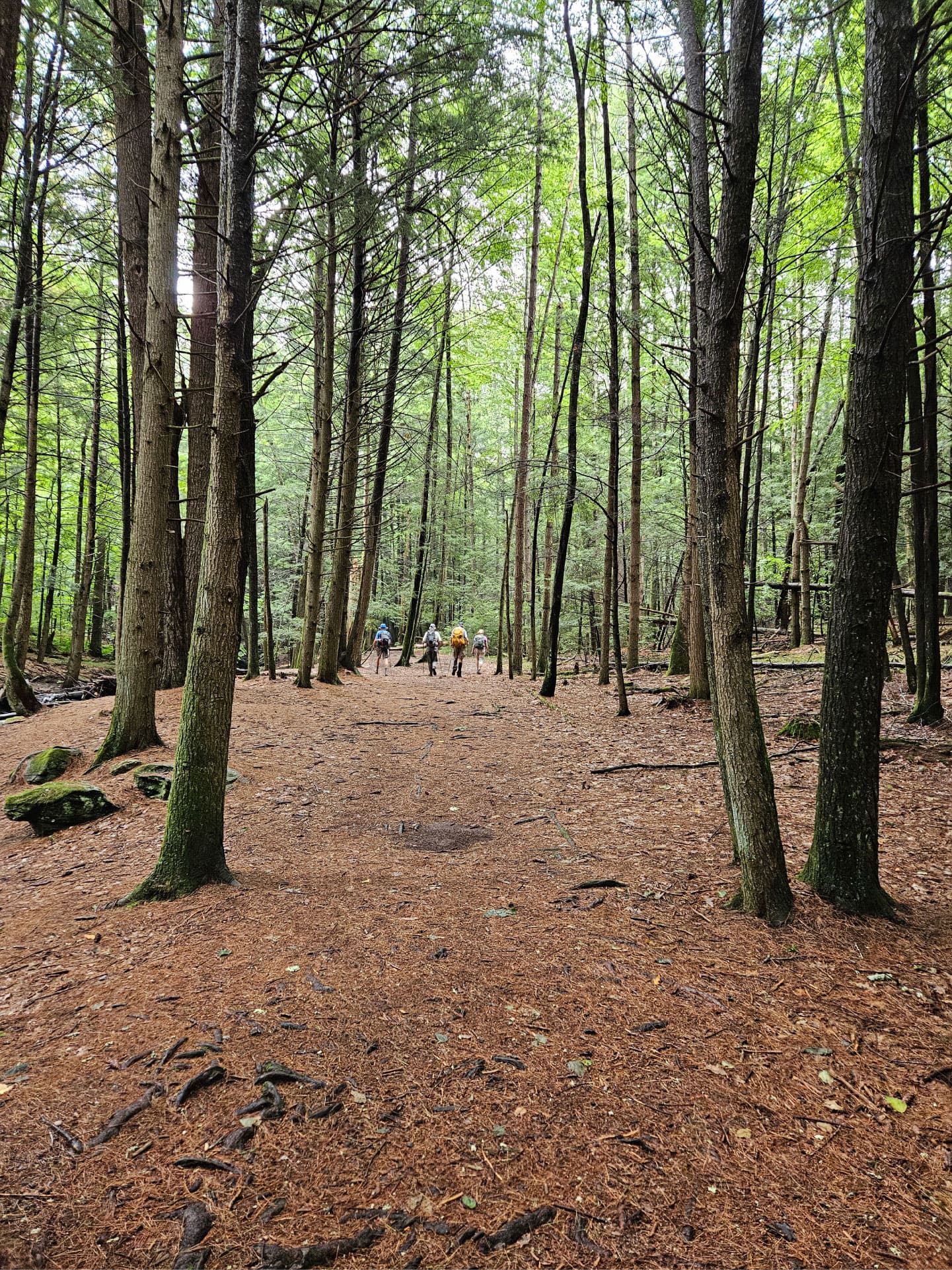
VIEW IMAGE » Backpacking in Southern VT
[05‑Jul‑2025] Hikers ford a stream while backpacking in southern Vermont.
VIEW IMAGE » Community Engagement Album
[12‑Jun‑2025] Media album for the Community Engagement Committee.
VIEW ALBUM » Fording a Brook on the Robert Frost Trail
[08‑Jun‑2025] Hikers cross a brook on the Robert Frost Trail.
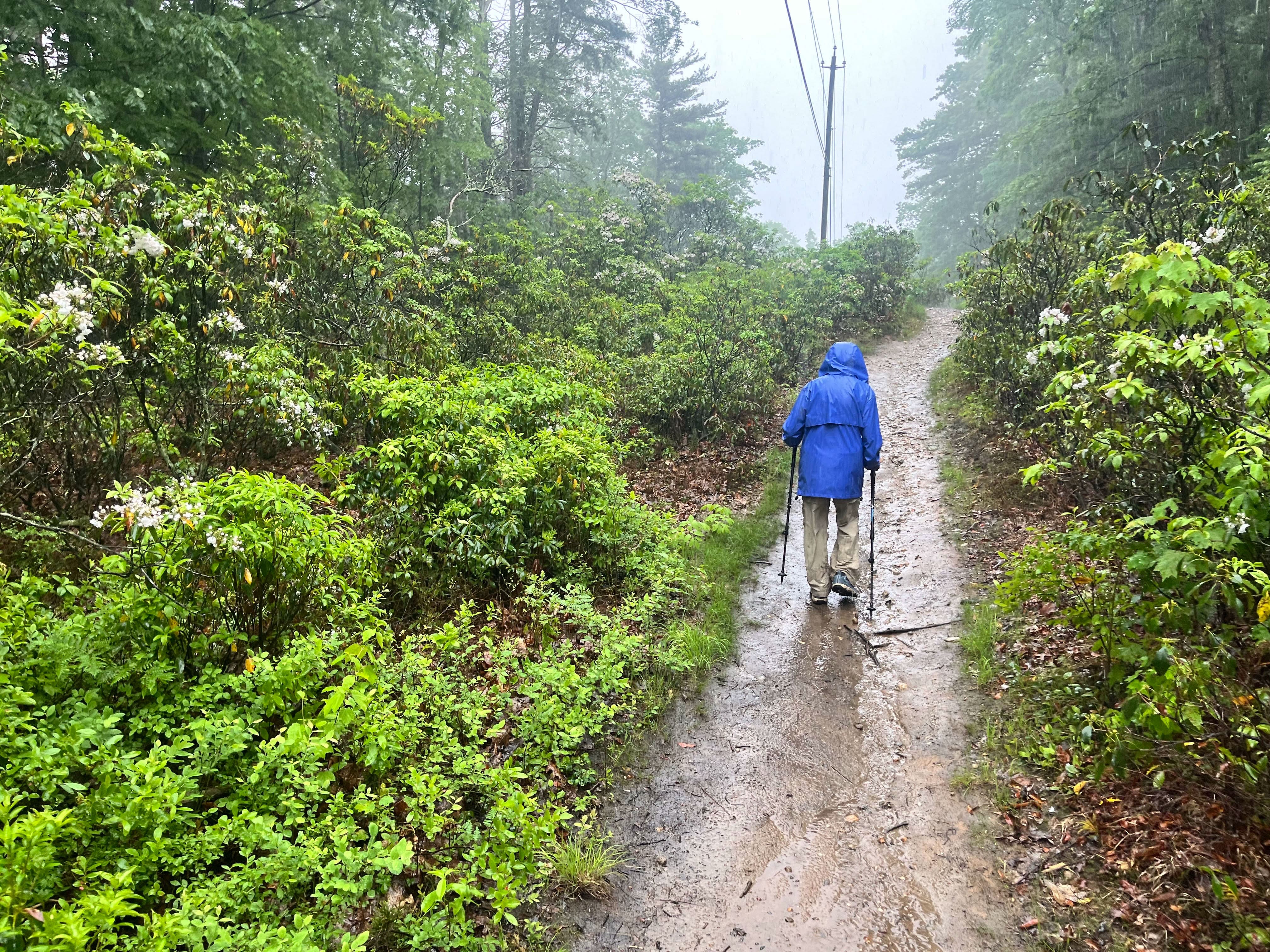
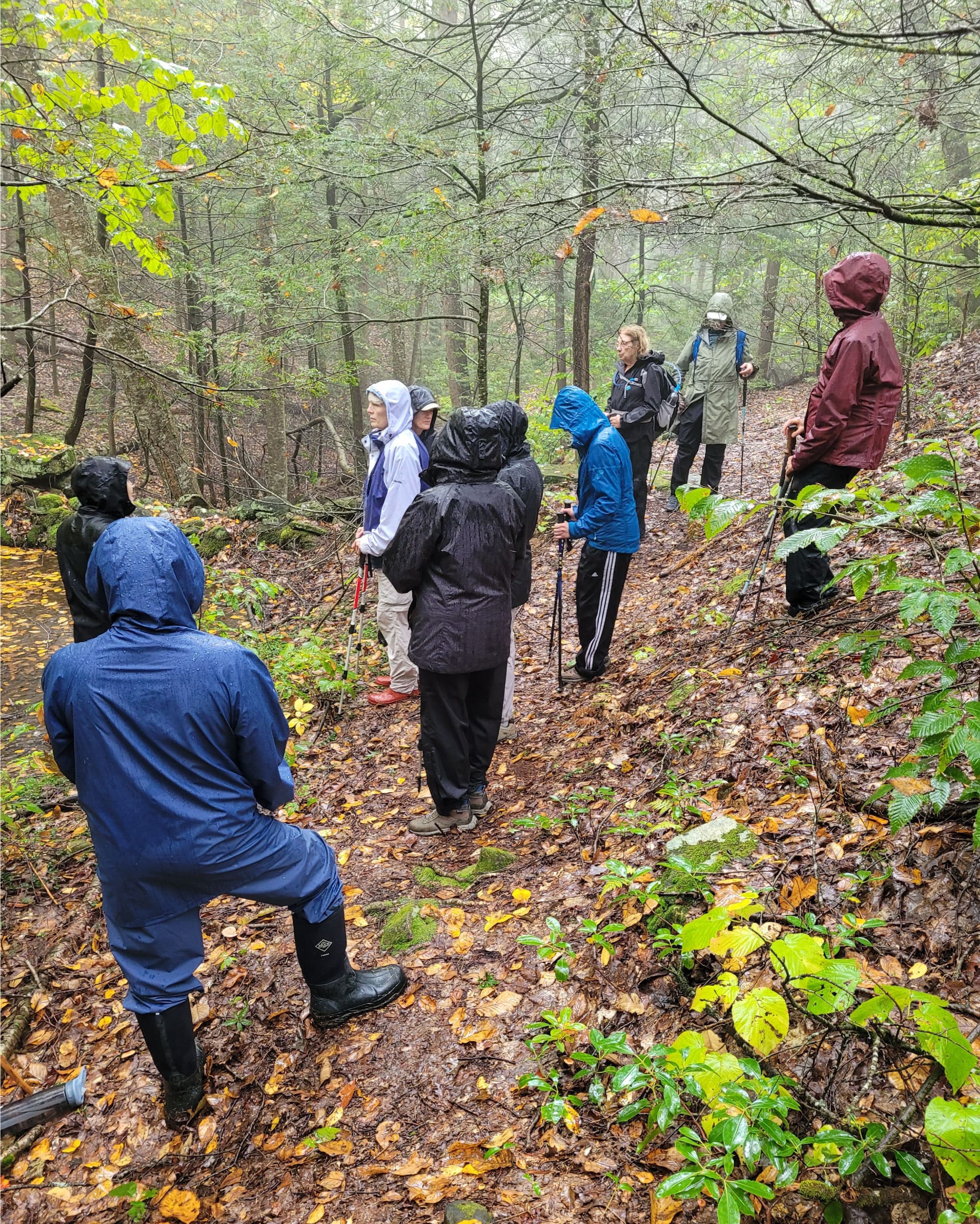
VIEW IMAGE » National Trails Day Hike
[07‑Jun‑2025] A solitary hiker braves the rain on a National Trails Day hike in Mt Holyoke Range State Park.
VIEW IMAGE » People’s State Forest
[27‑May‑2025] James Chaugham and Molly Barber established the Barkhamstead Lighthouse community in the mid-eighteenth century and their descendants lived there until 1860.
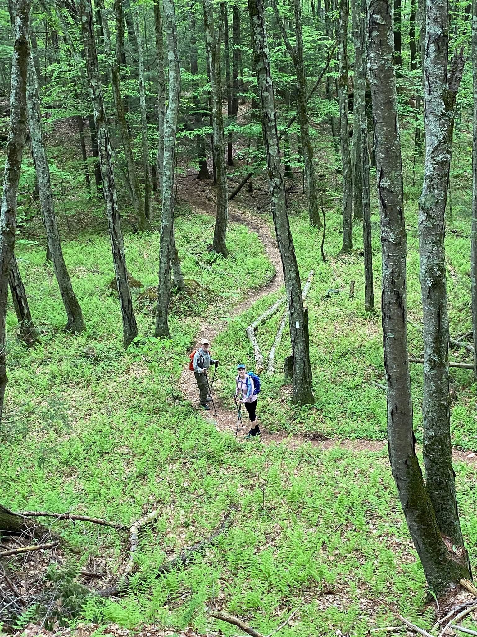
VIEW IMAGE » A.T. Hike Series Section 3
[17‑May‑2025] Hikers on the A.T. Section 3 in western MA.
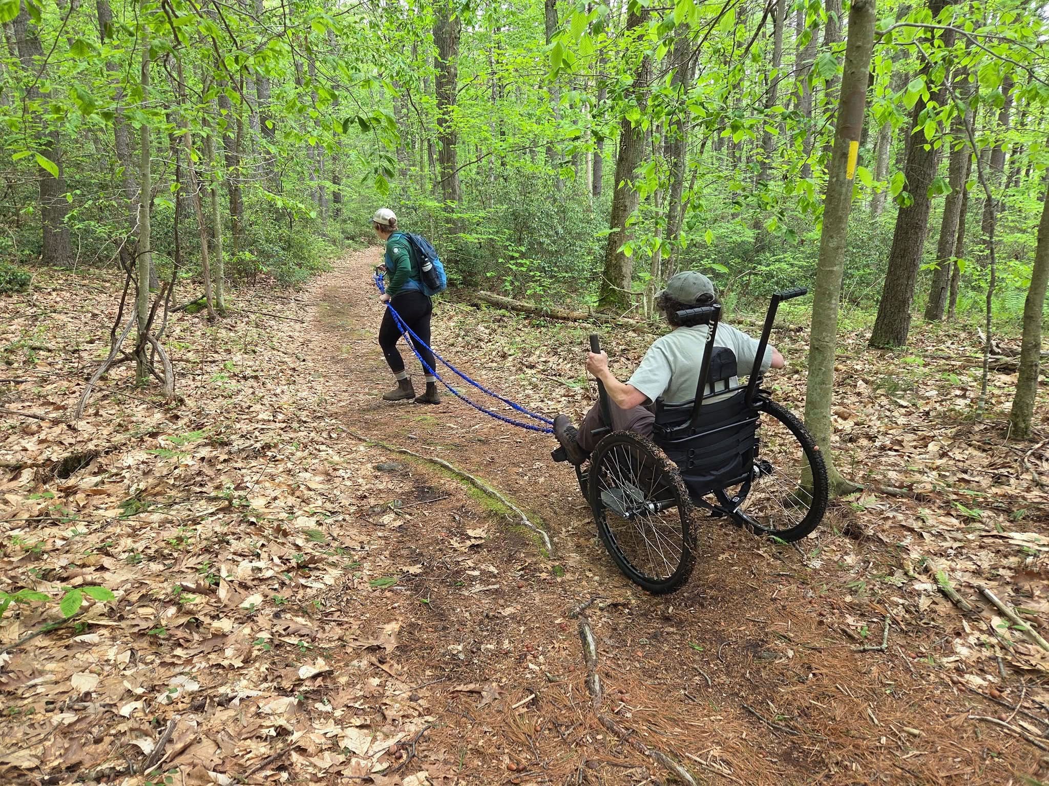
VIEW IMAGE » Bright Water Bog Adaptive Hike
[17‑May‑2025] AMC and All Out Adventures collaborated to host an adaptive hike at Bright Water Bog in Shutesbury in May 2025. The participants/volunteers learned how to use two adaptive walkers and the Freedom Chairbefore assisting several disabled people on a hike around the pond.
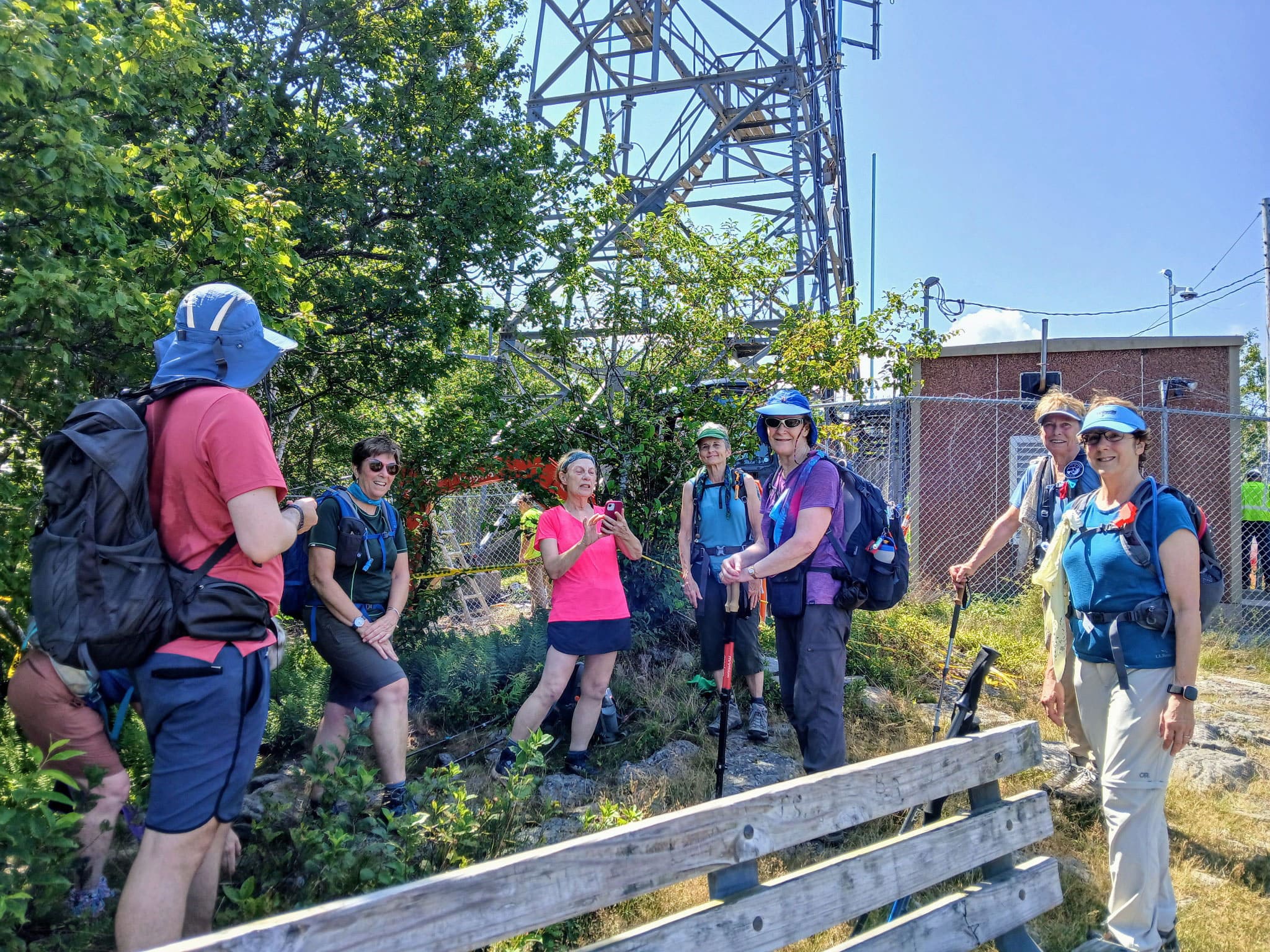
VIEW IMAGE » Seven Sisters Trail Race
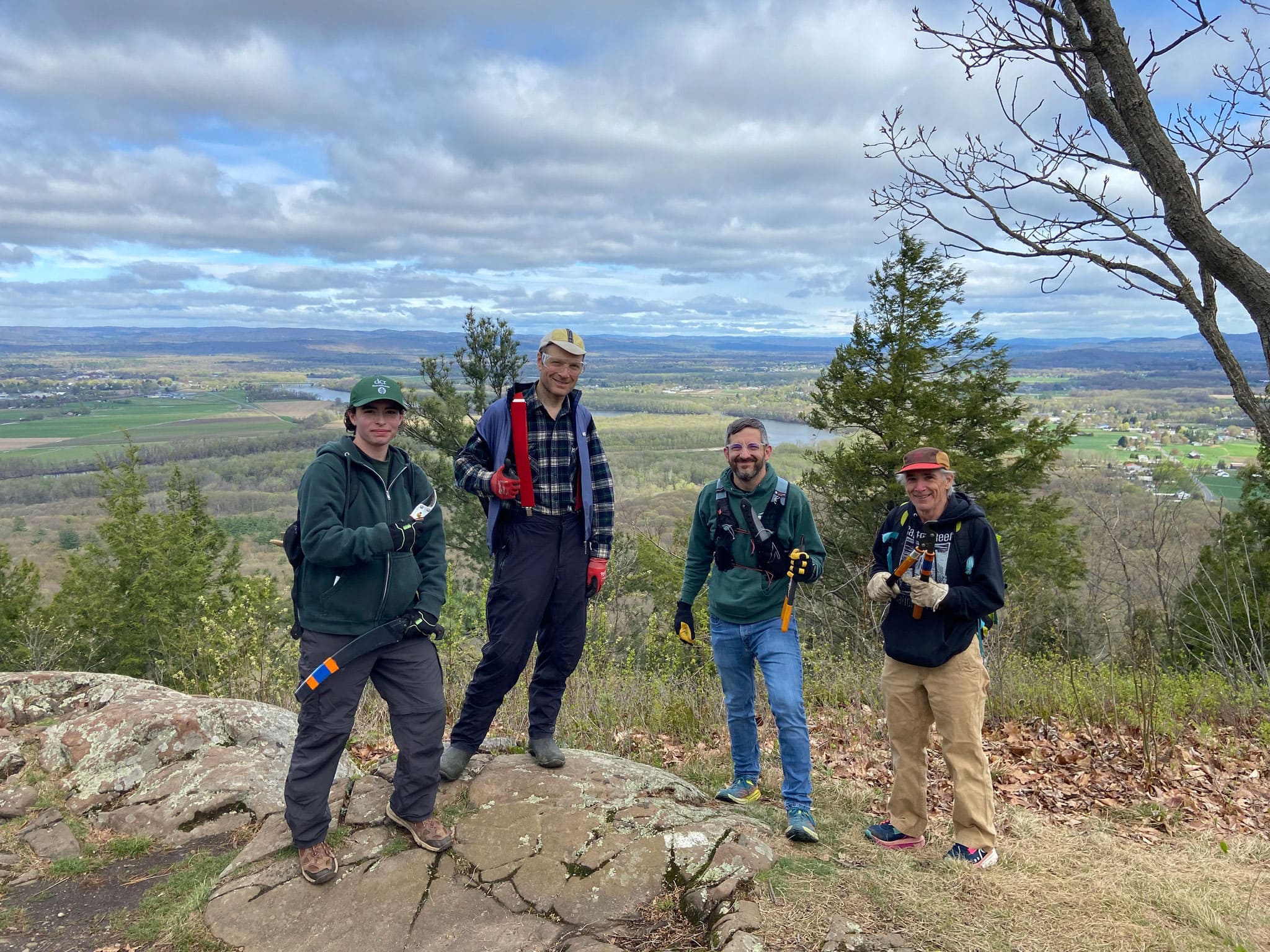
[27‑Apr‑2025] Ten volunteers, including NET adopters, DCR staff from Skinner State Park, and local trail runners, spent the day on Saturday, April 27
th clearing the trail in advance of the Seven Sisters Trail Race.
VIEW IMAGE » 20s/30s Album
[27‑Mar‑2025] Media album for the 20s/30s Committee.
VIEW ALBUM » Farley Ledge
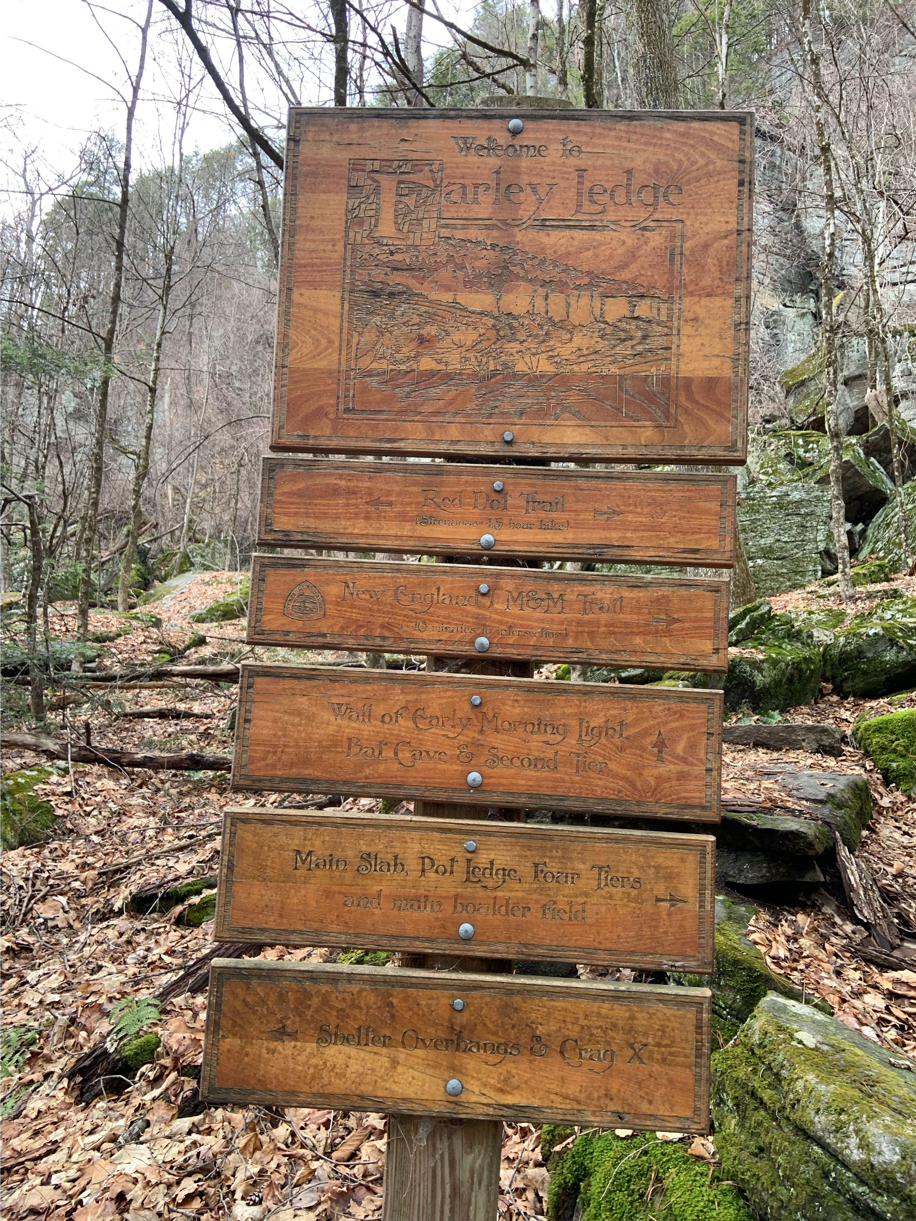
[25‑Mar‑2025] Farley Ledge trail sign.
VIEW IMAGE » Mt Toby
[23‑Mar‑2025] Happy hikers on the trail to Mt Toby.
VIEW IMAGE » Bog Bridge Repair
[23‑Mar‑2025] Bog bridge on the A.T. at Hubbard Brook.
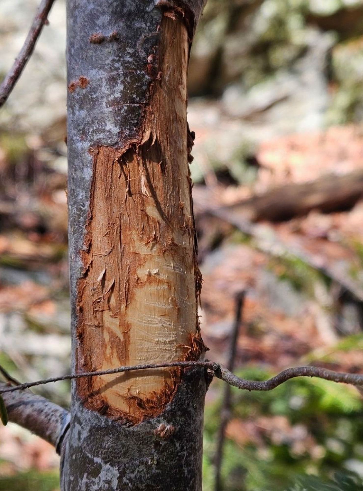
VIEW IMAGE » Porcupine Chew
[18‑Mar‑2025] Fresh porcupine chew found on Race Mountain during a wildlife transect.
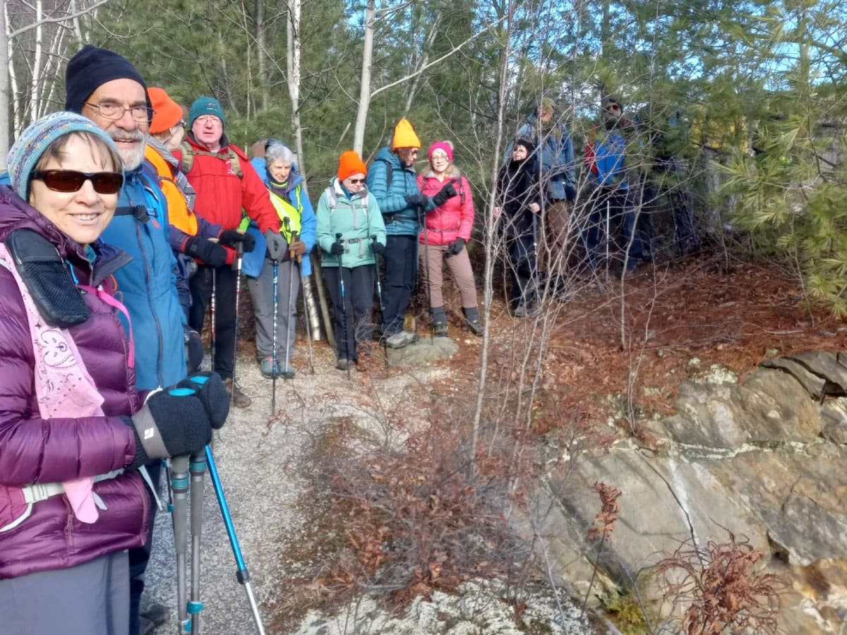
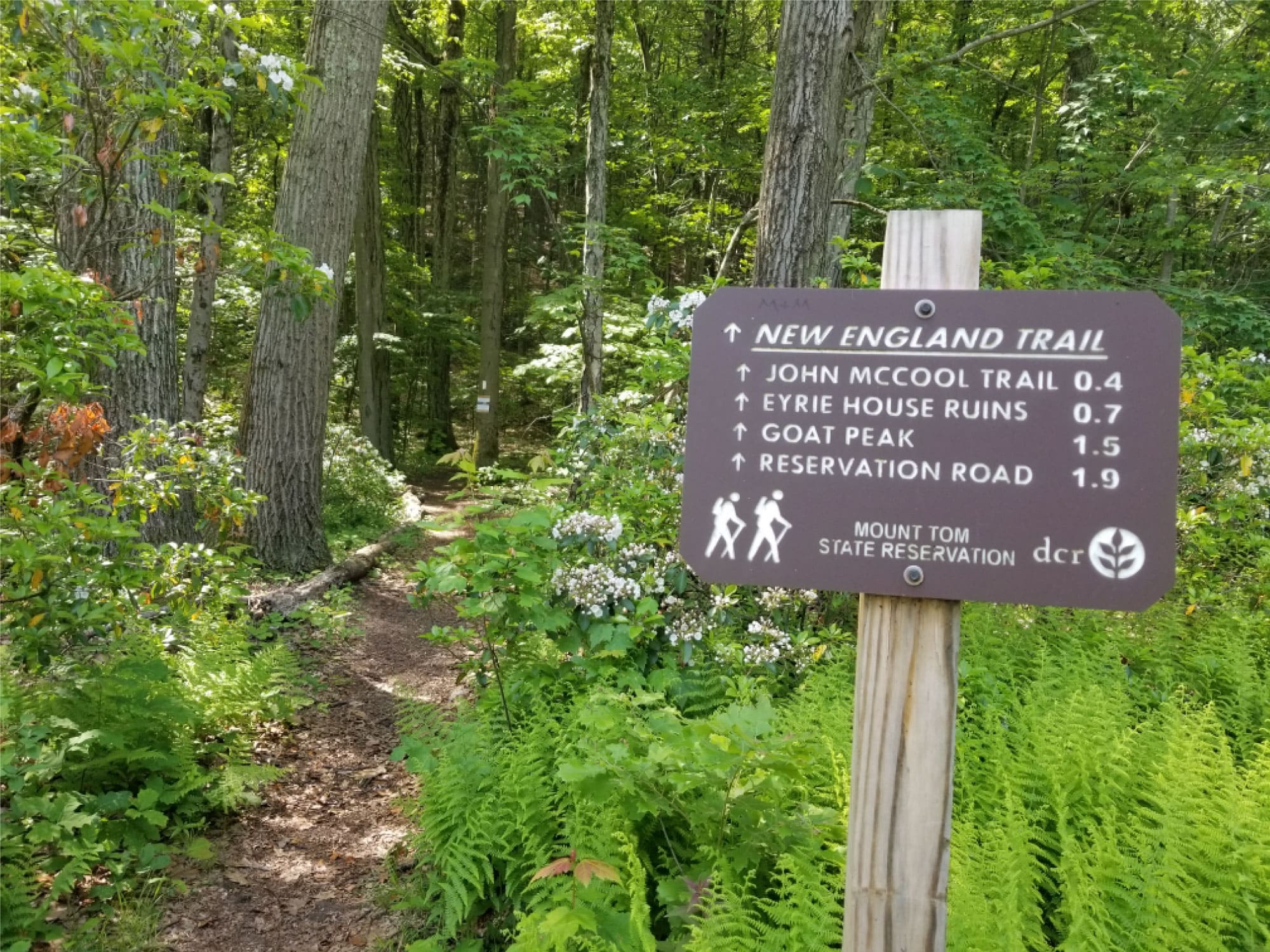
VIEW IMAGE » NET Section 8
[17‑Mar‑2025] Tuesday hikers stop for a photo op on Section 8 of the NET.
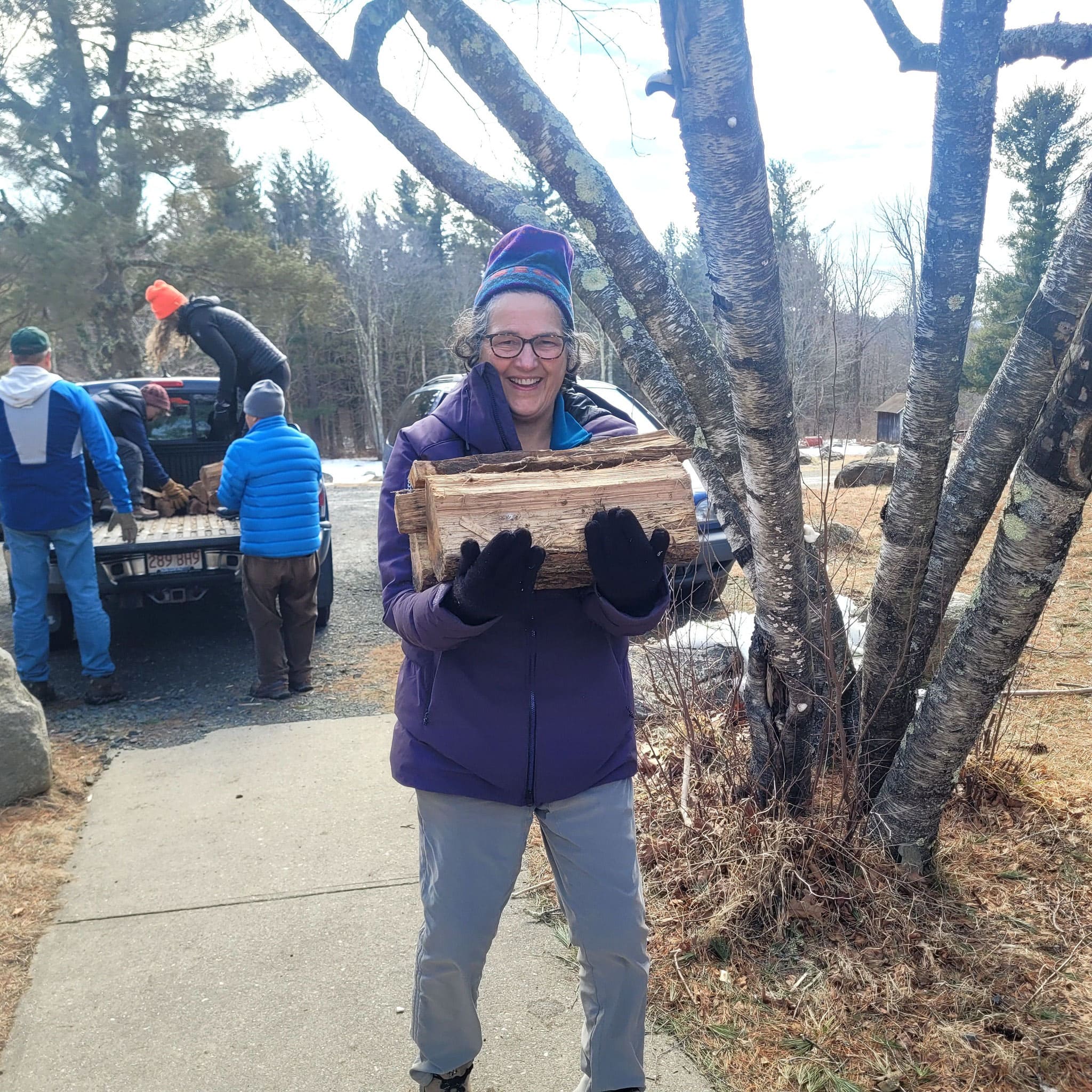
VIEW IMAGE » ExCom Social Outing
[09‑Mar‑2025] ExCom members load wood at Noble View Outdoor Center during a social outing.
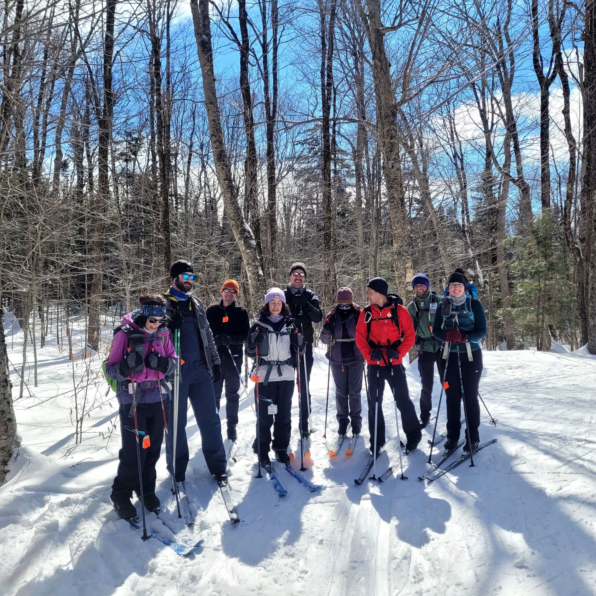
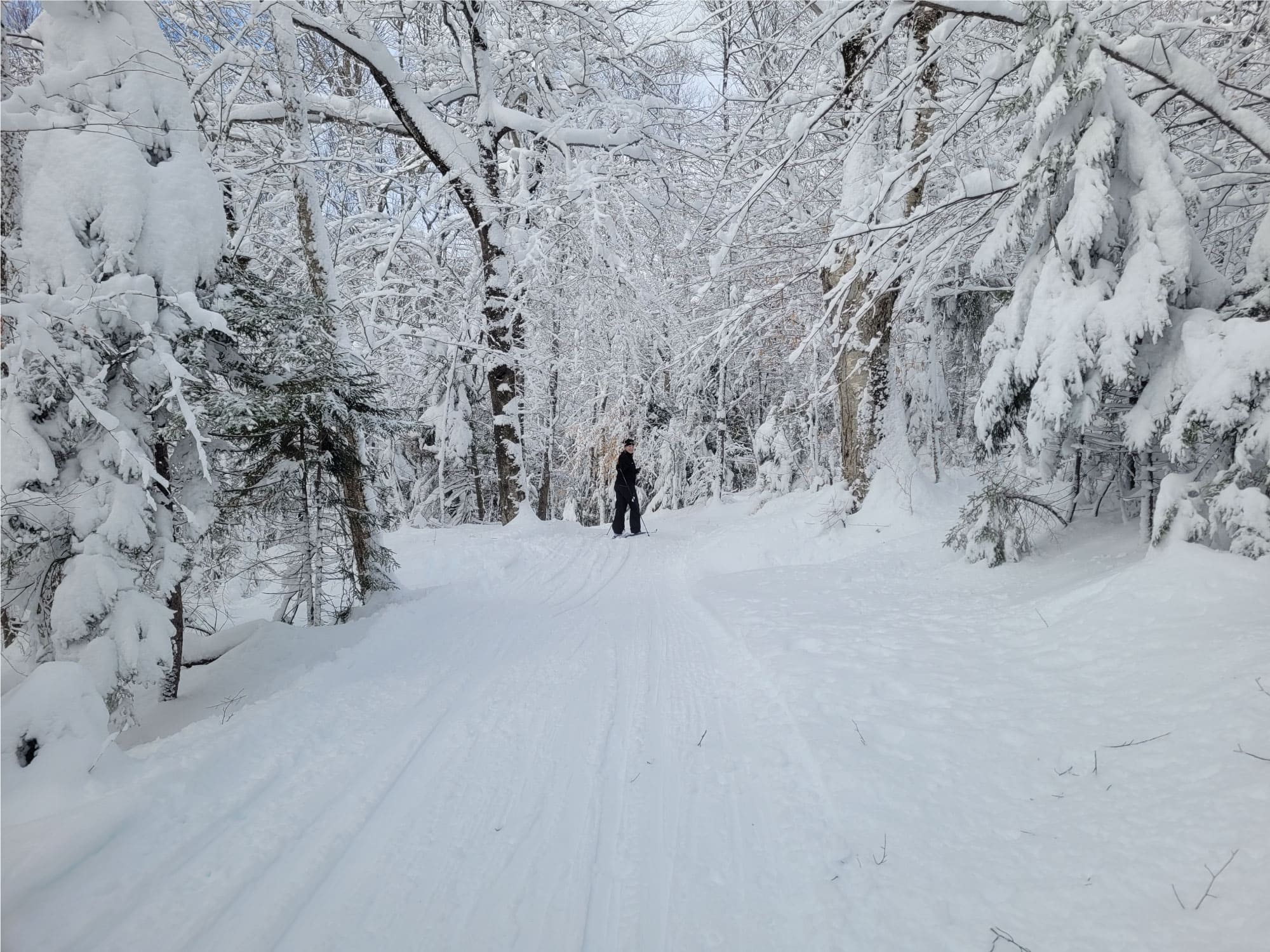
VIEW IMAGE » Cross-Country Skiing at Notchview
[25‑Feb‑2025] Group shot of cross-country skiers enjoying an outing at Notchview.
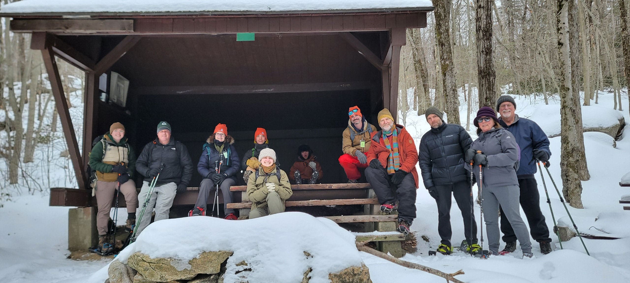
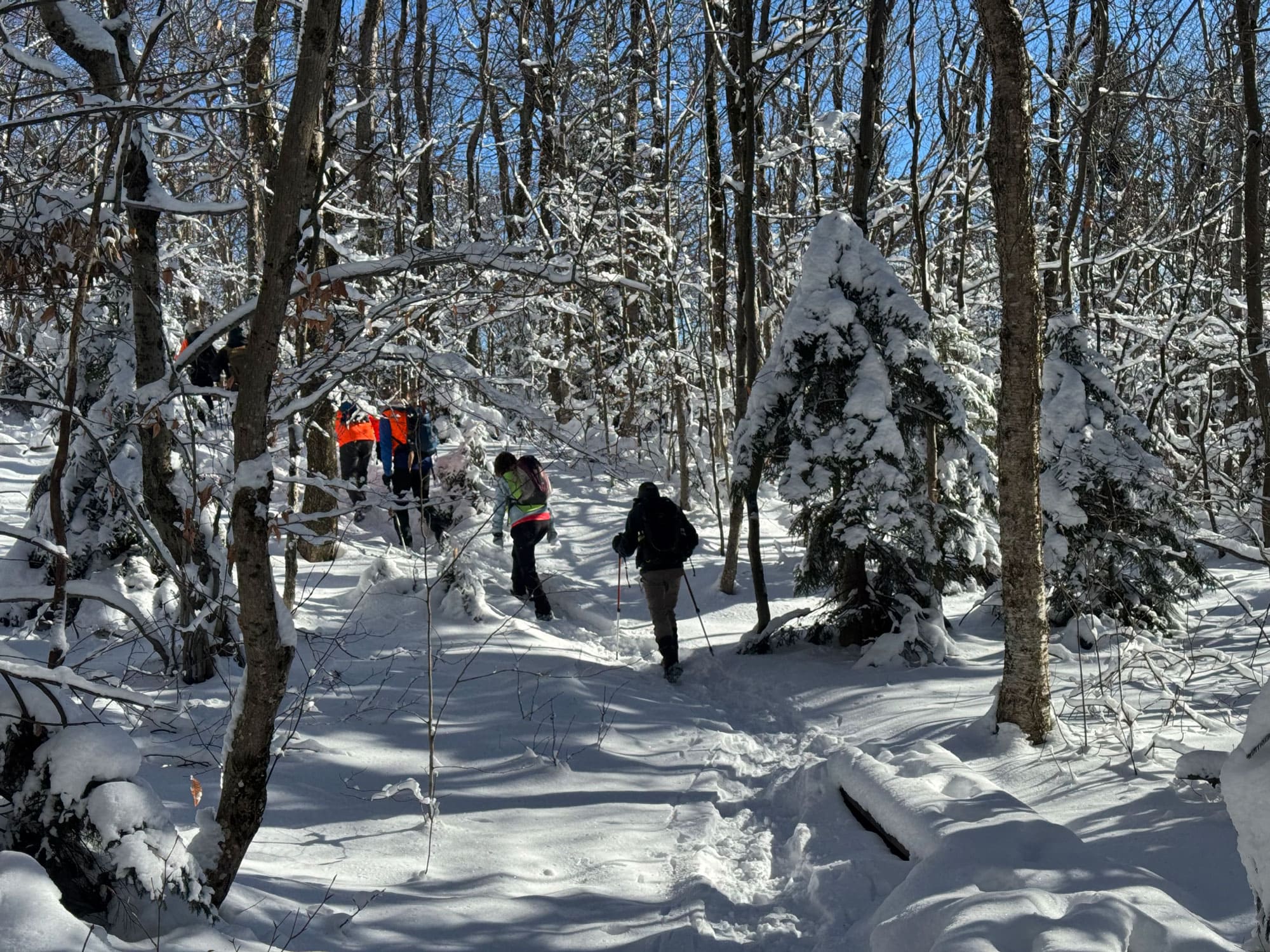
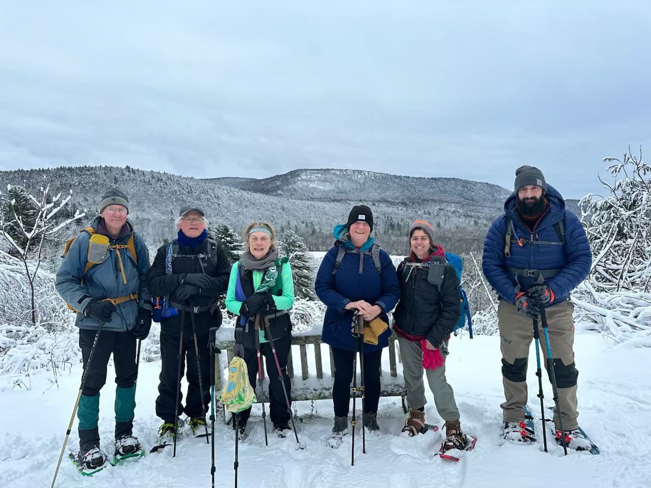
VIEW IMAGE » NET Snowshoe Hike
[15‑Feb‑2025] Party of snowshoers during a collaborative hike on the NET between the NET Management Committee, All Out Adventures, and the DCR Universal Access Program.
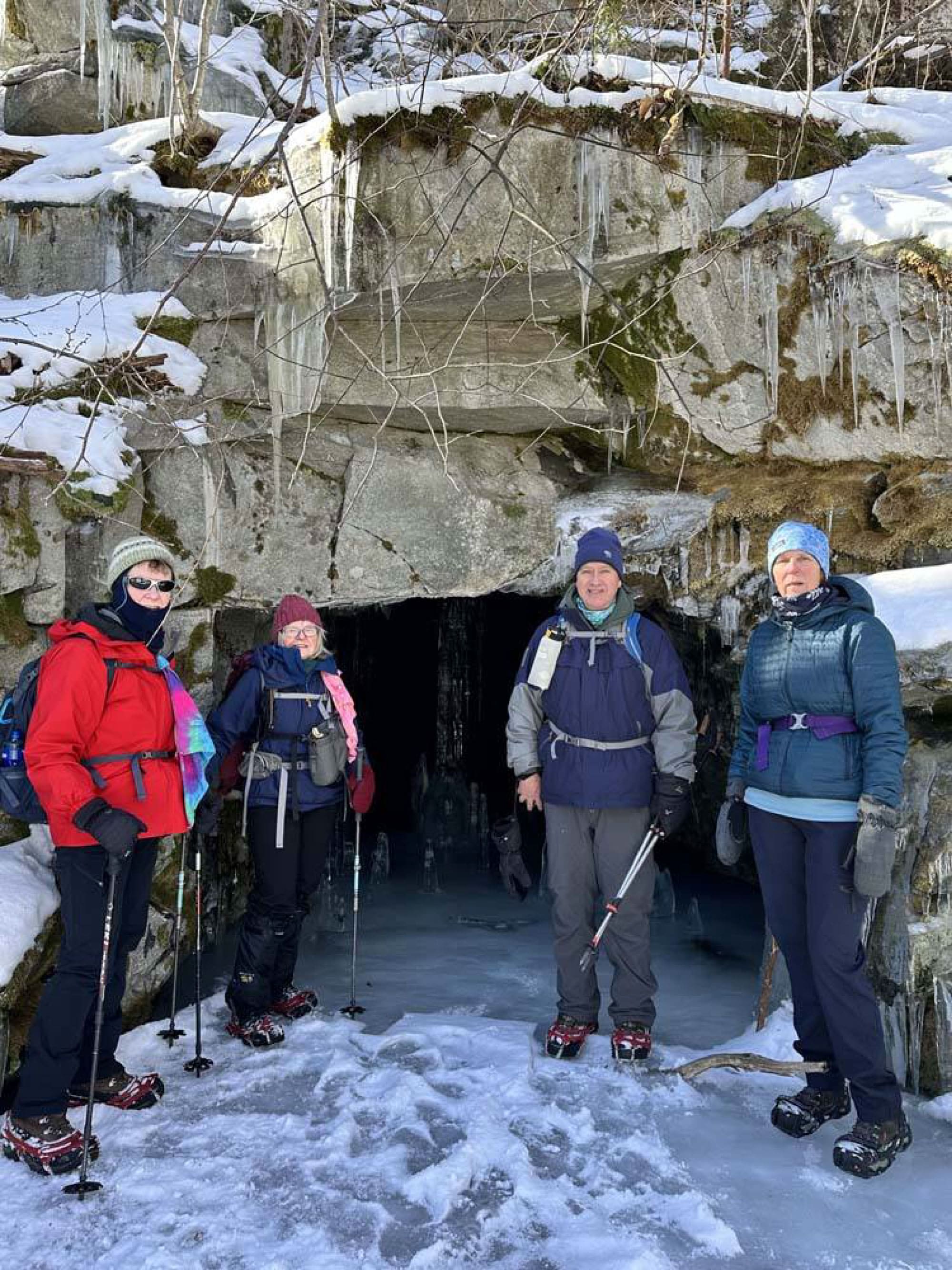
VIEW IMAGE » Becket Quarry
[28‑Jan‑2025] Tuesday hikers pause for a photo at the entrance to an adit at Becket Quarry.
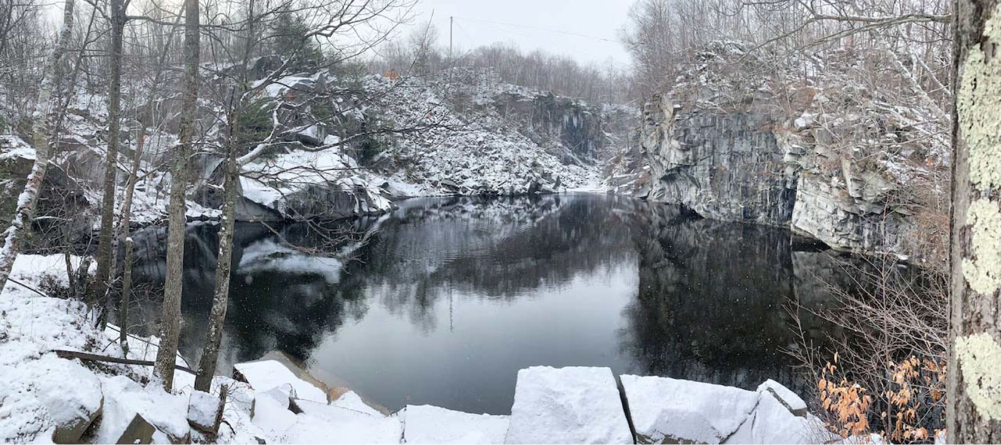
VIEW IMAGE » Becket Quarry
[28‑Jan‑2025] View of Becket Quarry on a winter day.
VIEW IMAGE » Membership Album
[10‑Dec‑2024] Media album for the Membership Committee.
VIEW ALBUM » Rounds Rock Trail
[03‑Dec‑2024] Tuesday hikers ascend Rounds Rock Trail at Mt Greylock on a winter day.
VIEW IMAGE » Tuesday Hikers
[23‑Nov‑2024] Two Tuesday hikers on the A.T. in Great Barrington, MA.
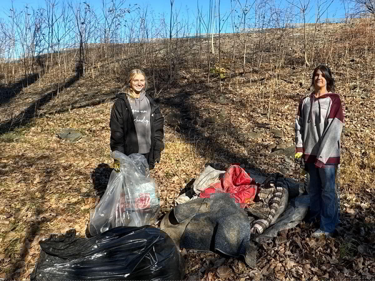
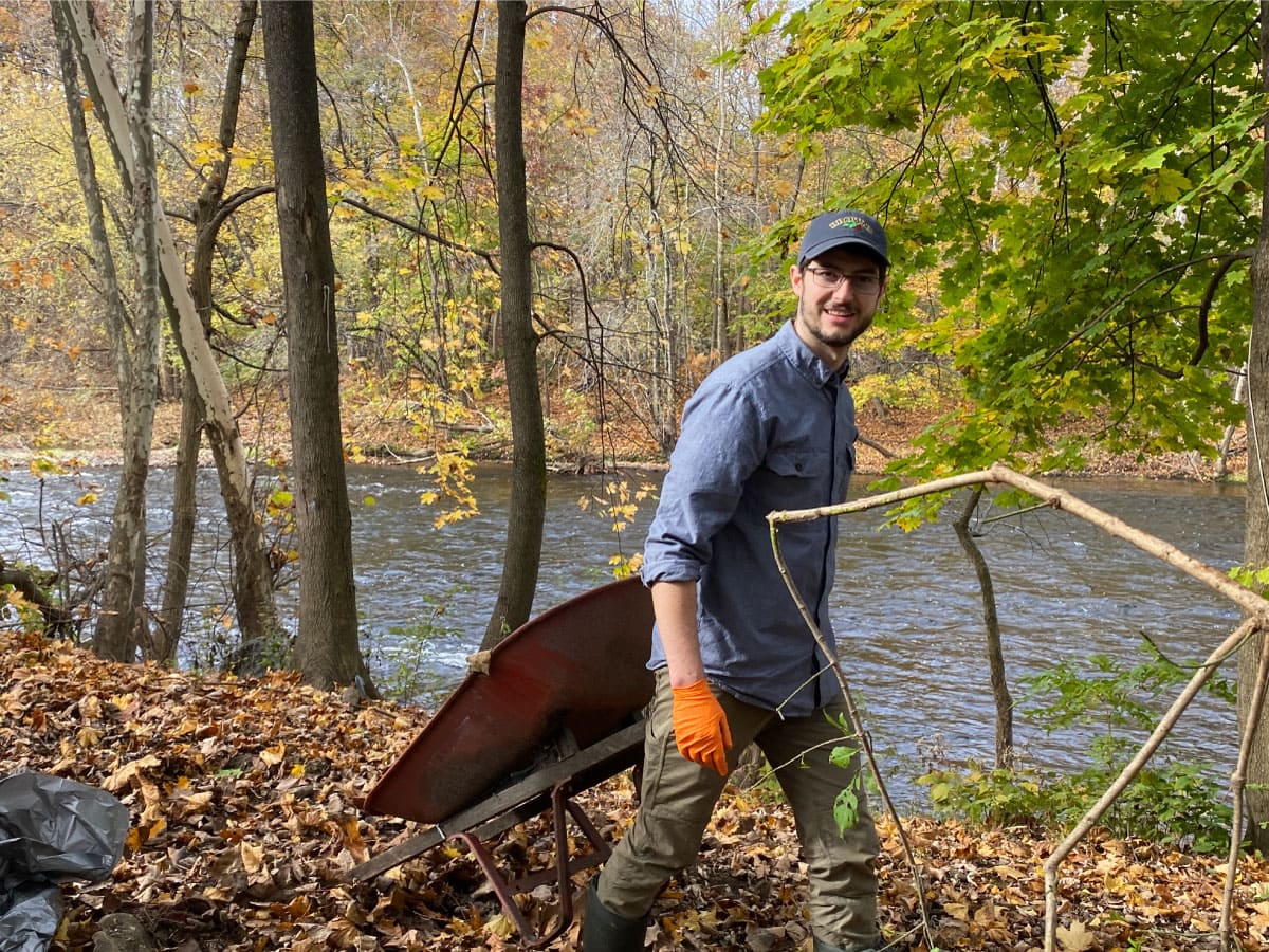
VIEW IMAGE » 2024 Westfield River Waterfront Cleanup
[03‑Nov‑2024] Conservation volunteers fill bags with trash collected from a riverbank during the 2024 Westfield River Waterfront Cleanup day.
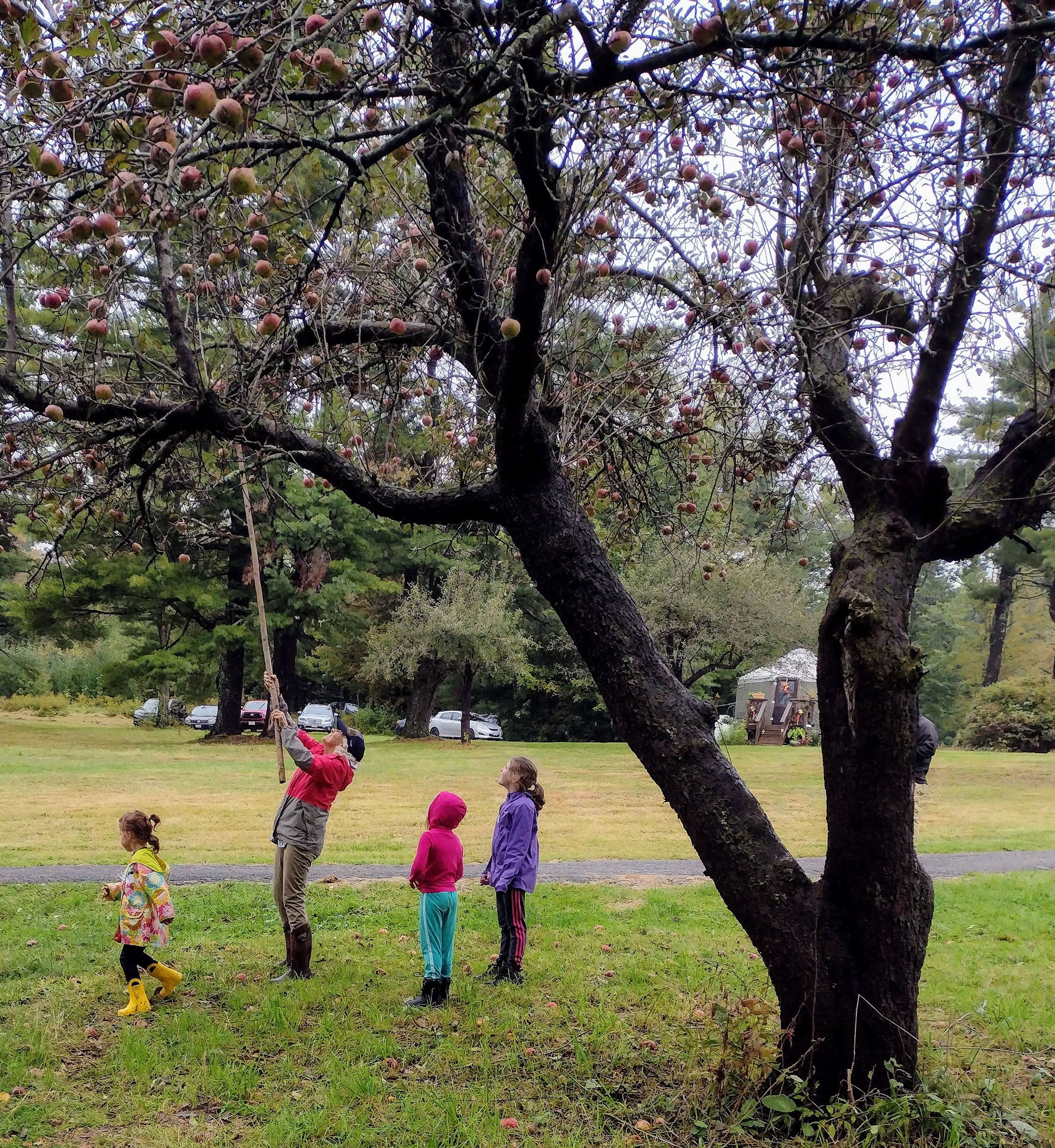
VIEW IMAGE » Apple Picking
[29‑Oct‑2024] Apple picking at Noble View.
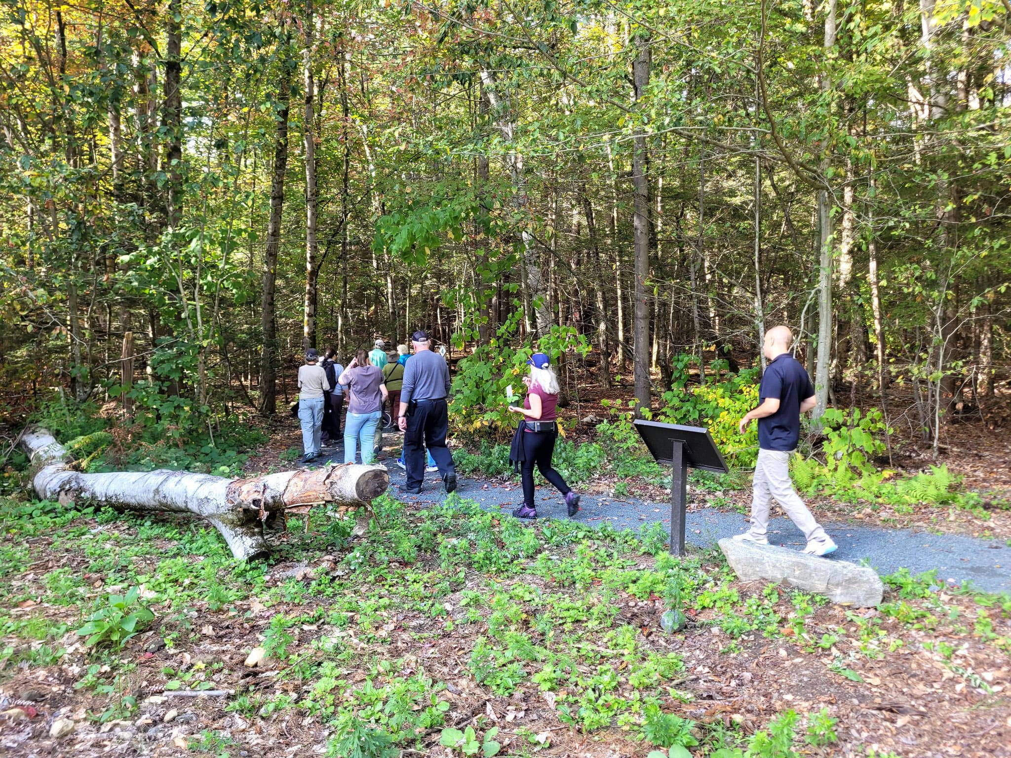
VIEW IMAGE » APT Celebration Walk
[28‑Sep‑2024] After the ribbon cutting, folks walked on the 0.6-mile accessible trail, then enjoyed refreshments at the Double Cottage with beautiful views of the valley below.
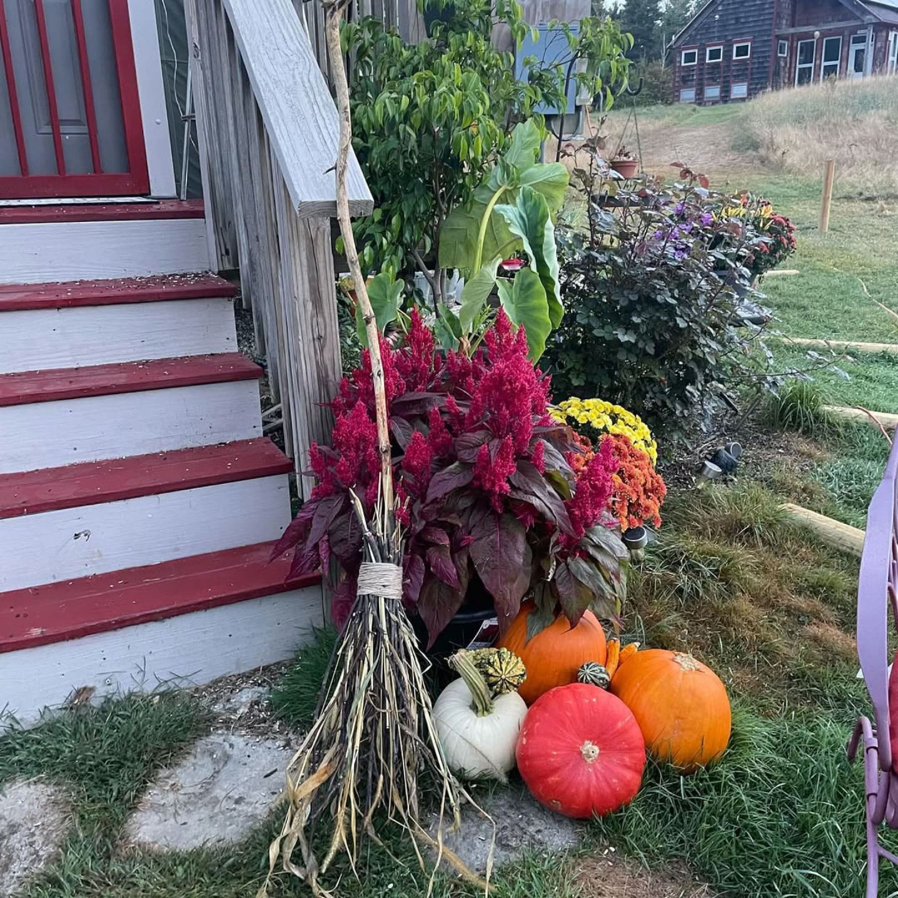
VIEW IMAGE » Fall at Noble View
[23‑Sep‑2024] Pumpkins at Noble View.
VIEW IMAGE » Robert Frost Trail
[23‑Jul‑2024] Tuesday hikers on a six-mile trek to the Robert Frost Trail.
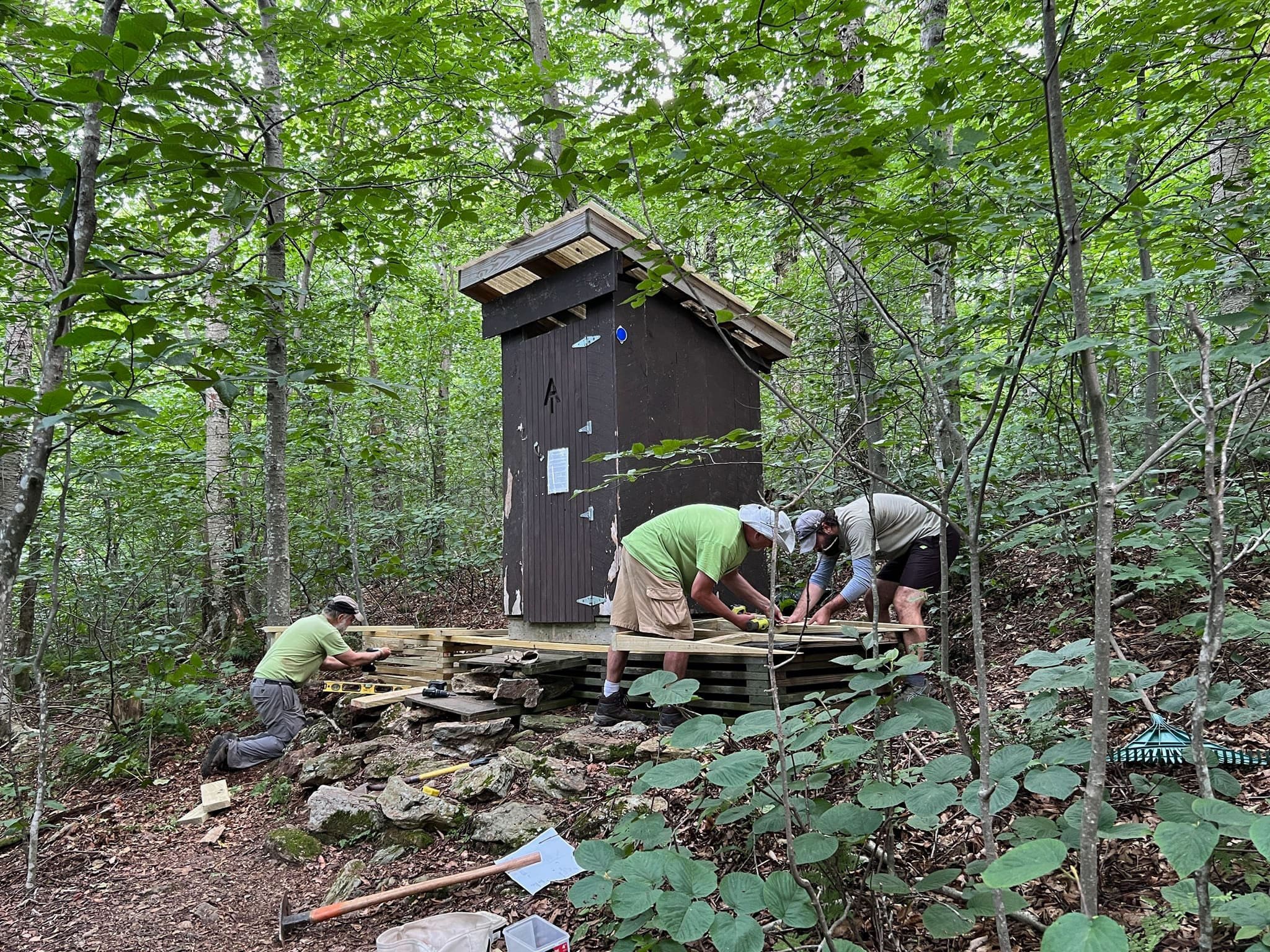
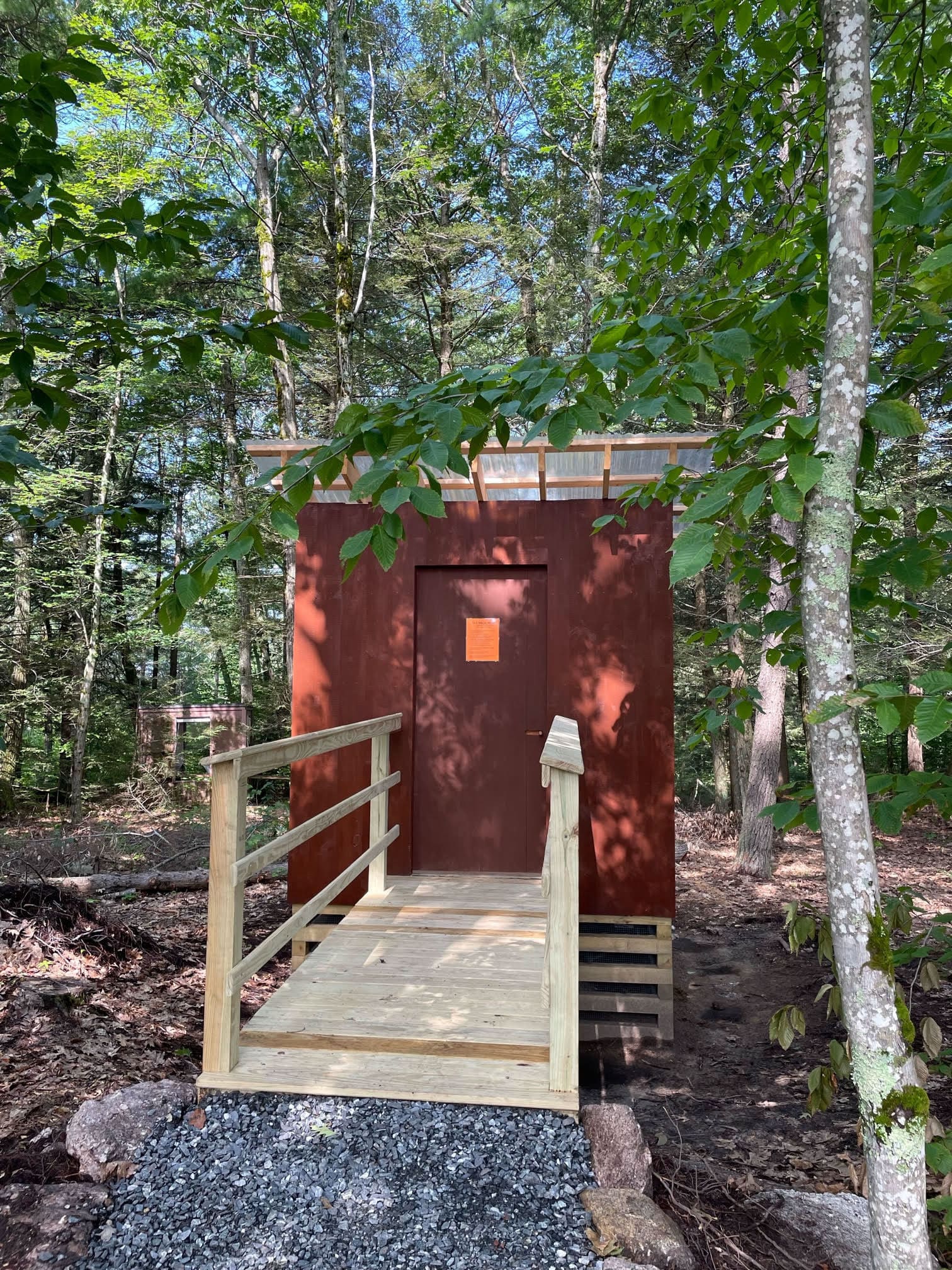
VIEW IMAGE » Trail Work at Mt Greylock
[20‑Jul‑2024] Members of the A.T. Committee upgrading the privy at Mt Greylock.
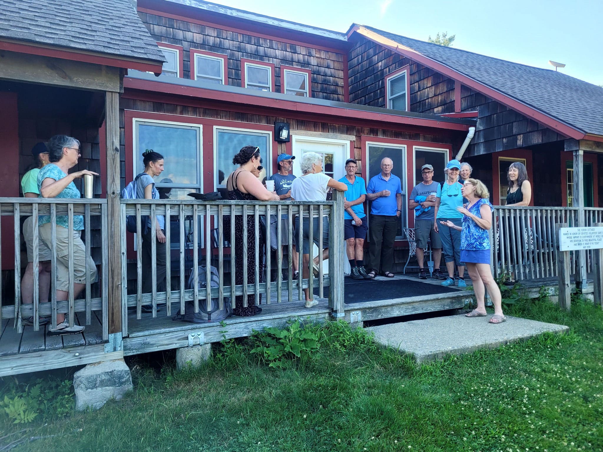
VIEW IMAGE » ExCom Social
[08‑Jul‑2024] Western MA volunteers gather on the deck at Noble View during a July social.
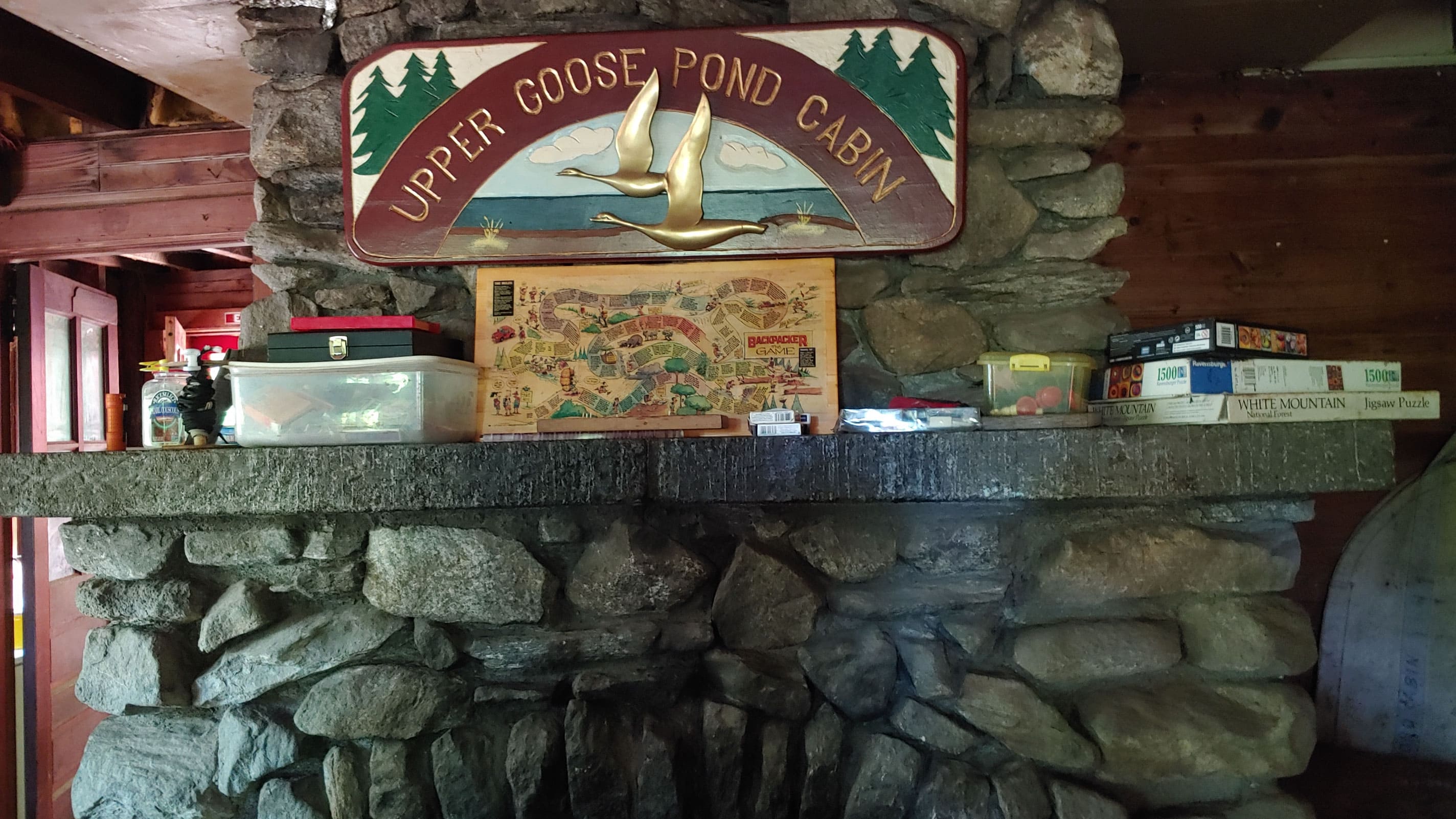
VIEW IMAGE » Upper Goose Pond Cabin Fireplace
[15‑Jun‑2024] Upper Goose Pond Cabin fireplace.
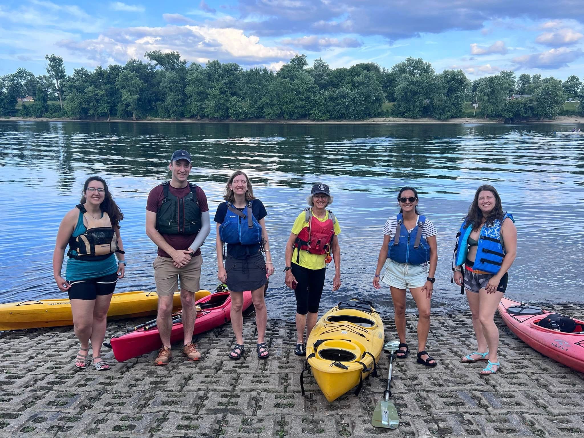
VIEW IMAGE » Paddling the Connecticut River
[12‑Jun‑2024] Group photo of 20s/30s members as they get ready to kayak with Deb Weisenstein, Co-Chair of the Paddling Committee.
VIEW IMAGE » Mary Edwards Mountain Property
[28‑May‑2024] Tuesday hikers at Mary Edwards Mountain Property in North Granby, CT.
VIEW IMAGE » A.T. Boundary Maintenance
[05‑May‑2024] 20s/30s members collaborated with the AT Management Committee to maintain the A.T. corridor.
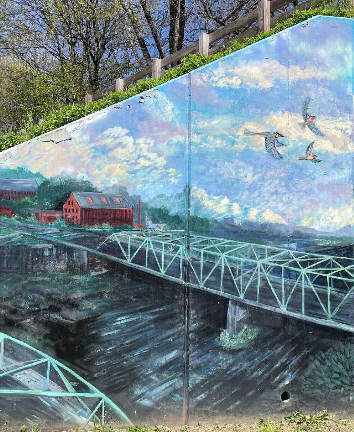
VIEW IMAGE » Heroes Are Everywhere
[30‑Apr‑2024] View of the multi-panel mural "Heroes are Everywhere" created by community volunteers and members of Artworks Westfield.
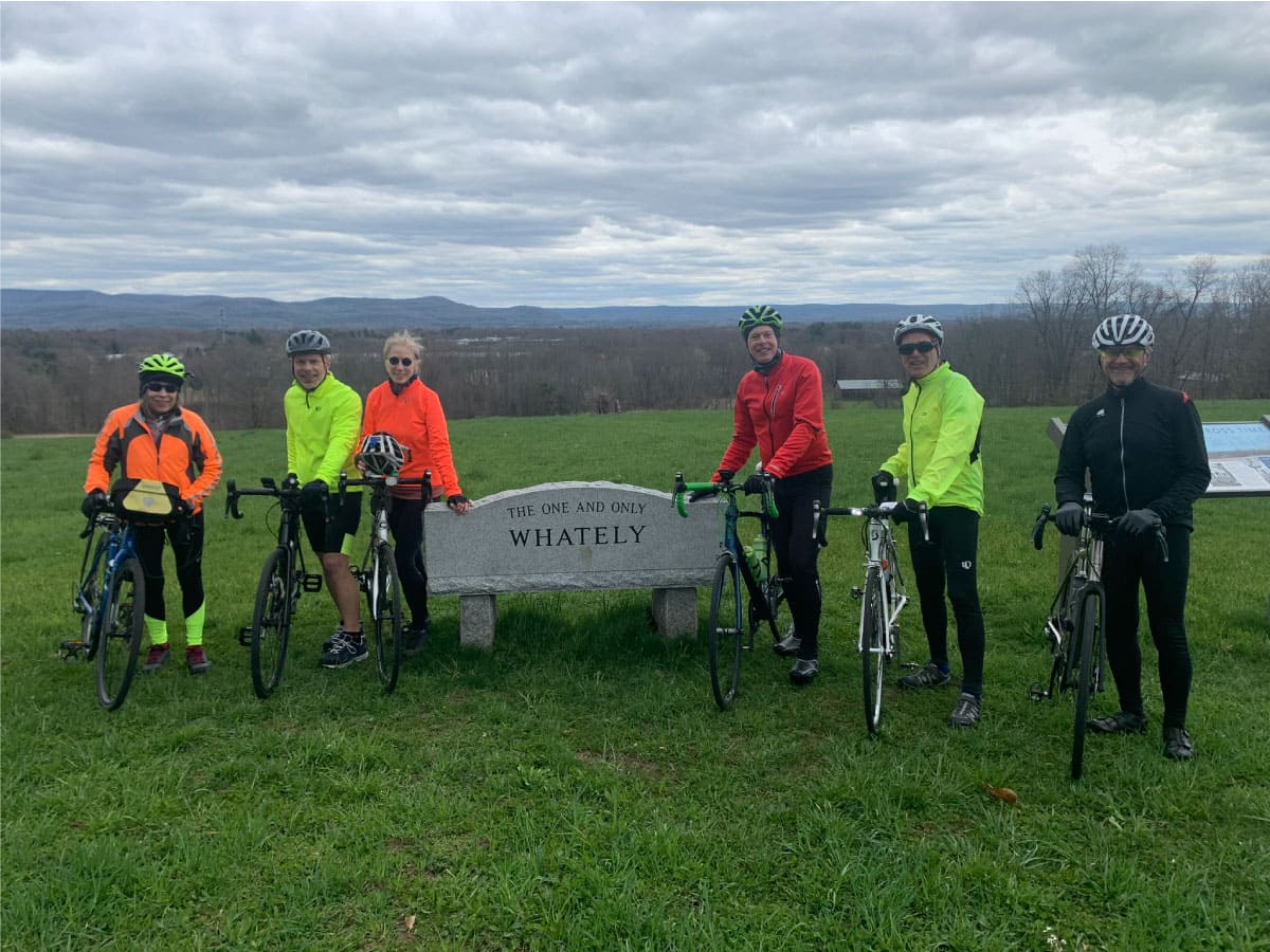
VIEW IMAGE » Spring Warmup
[30‑Apr‑2024] Cyclists stop for a photo during a ride in Whately, MA.
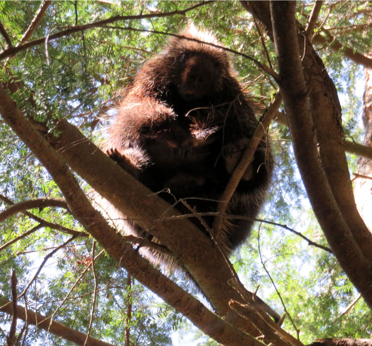
VIEW IMAGE » Hello!
[26‑Apr‑2024] While checking on what the wild things have been up to on A.T. lands in Tyringham our fearless trackers spotted this chunky porcupine up a tree. Watching us.
VIEW IMAGE » Monroe State Forest
[23‑Apr‑2024] Tuesday hikers pose for a photo op on the Dunbar Brook Trail in Monroe State Forest.
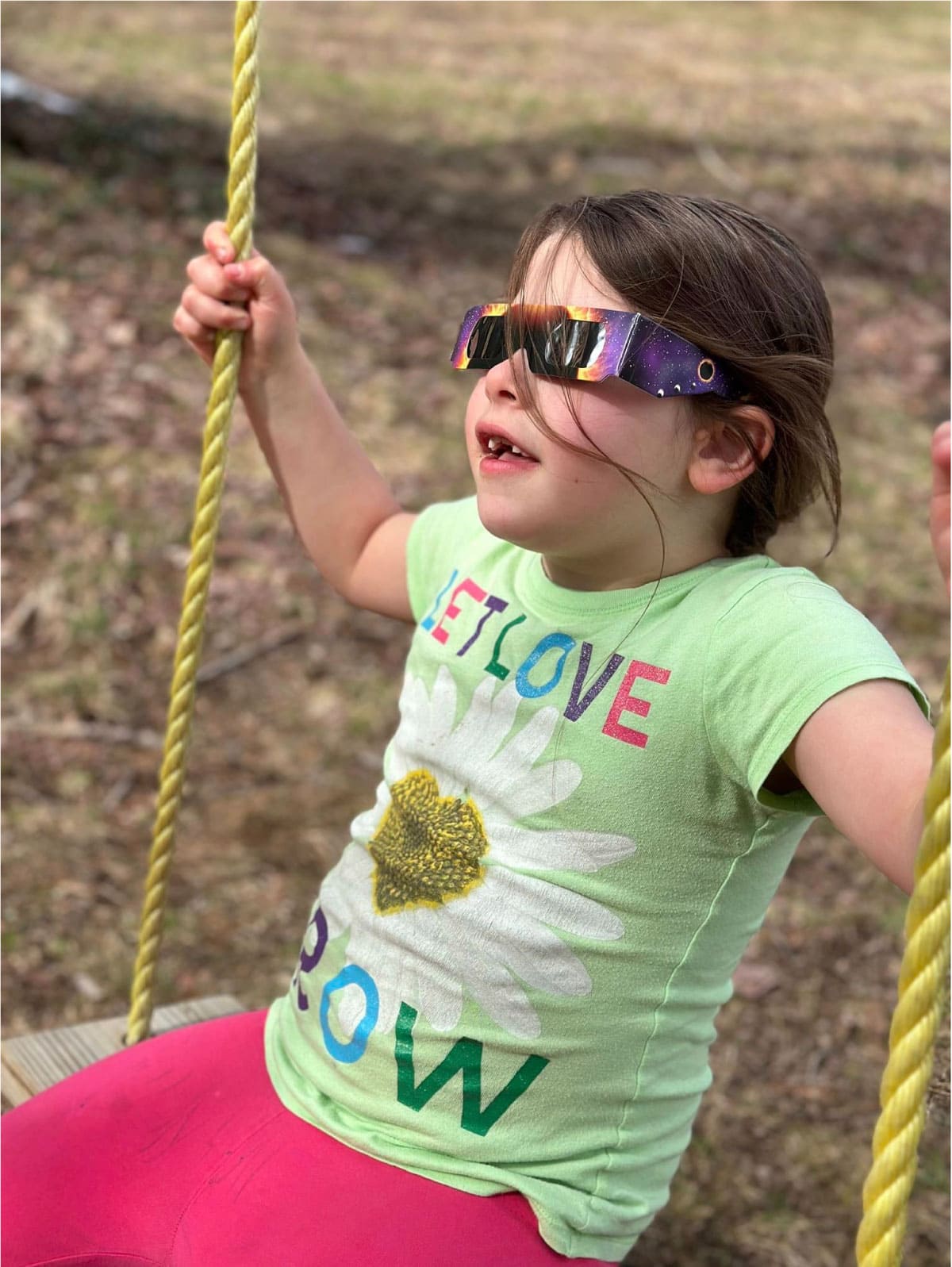
VIEW IMAGE » 2024 Eclipse
[10‑Apr‑2024] Girl on a swing taking in the solar eclipse.
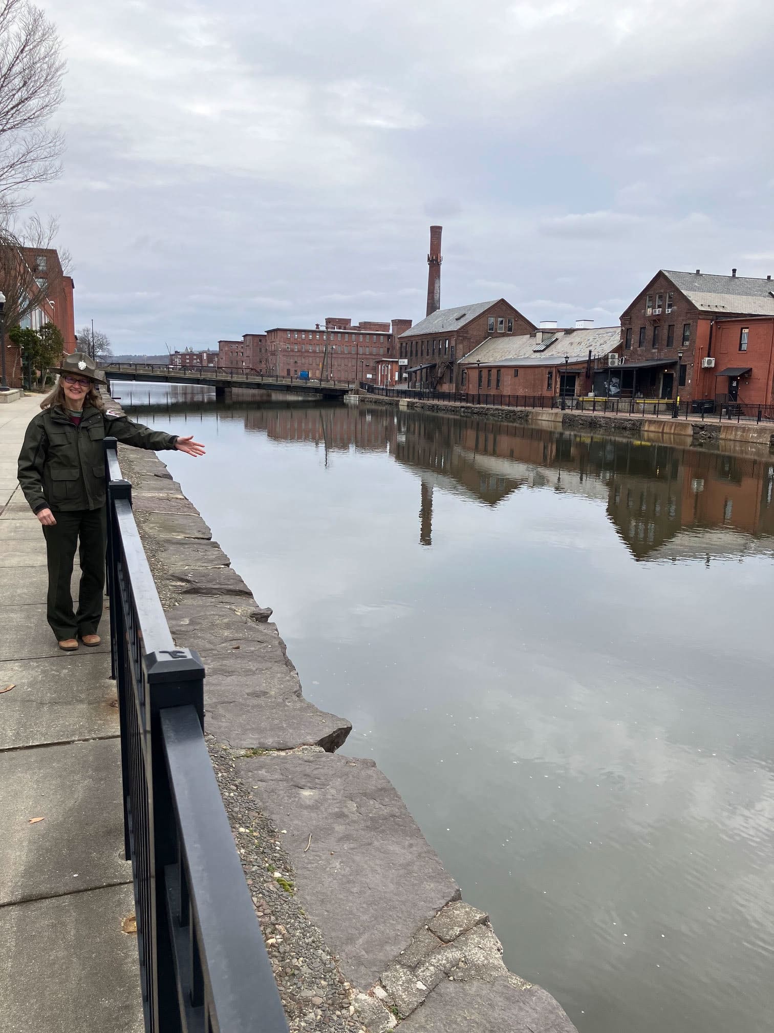
VIEW IMAGE » Reimagining an Industrial City
[16‑Mar‑2024] Holyoke Heritage State Park interpreter takes visitors on a tour of Holyoke Canal.
VIEW IMAGE » Mt Ascutney
[09‑Feb‑2024] View from Mt Ascutney in winter.
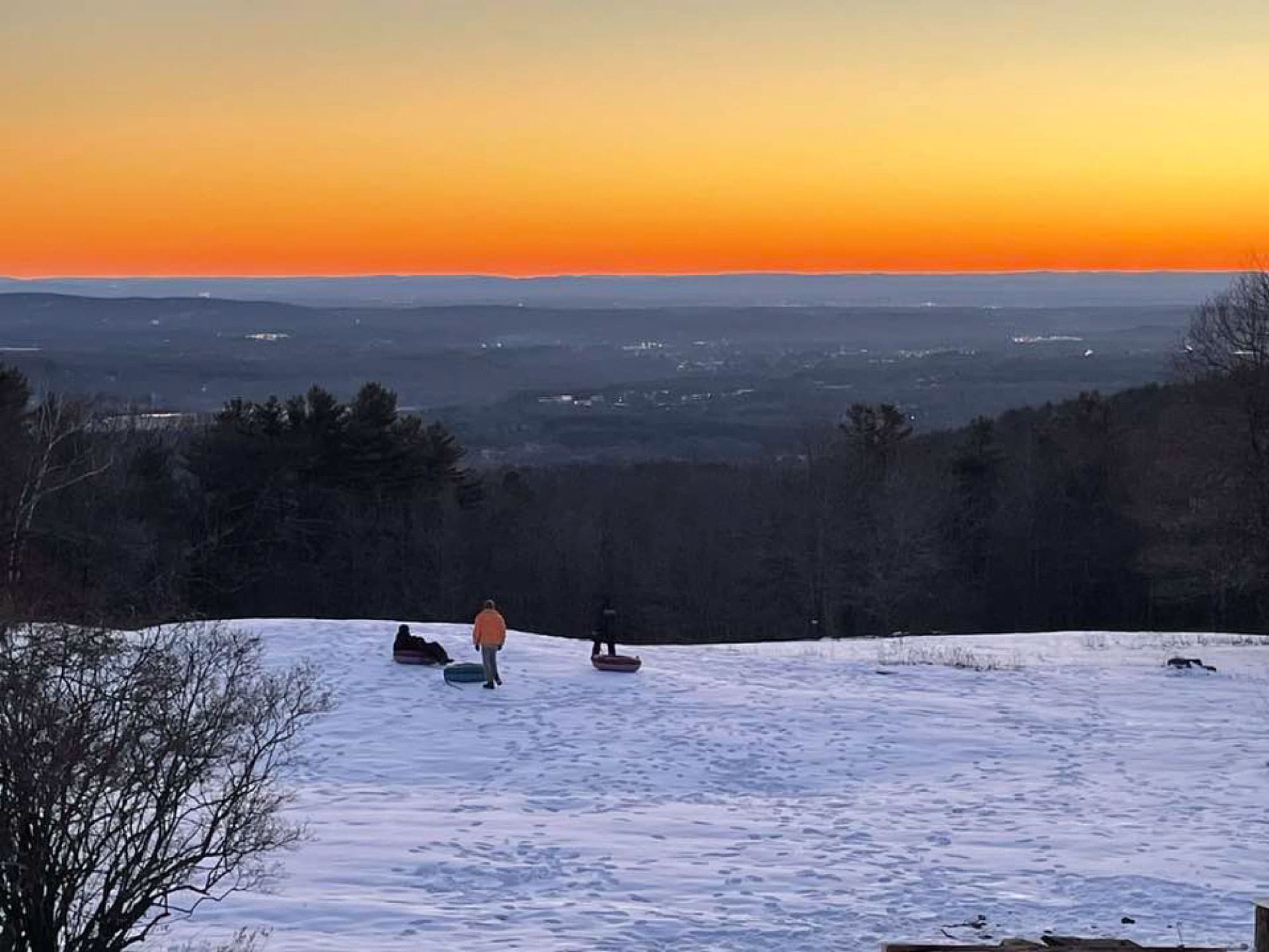
VIEW IMAGE » Tubing at Noble View
[04‑Feb‑2024] Tubing on the slope at Noble View.
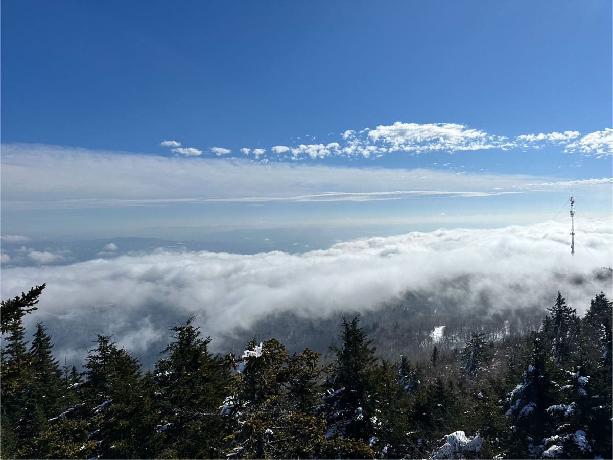
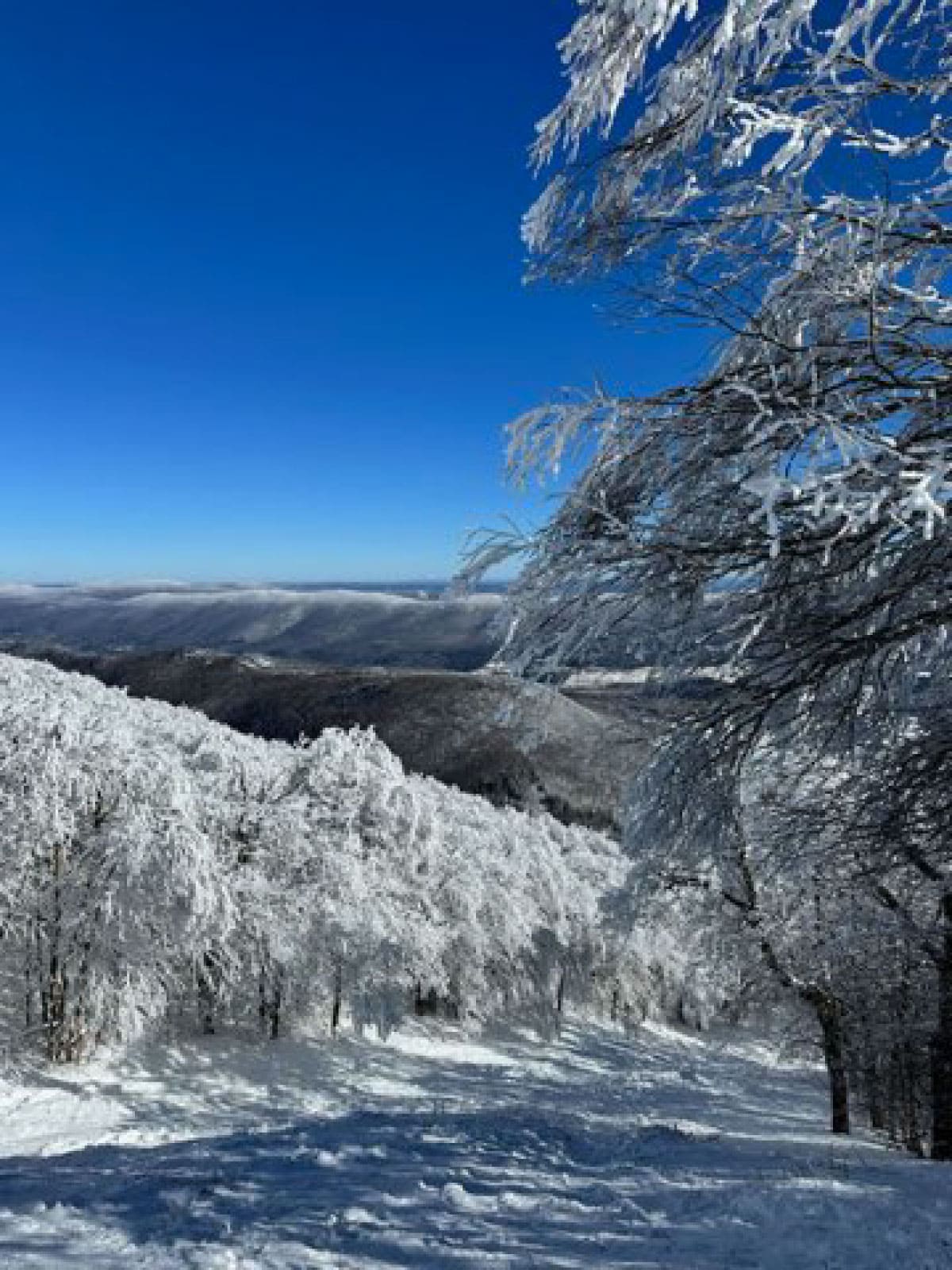
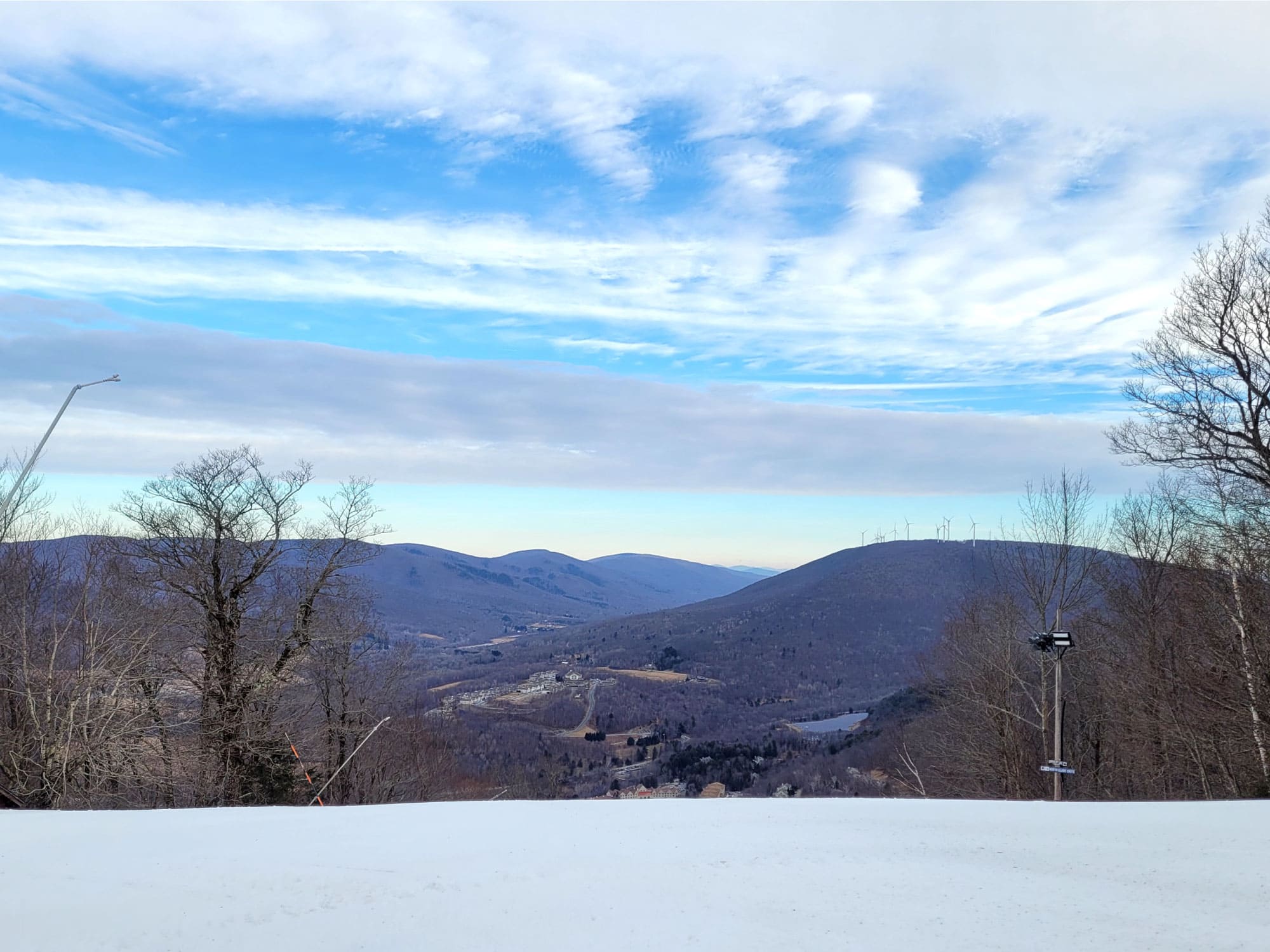
VIEW IMAGE » Winter View
[04‑Feb‑2024] View from Mt Greylock in winter.
VIEW IMAGE » Alford Springs
[30‑Jan‑2024] Tuesday hikers snowshoeing at Alford Springs nature preserve, a forested ridge laced with hiking trails.
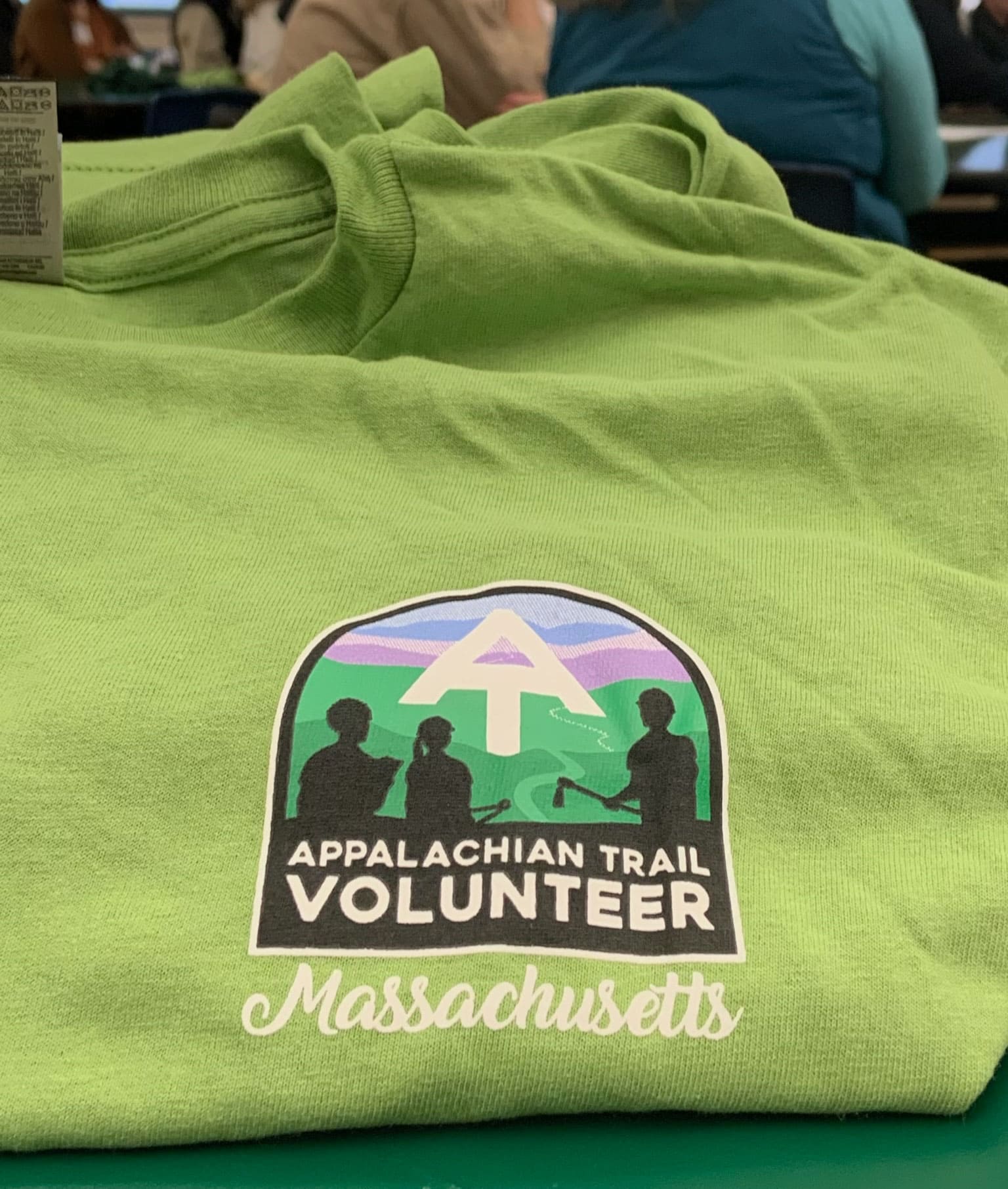
VIEW IMAGE » A.T. Volunteer T-Shirt
[27‑Jan‑2024] A.T. volunteer t-shirt.
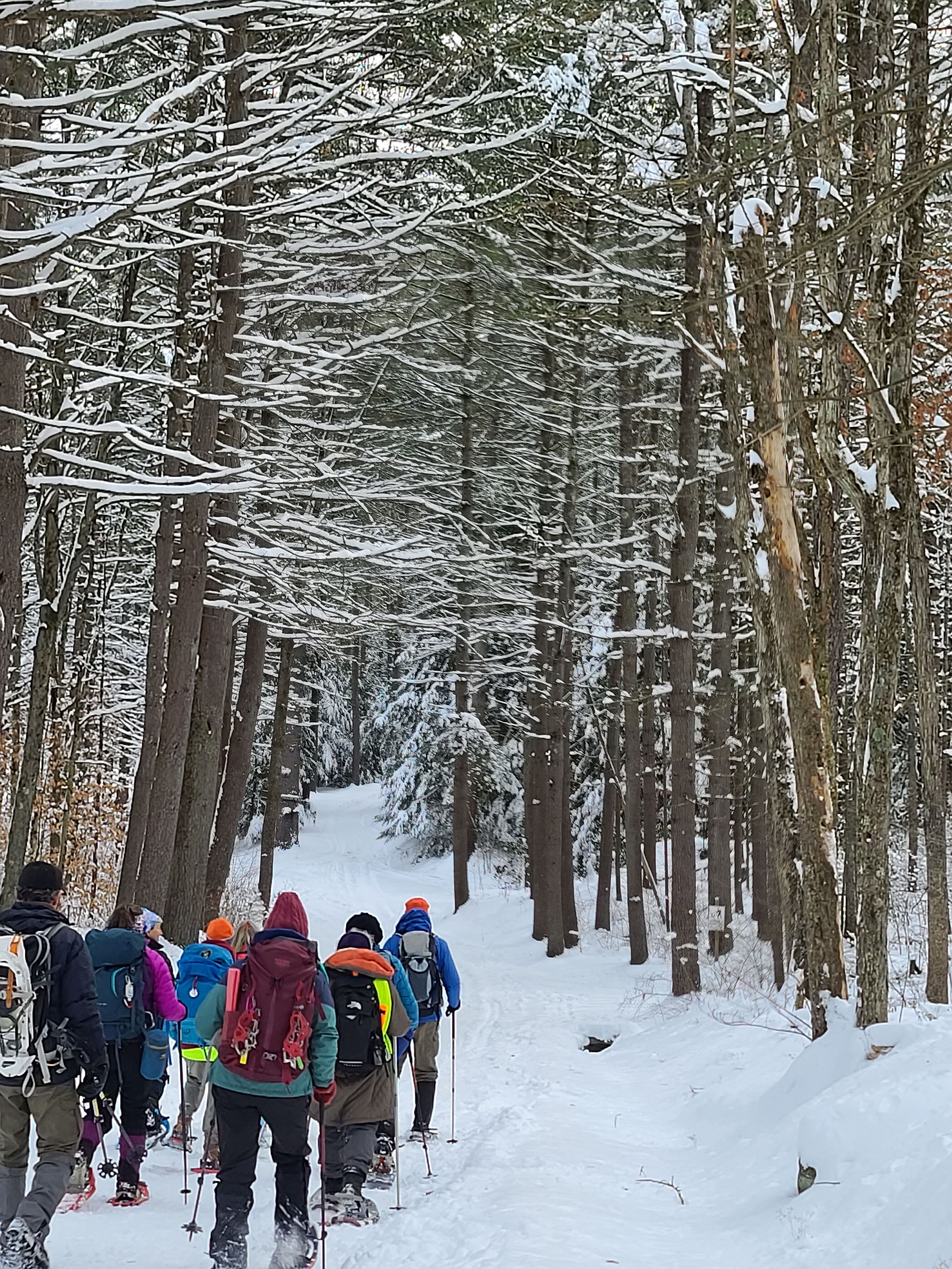
VIEW IMAGE » Wendell State Forest
[09‑Jan‑2024] Tuesday snowshoers navigate a winter wonderland in Wendell State Forest.
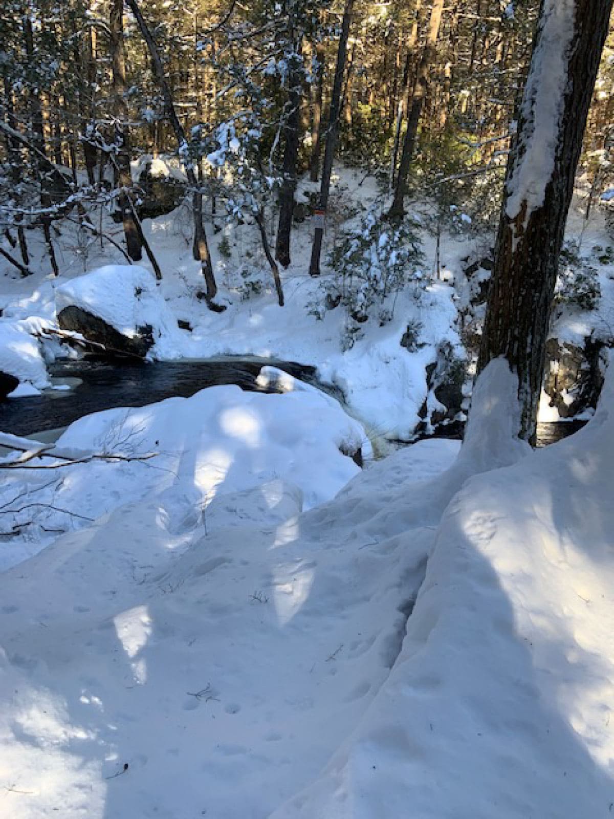
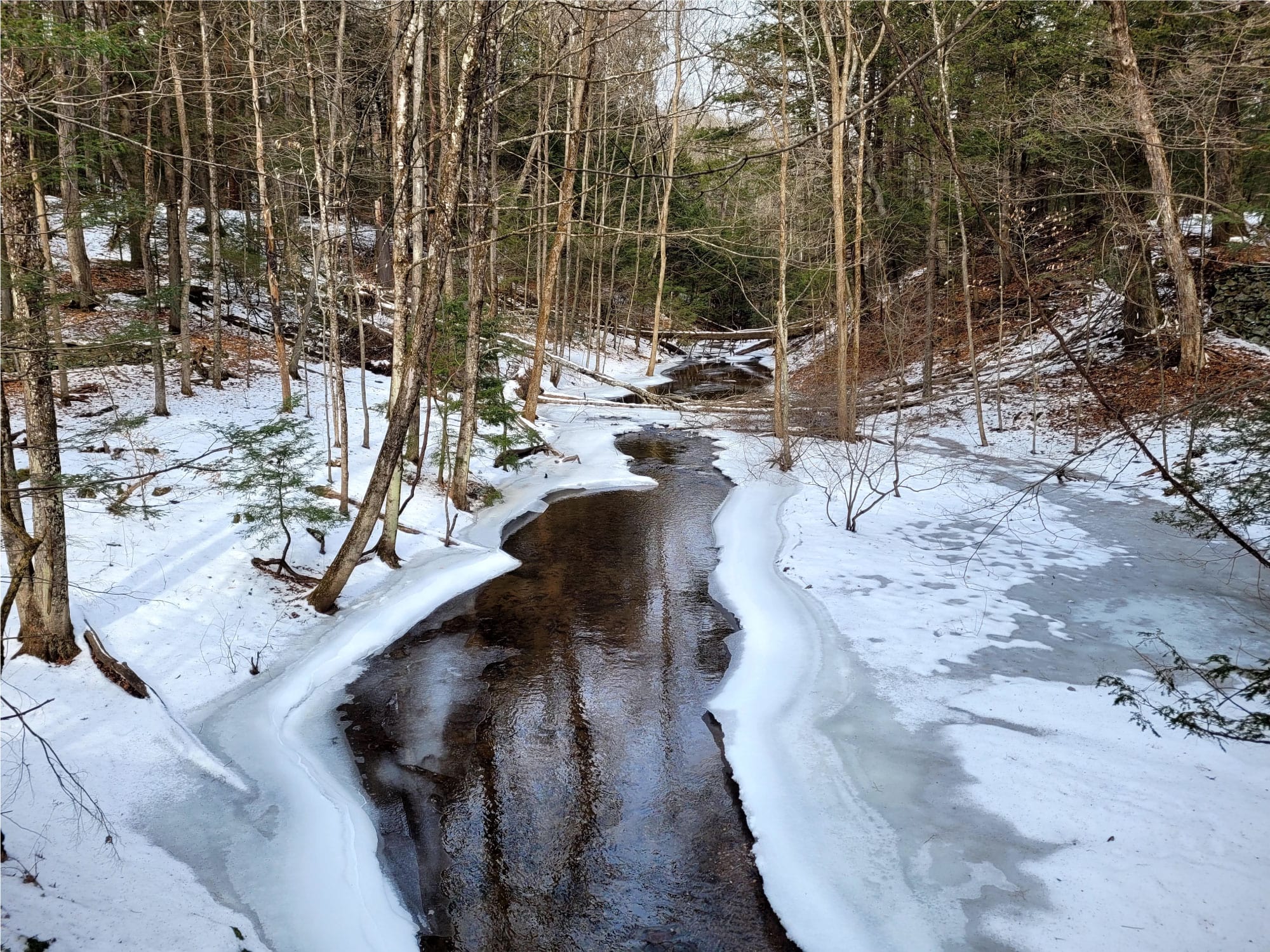
VIEW IMAGE » Six Days Later
[08‑Jan‑2024] Granville State Forest after a snowstorm.
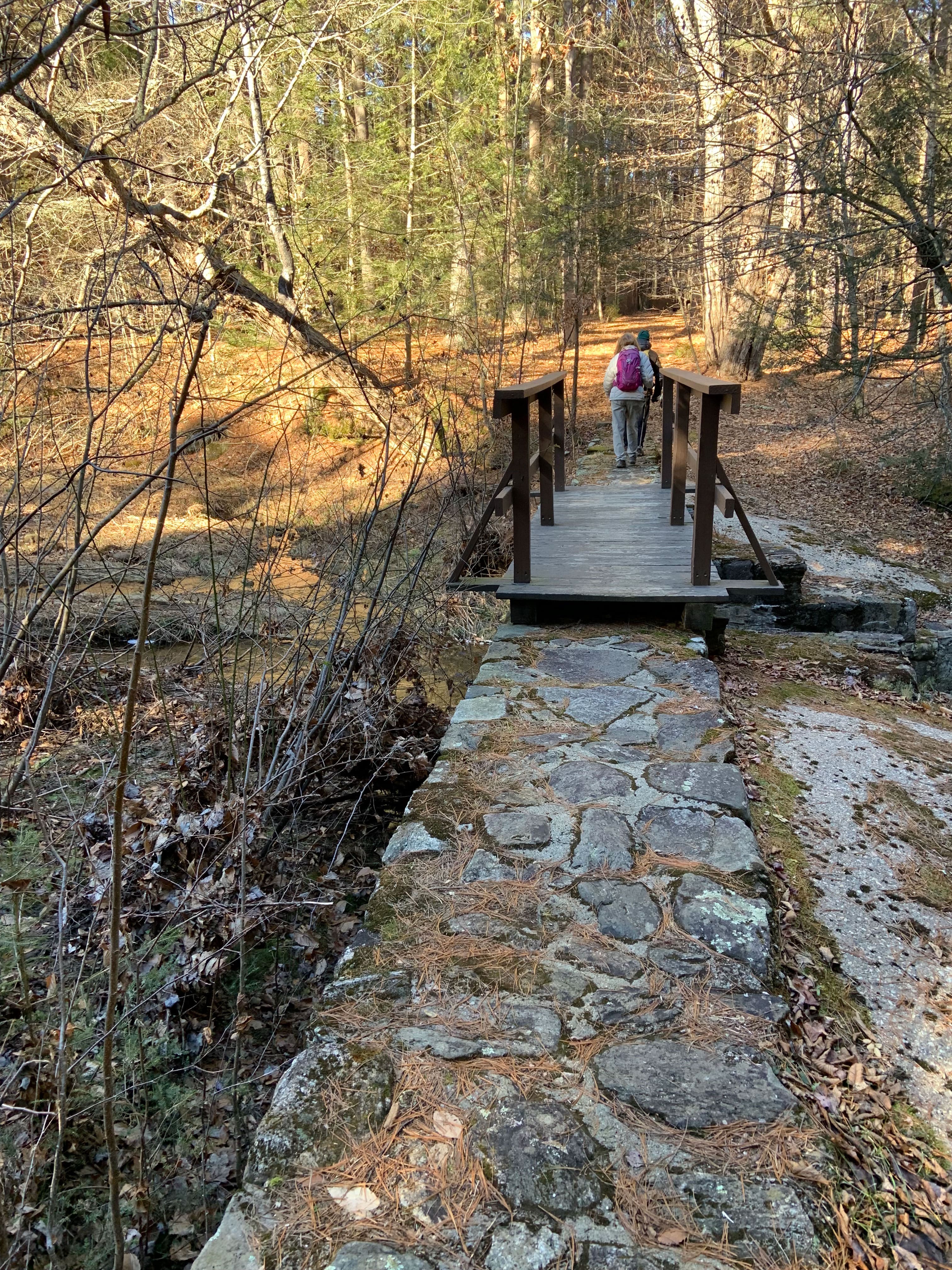
VIEW IMAGE » Granville State Forest
[02‑Jan‑2024] Tuesday hikers walk across a bridge in Granville State Forest.
VIEW IMAGE » Mineral Hills Conservation Area
[19‑Dec‑2023] Tuesday hikers pause for a photo op at the quarry in Mineral Hills Conservation Area.
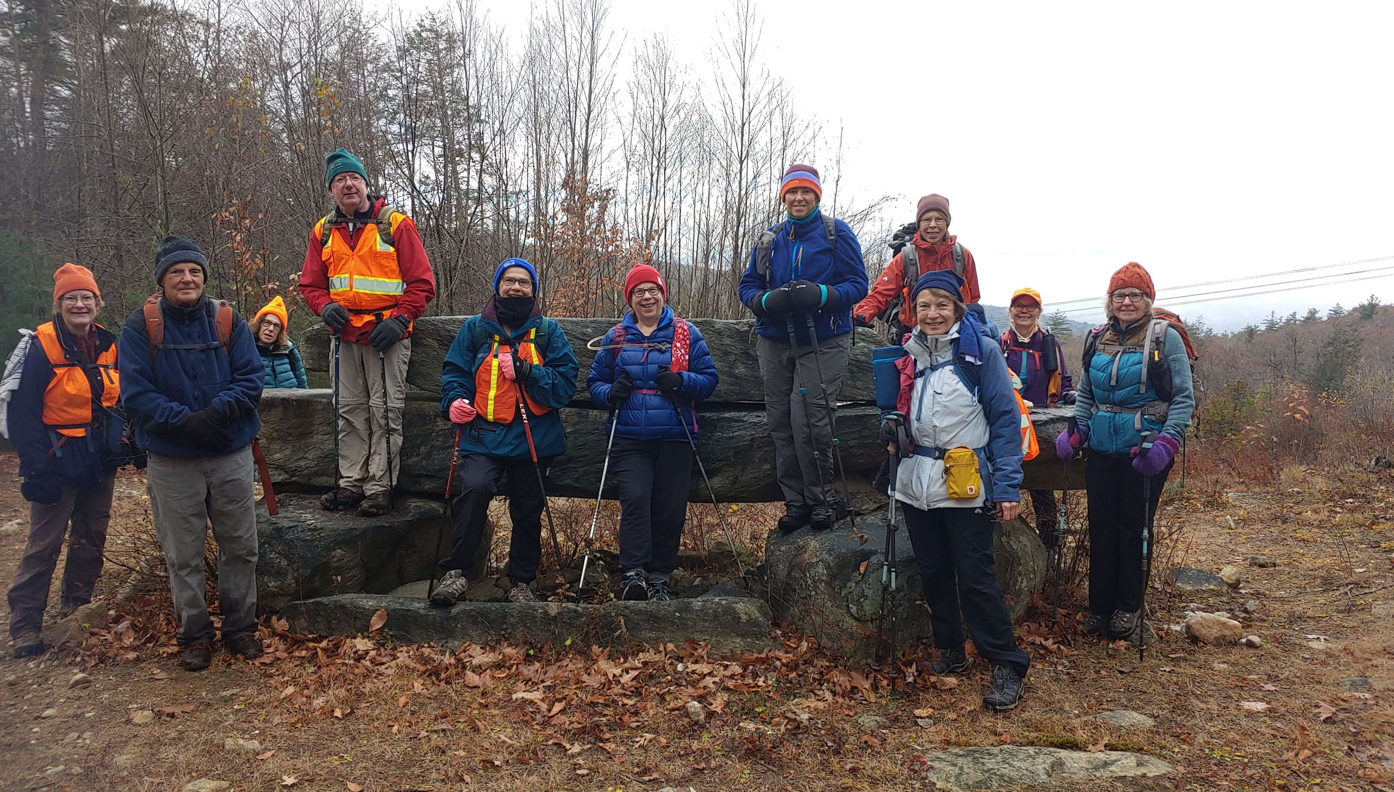
VIEW IMAGE » Stratton Mountain
[14‑Nov‑2023] Tuesday hikers pause for a photo op on Stratton Mountain.
VIEW IMAGE » 2023 Westfield River Waterfront Cleanup
[04‑Nov‑2023] Conservation volunteer removes trash from a riverbank during the 2023 Westfield River Waterfront Cleanup day.
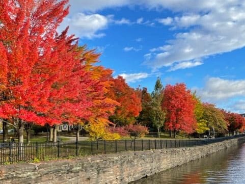
VIEW IMAGE » Holyoke Canal
[22‑Oct‑2023] Fall color along the Holyoke Canal.
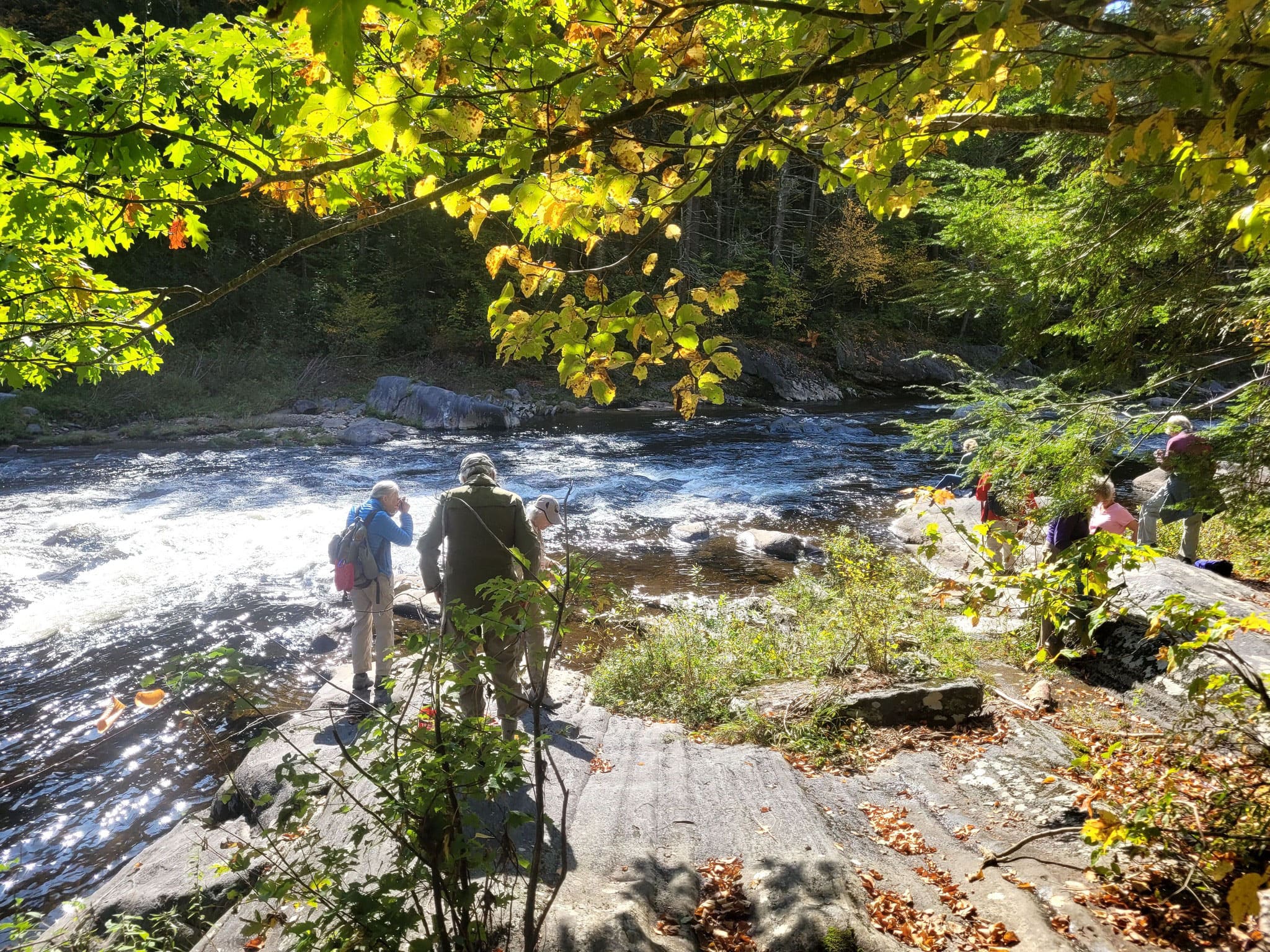
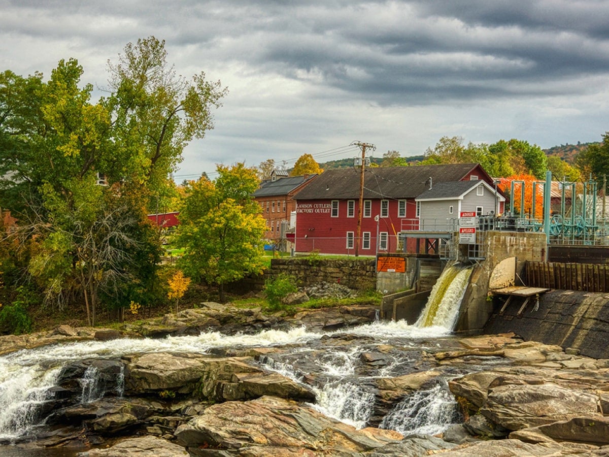
VIEW IMAGE » Westfield River
[10‑Oct‑2023] Tuesday hikers pause to take photos on a bank of the Westfield River.
VIEW IMAGE » FallFest 2023 Album
[09‑Oct‑2023] Media album for FallFest 2023.
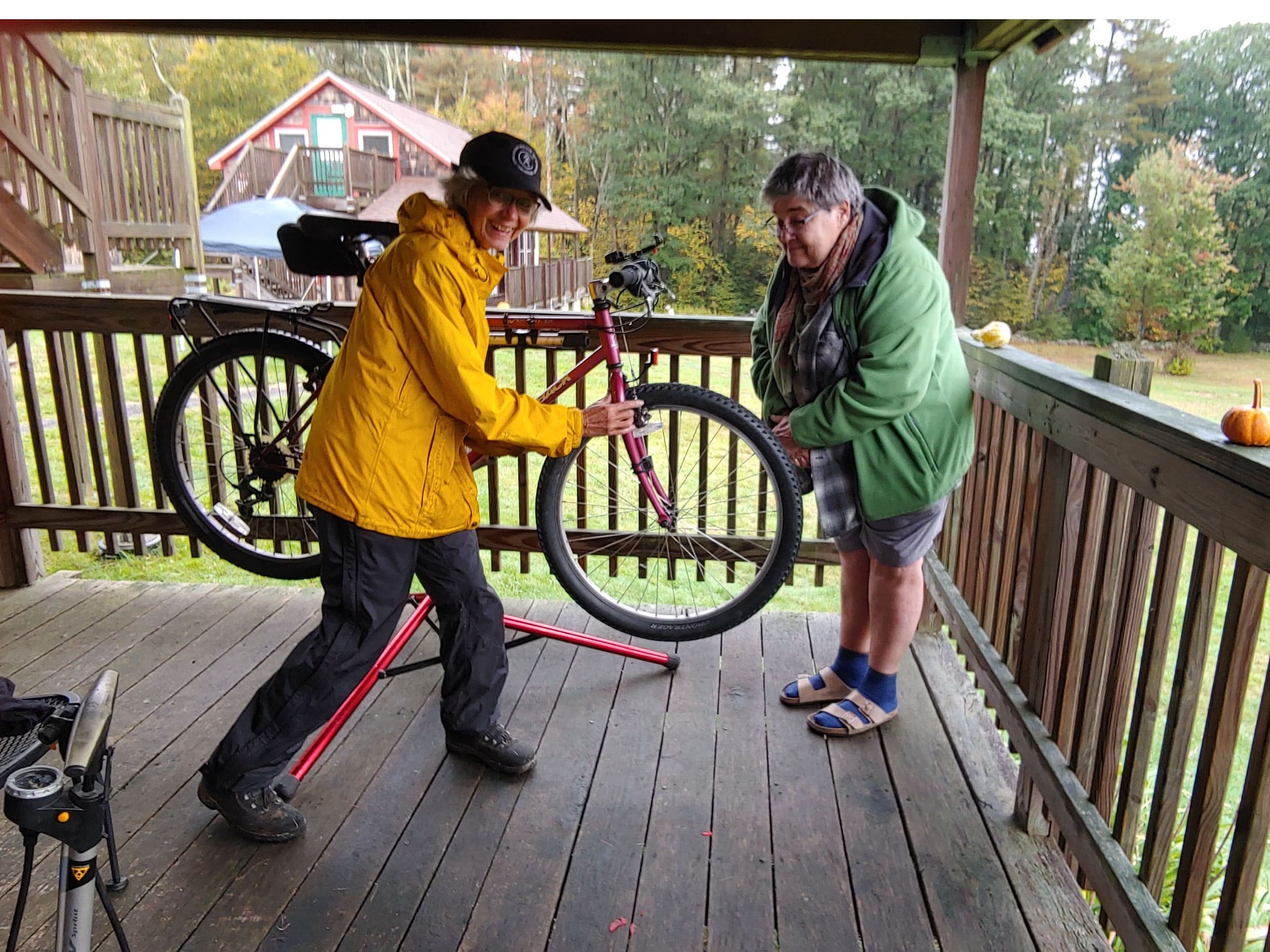
VIEW ALBUM » Bike Repair Training
[06‑Oct‑2023] Participants at Women's Weekend learn how to repair a bicycle.
VIEW IMAGE » Women’s Weekend 2023
[06‑Oct‑2023] Boaters on Russell Pond during Women's Weekend.
VIEW IMAGE » Women’s Weekend 2023
[06‑Oct‑2023] Women's Weekend 2023.
VIEW IMAGE » Women’s Weekend 2023
[06‑Oct‑2023] Trail walk during Women's Weekend.
VIEW IMAGE » Noble View
[01‑Aug‑2023] Summer view of Double Cottage at Noble View.
VIEW IMAGE » New Moldering Privy at Richardson-Zlogar Cabin
[24‑Jul‑2023] New moldering privy constructed by the NET Management Committee at the Richardson-Zlogar cabin.
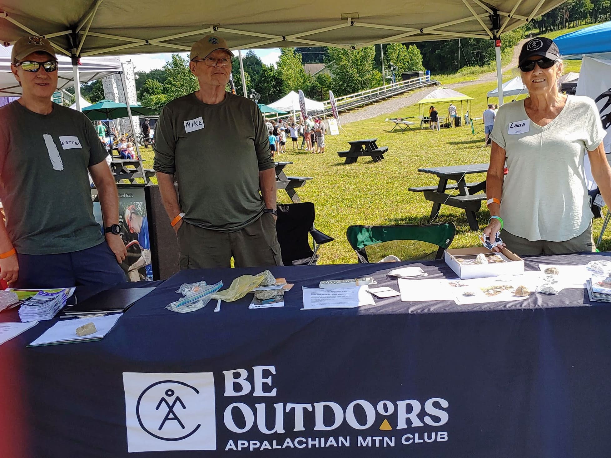
VIEW IMAGE » Mountain Day Information Table
[22‑Jul‑2023] Western MA members meet and greet the public at Bousquet Mountain.
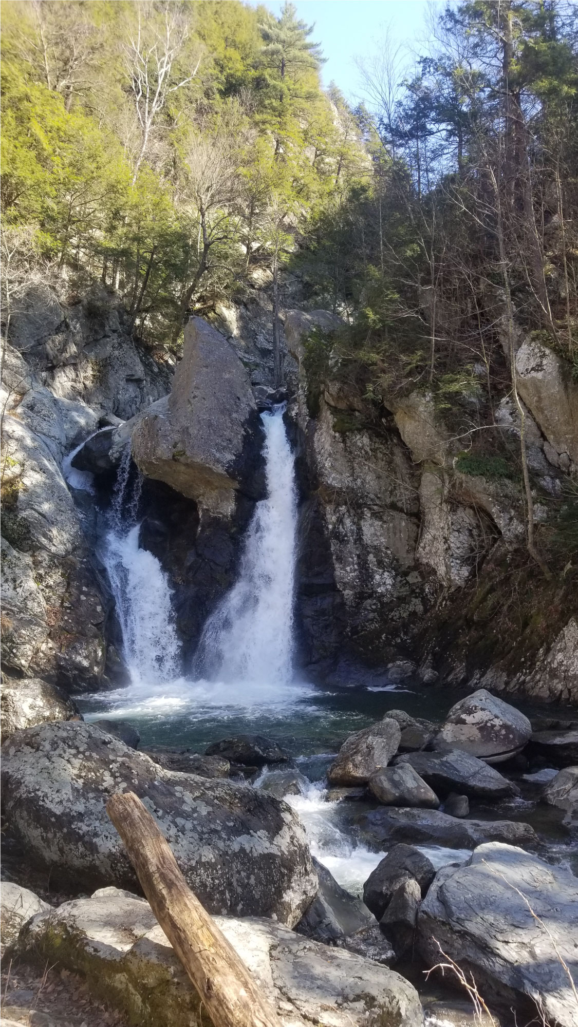
VIEW IMAGE » Campbell Falls
[10‑Jul‑2023] The Whiting River in Campbell Falls State Park drops 50 feet in a magnificent thundering display at Campbell Falls.
READ MORE » Conservation Album
[01‑Jul‑2023] Media album for the Conservation Committee.
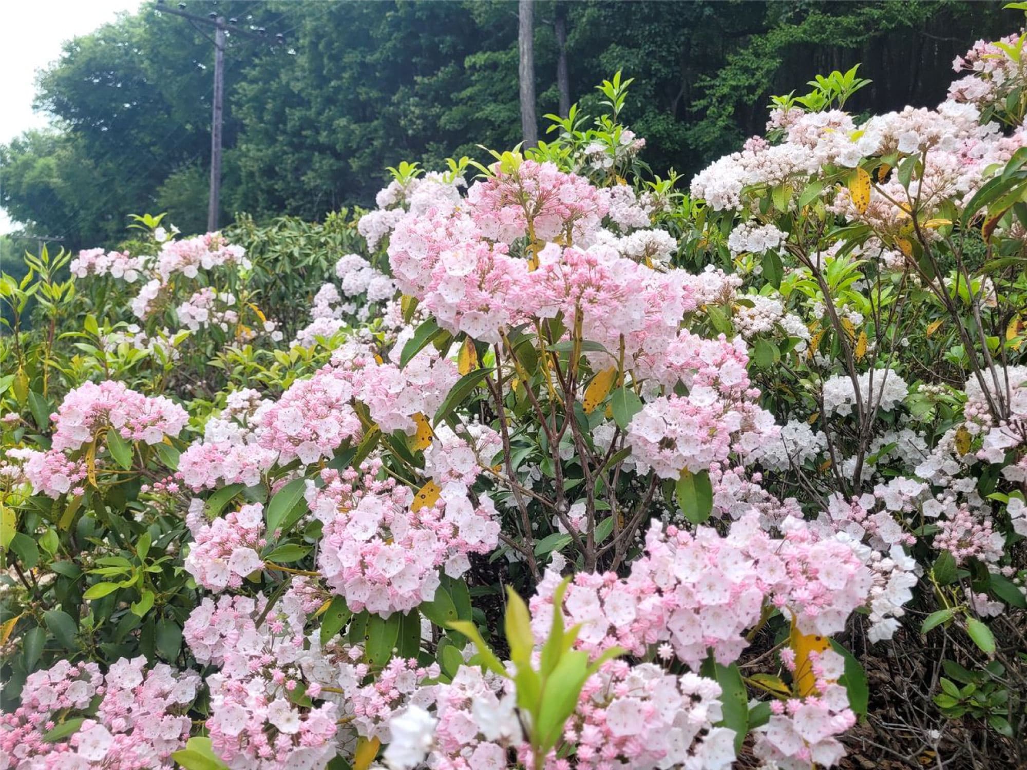
VIEW ALBUM » Laurel Blossoms
[10‑Jun‑2023] Laurel blossoms, Noble View Outdoor Center.
VIEW IMAGE » Laurel Day 2023
[10‑Jun‑2023] It was a beautiful afternoon at Noble View Saturday as we brought back the Laurel Weekend tradition, gathering to celebrate mountain laurel season. Thirty-eight guests and volunteers enjoyed the gorgeous views and a short hike to admire the laurels followed by chili, cornbread, lemonade and strawberry shortcake outdoors on the picnic tables.
READ MORE » Laurel Day 2023
[10‑Jun‑2023] It was a beautiful afternoon at Noble View Saturday as we brought back the Laurel Weekend tradition, gathering to celebrate mountain laurel season. Thirty-eight guests and volunteers enjoyed the gorgeous views and a short hike to admire the laurels followed by chili, cornbread, lemonade and strawberry shortcake outdoors on the picnic tables.
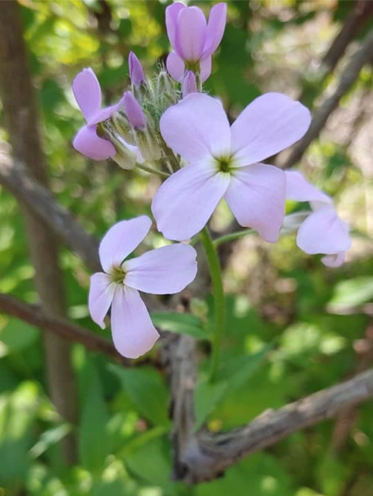
VIEW IMAGE » Dame’s Rocket
[30‑May‑2023] Dame's rocket, Noble View Outdoor Center
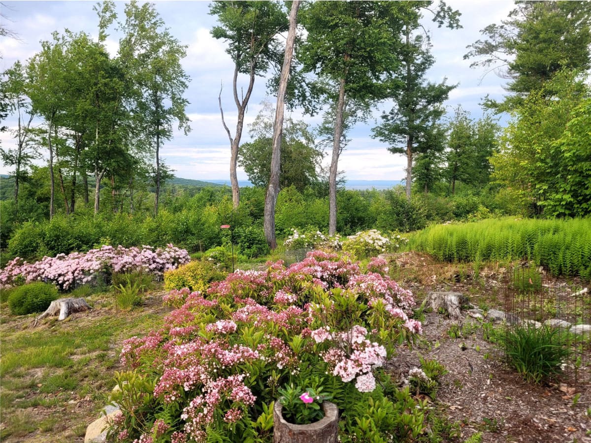
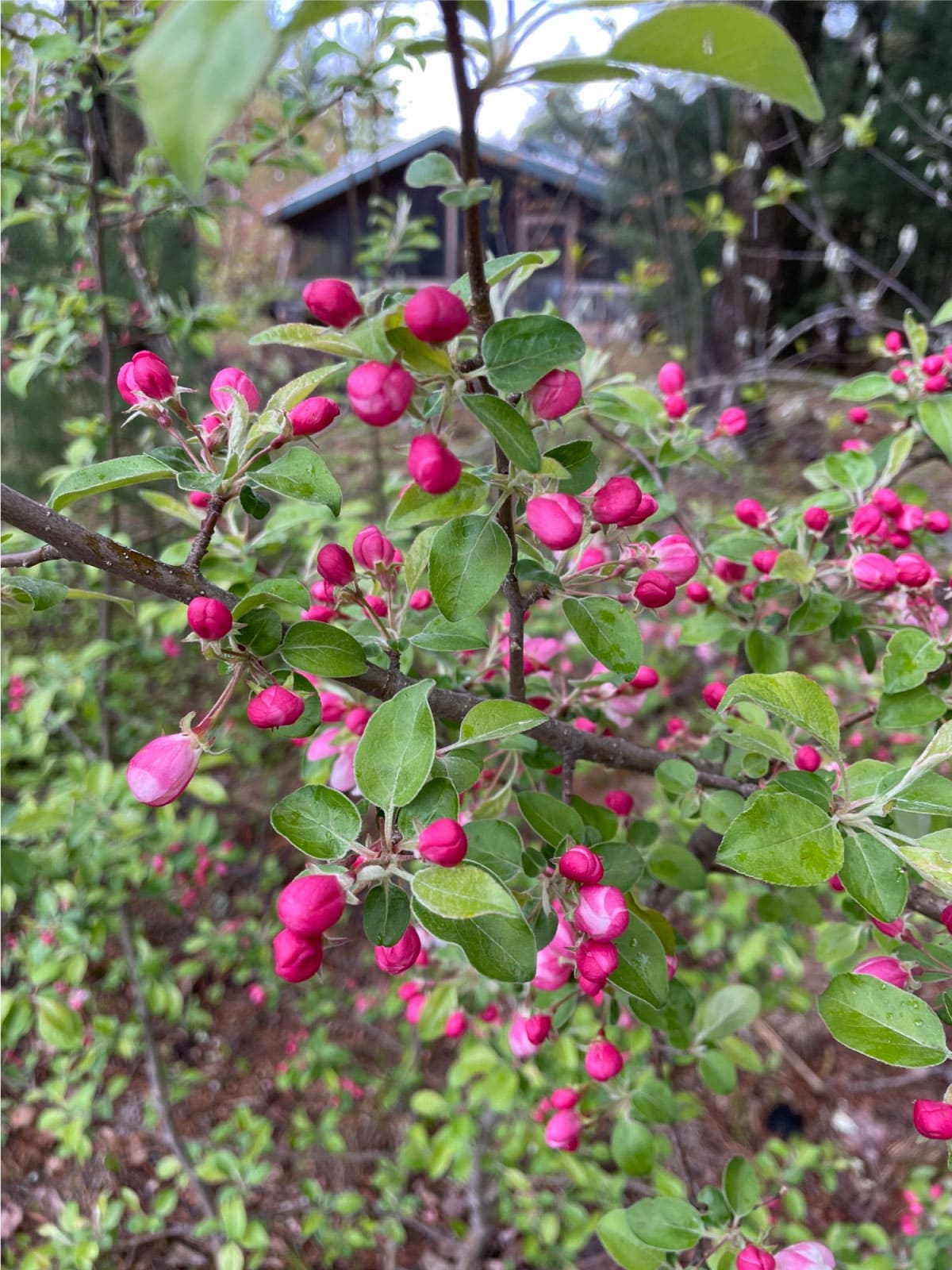
VIEW IMAGE » Spring Blooms at Noble View
[04‑May‑2023] Spring blooms at Noble View.
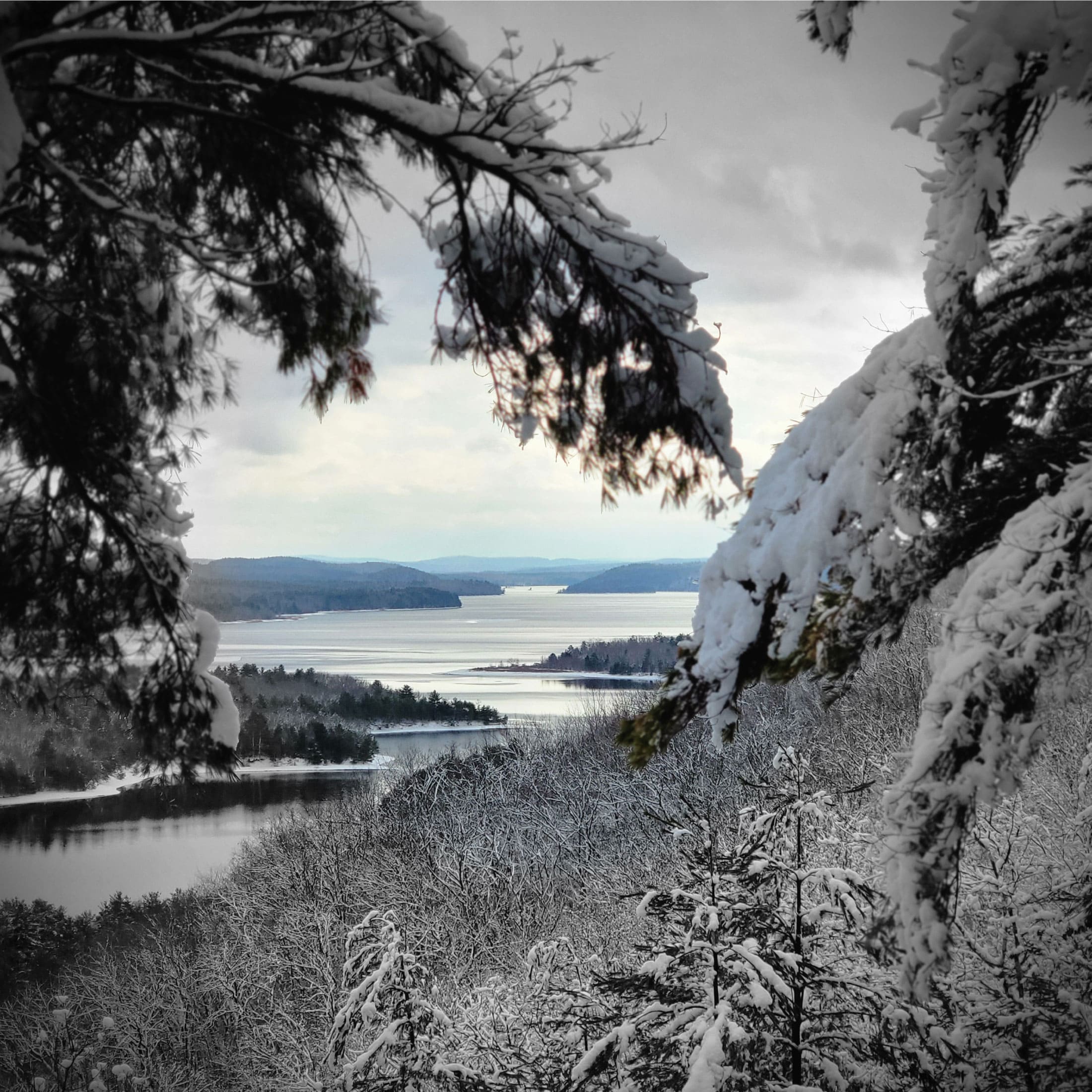
VIEW IMAGE » Quabbin Reservoir
[28‑Feb‑2023] View of Quabbin Reservoir from Rattlesnake Hill.
VIEW IMAGE » Quabbin Reservoir
[28‑Feb‑2023] View of Quabbin Reservoir from Rattlesnake Hill.
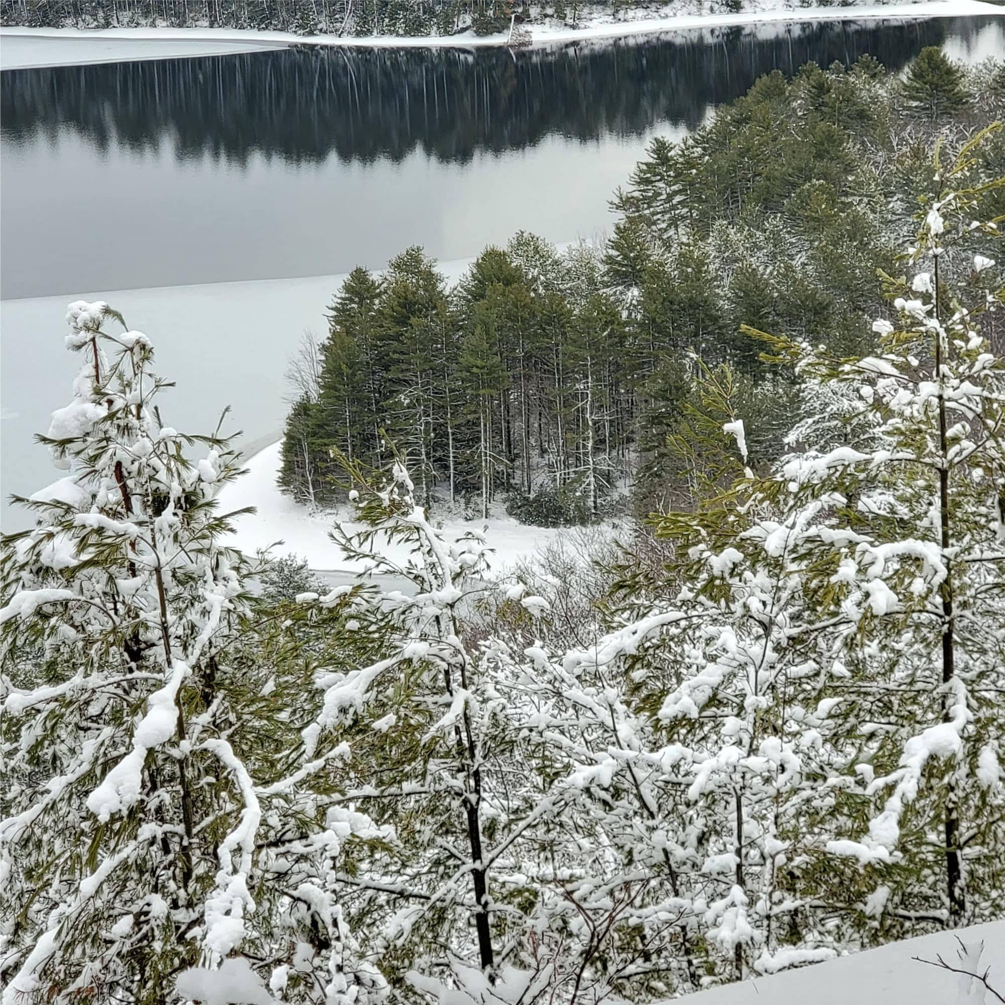
VIEW IMAGE » Frosty Pines
[28‑Feb‑2023] Snow-covered pine needles on Rattlesnake Hill in Quabbin.
VIEW IMAGE » Noble View Album
[28‑Feb‑2023] Media album for Noble View.
VIEW ALBUM » Bear Hole Reservoir Waterfall
[31‑Dec‑2022] Bear Hole is a ~1,700-acre wooded area that encompasses Bear Hole Reservoir. This protected landscape, which is jointly held by Mass Audubon and the Massachusetts Department of Conservation & Recreation, features a lake, a waterfall, and interesting relics from the past.
READ MORE » Nordic Skiing at Notchview
[18‑Dec‑2022] With more than 3,000 acres of rolling terrain and 25 miles of groomed ski trails, Notchview – a part of the Hoosac Range in the Berkshire Hills – offers an idyllic escape all year round, but especially in winter.
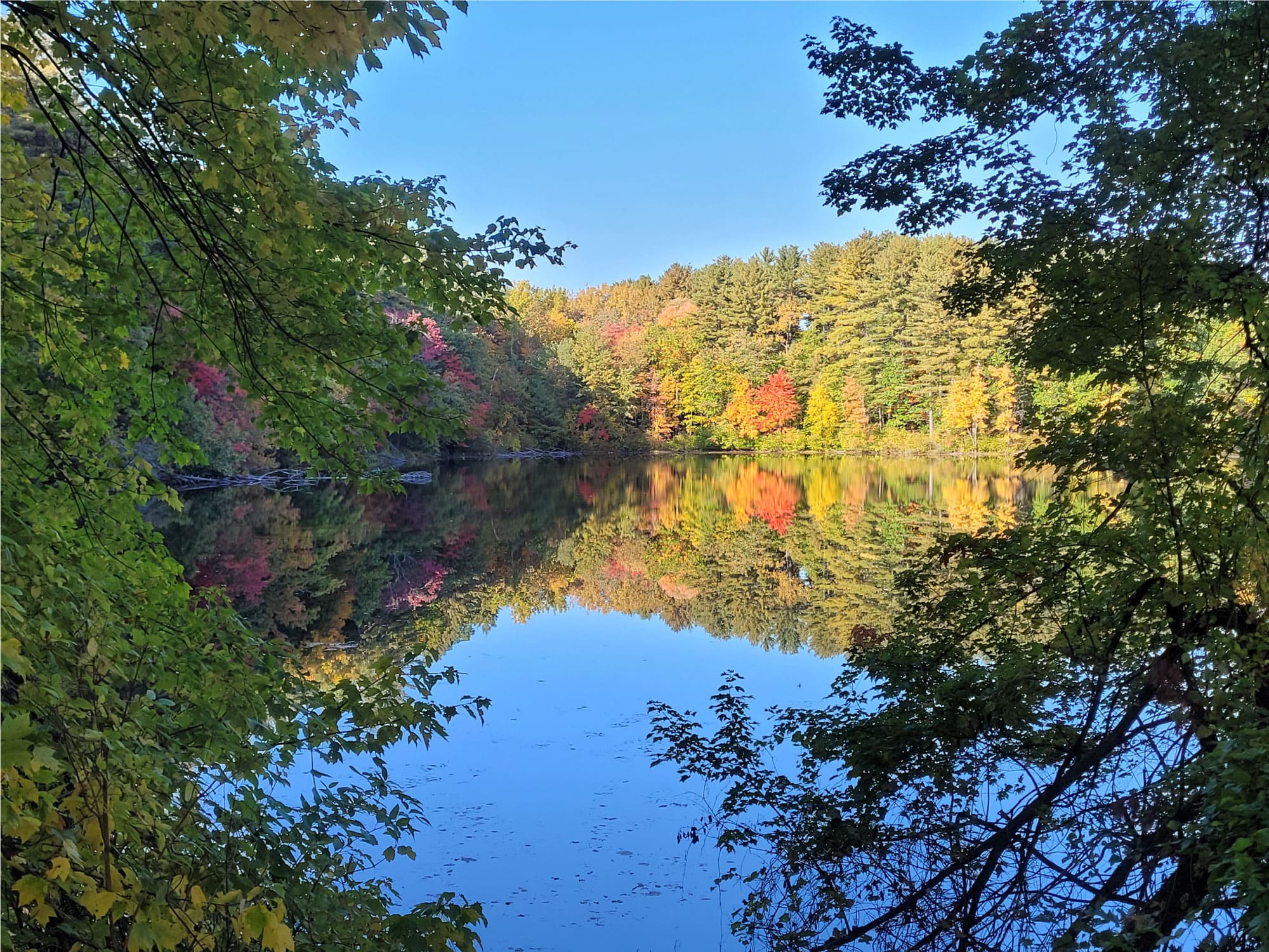
VIEW IMAGE » Westfield River
[17‑Dec‑2022] The Westfield River is the Connecticut River's longest tributary in Massachusetts. From its headwaters in the Berkshire Hills, it flows 78.1 miles to its confluence with the Connecticut River at Agawam, MA.
READ MORE » Home Page Banners
[05‑Nov‑2022] These images display randomly on our home page.
VIEW IMAGE » Seven Sisters
[20‑Oct‑2022] The Seven Sisters, part of the Holyoke Range and located within the Connecticut River Valley region of Massachusetts, are a series of basalt ridgeline knobs between Mount Holyoke and Mount Hitchcock.
READ MORE » Ashley Reservoir
[11‑Oct‑2022] Ashley Reservoir is the secondary drinking supply for the city of Holyoke, MA. The impoundment was constructed in the 1890s and is home to robust populations of bears, deer, geese, ducks, beavers, and many other animal species. To protect this secondary water supply, most areas around the reservoir are publicly accessible only by foot, with limited parking available at some of the surrounding gates.
VIEW IMAGE » A.T. Management Album
[10‑Oct‑2022] Media album for the A.T. Management Committee.
VIEW ALBUM » Nonotuck Park
[09‑Oct‑2022] Nonotuck Park, Easthampton, MA. This family-friendly facility provides a multitude of venues for picnicking and outdoor sports. The Toteman trail circles the park, affording views of Mount Tom and access to Nashawannuck Pond.
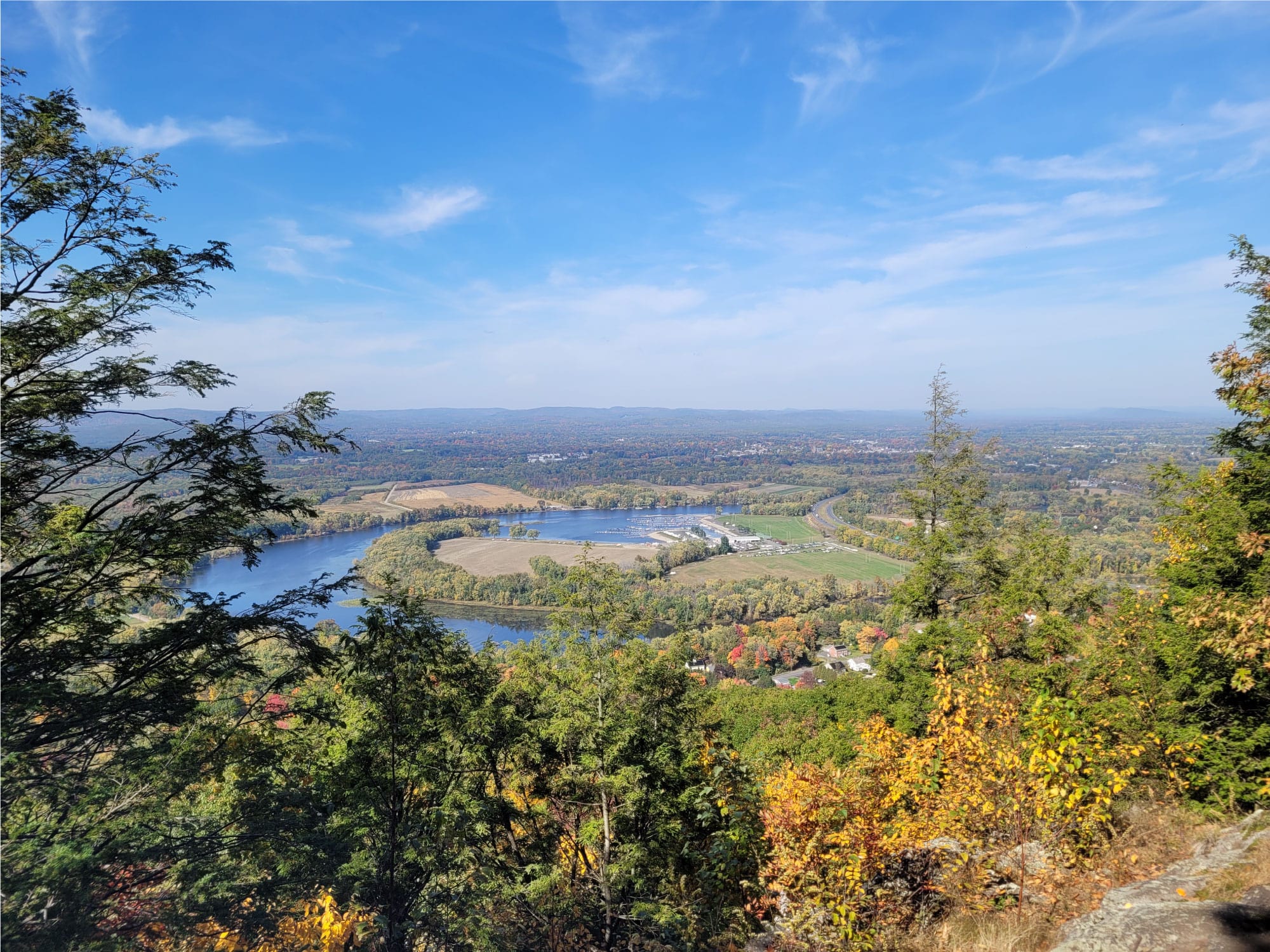
VIEW IMAGE » Connecticut River
[01‑Oct‑2022] The Connecticut River is the longest river in New England, flowing roughly southward for 406 miles through four states.
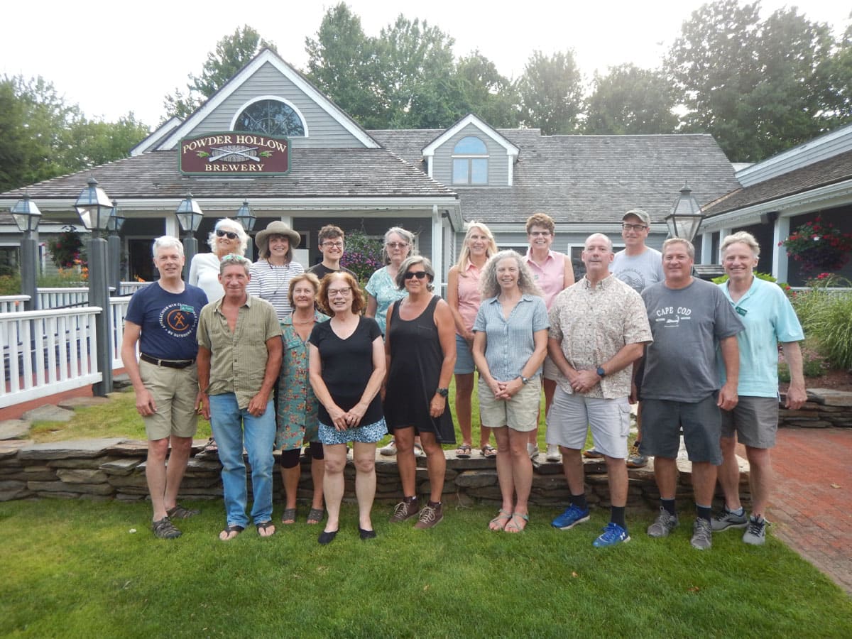
VIEW IMAGE » ExCom Members
[29‑Sep‑2022] ExCom members pose for a photograph during a meeting at Powder Hollow Brewery.
VIEW IMAGE » NET Album
[24‑Sep‑2022] Media album for the NET Management Committee.
VIEW ALBUM » Shaker Campsite Bears
[28‑Aug‑2022] A sow and two bear cubs investigate a food storage box at Shaker Campsite.
READ MORE » Hiking Album
[15‑Aug‑2022] Media album for the Hiking Committee.
VIEW ALBUM » NET Section 7
[16‑Jul‑2022] Section 07 is a challenging portion of the New England Scenic Trail which rises and falls over the seemingly endless succession of minor hills known as the "Seven Sisters" that make up the Mount Holyoke Range.
VIEW IMAGE » Noble View
[10‑May‑2022] A pretty spring day at Noble View.
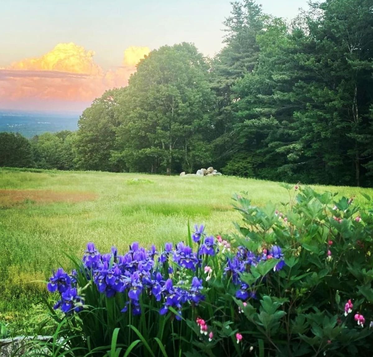
VIEW IMAGE » Sunset at Noble View
[09‑May‑2022] Sunset at Noble View Outdoor Center.
VIEW IMAGE » Deerfield River Dam
[21‑Mar‑2022] Before AMC and other groups negotiated more favorable dam releases upriver, the Deerfield River was not the whitewater paddling destination it is today.
VIEW IMAGE » Jiminy Peak
[24‑Feb‑2022] Jiminy Peak Mountain Resort – located in Hancock, MA – is the largest ski and snowboard resort in southern New England.
VIEW IMAGE » Bear Hole Reservoir
[23‑Jan‑2022] Bear Hole is a ~1,700-acre wooded area that encompasses Bear Hole Reservoir. The reservoir supplies a minimal amount of West Springfield's drinking water. The area supports a diversified biological environment including great horned owl, white tailed deer, hawk, and several vernal pools. Hiking, dog walking and nature watching are popular activities year round.
VIEW IMAGE » Notchview
[22‑Jan‑2022] Notchview is a 3,100-acre conservation property located in Windsor, MA. Notchview is part of the Hoosac Range, which forms the western edge of the northwest Berkshire Plateau.
READ MORE » Mountaineering Album
[16‑Jan‑2022] Media album for the Mountaineering Committee.
VIEW ALBUM » View from Mount Greylock
[21‑Oct‑2021] At 3,491 feet, Mount Greylock is the highest point in Massachusetts. From its peak on a clear day, you can see as far as 90 miles away.
READ MORE » Family Programs Album
[16‑Oct‑2021] Media album for the Family Programs Committee.
VIEW ALBUM » Cheshire Lake at Sunset
[07‑Oct‑2021] Cheshire Lake, also known as Cheshire Reservoir, Hoosac Reservoir and Hoosac Lake, is divided into three basins by a pair of causeways.
READ MORE » Laurels in Bloom
[06‑Oct‑2021] Laurels in bloom on the NET, Section 5.
VIEW IMAGE » Noble View Farmhouse
[06‑Sep‑2021] Farmhouse at Noble View.
VIEW IMAGE » Sanderson Brook Falls
[21‑Aug‑2021] The Sanderson Brook Falls are located in the publicly-owned Chester-Blandford State Forest in Chester and Blandford, MA. The state forest includes remnants of small mining operations and the 60-foot cascade at Sanderson Brook Falls.
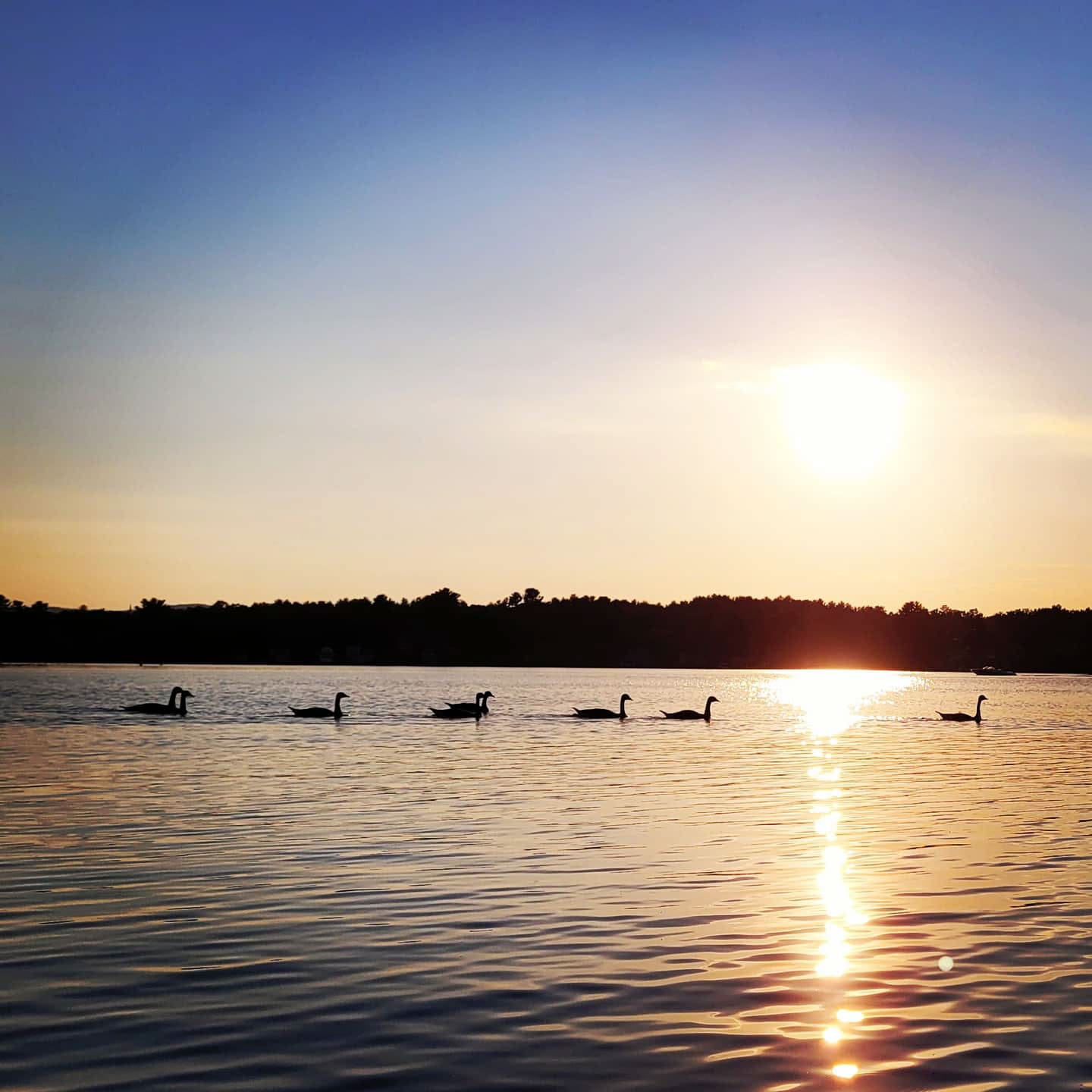
READ MORE » Hampton Ponds
[28‑Jun‑2021] A gaggle of geese floats on Hampton Pond at sunset.
VIEW IMAGE » October Mountain Reservoir
[27‑Jun‑2021] October Mountain Reservoir, October Mountain State Forest, MA.
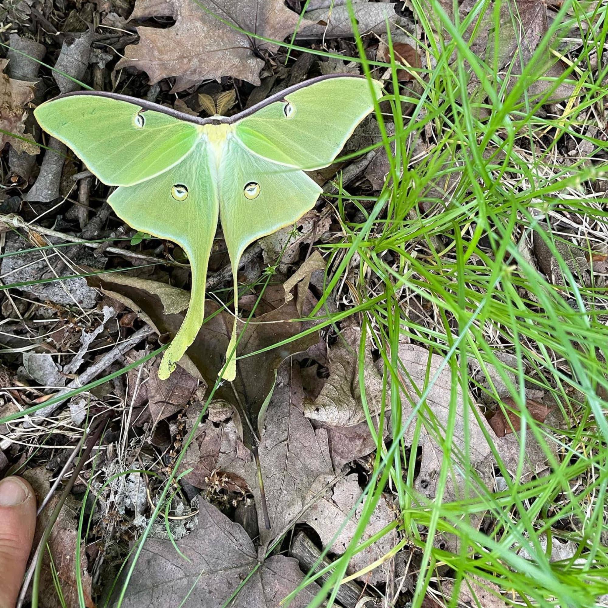
READ MORE » Luna Moth
[21‑Jun‑2021] Luna moth at Noble View Outdoor Center.
VIEW IMAGE » Tuesday Hikers Album
[21‑Jun‑2021] Media album for the Tuesday hikers.
VIEW ALBUM » Chesterfield Gorge
[23‑May‑2021] Chesterfield Gorge is a nature reserve located in Chesterfield, MA. The property is owned by The Trustees of Reservations, who have administered the site since 1929.
READ MORE » Paddling Album
[20‑Oct‑2020] Media album for the Paddling Committee.
VIEW ALBUM » Bash Bish Falls
[21‑Feb‑2020] Bash Bish Falls, a waterfall in Bash Bish Falls State Park in the Taconic Mountains of southwestern Massachusetts, is the highest waterfall in the state. The falls are made up of a series of cascades, nearly 200 feet long in total.
VIEW IMAGE » Wahconah Falls
[02‑Nov‑2019] The Wahconah Falls Brook flows over several smaller falls before ending in the 40-foot Wahconah Falls. The cascade is scenic any time of year, but is especially impressive during the spring runoff.
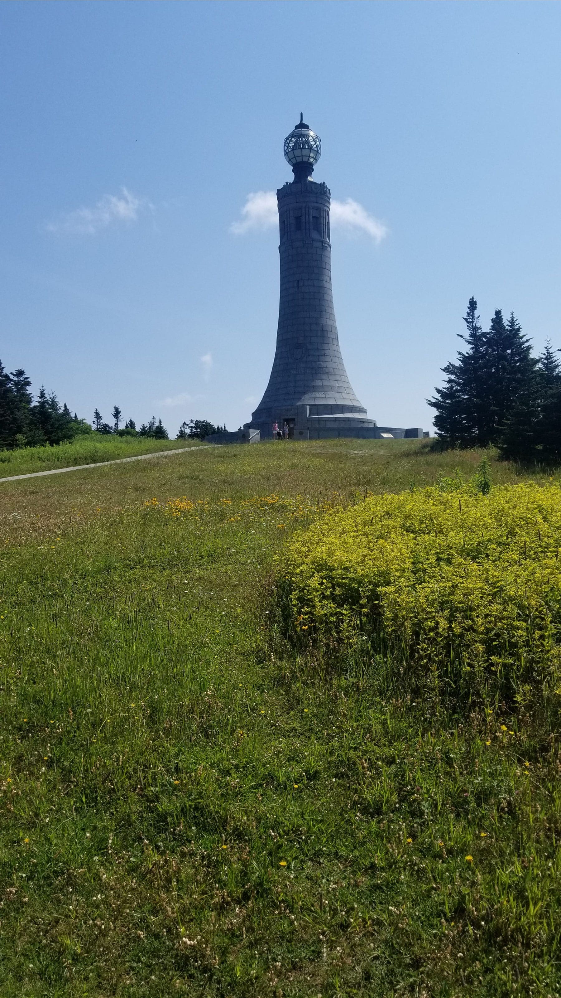
READ MORE » Mt Greylock Veterans War Memorial Tower
[30‑Jul‑2019] Mount Greylock is a 3,489-foot mountain located in the northwest corner of Massachusetts. It is the highest point in the state. The summit is topped by the 93-foot-high lighthouse-like Massachusetts Veterans War Memorial Tower.
VIEW IMAGE » Noble View
[08‑Jun‑2019] View of the cottages from the rock wall.
VIEW IMAGE » Bicycling Album
[23‑Sep‑2018] Media album for the Bicycling Committee.
VIEW ALBUM » 3rd Annual Outdoor Festival
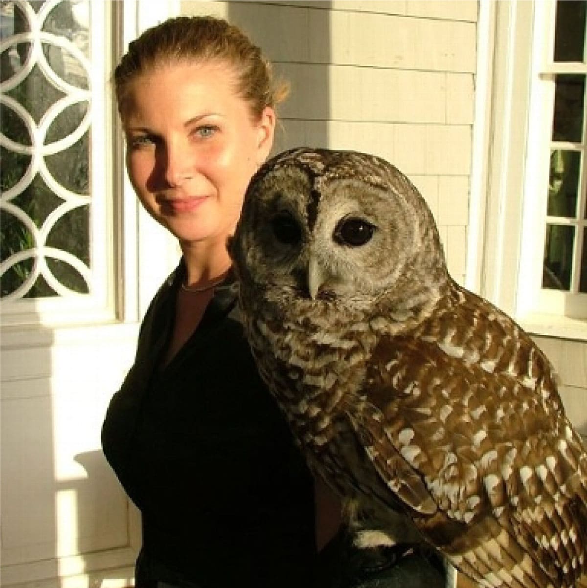
[17‑Sep‑2016] Erin O'Connell (Environmental Learning Centers of Connecticut) displays a barred owl at Western MA's 3rd Annual Outdoor Festival.
VIEW IMAGE »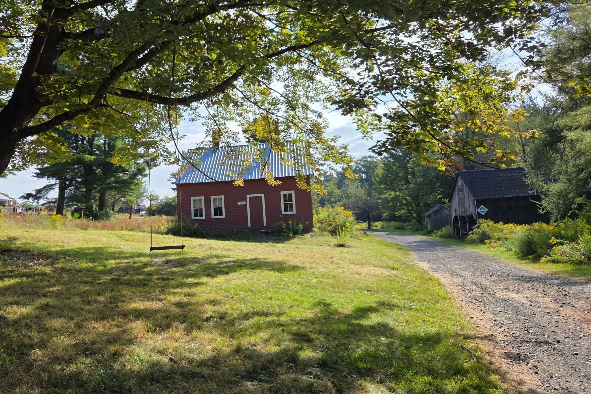